- Milan Metro
-
 Milan Metro
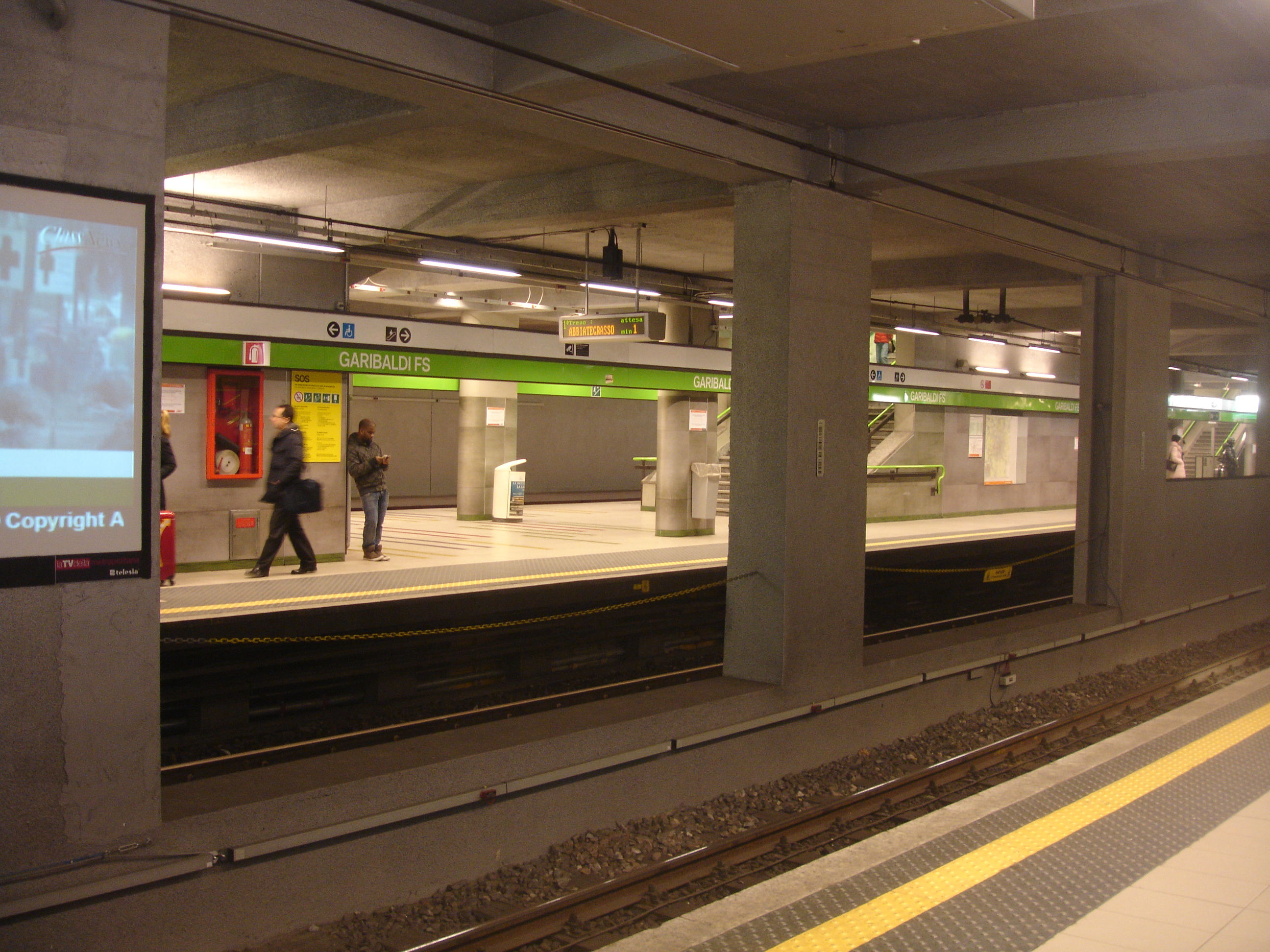
Line 2 at Porta GaribaldiInfo Locale Milan Transit type Rapid Transit Number of lines 3 Number of stations 94 Daily ridership 899,000 [1] Operation Began operation 1964 Operator(s) Azienda Trasporti Milanesi Technical System length 83.3 km (52 mi) [1] Track gauge 1,435 mm (4 ft 8 1⁄2 in) (standard gauge) System map 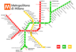
The Milan Metro (Metropolitana di Milano in Italian) is the rapid transit system serving Milan, Italy, operated by Azienda Trasporti Milanesi. Milan metro is the longest metro system in Italy, and is the core of the Milan Transportation System. The network consists of 3 lines, identified by different numbers and colors, with a total length of 83.3 km (51.8 mi) and a total of 94 stations, mostly underground.[1] It has a daily ridership of 899,000.
The first line, the red one, opened in 1964. The green line opened 5 years later and the yellow line in 1990.
Contents
History
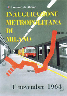 A poster for the opening of the first line in 1964
An Elevated Light Rail was built in Milan for the World's Fair Exhibition in 1906. The line linked the two main areas of the Fair between the Piazza d'Armi and the Arena Stadium close to the city centre. The line was dismantled 8 years later. It can be considered the first Italian electric public transport line totally independent of other railway lines.
The first projects for a subway line in Milan were drawn up in 1914 and 1925, following the examples of underground transport networks in other European countries like London and Paris. Planning proceeded in 1938 for the construction of a system of 7 lines, but this too halted after the start of World War II and due to lack of funds.[2]
On 6 April 1952 the city administration asked for a project of a metro system and on 6 October 1955 a new company, Metropolitana Milanese, was created to manage the construction of the new infrastructure.[2] The project was funded with ₤ 500 million from the municipality and the rest from a loan. The construction site of the first line was opened in viale Monte Rosa on 4 May 1957.[2] Stations on the new line were designed by Albini-Helg architecture studio. Bob Noorda designed the famous signaling.[2]
The first line from Lotto to Sesto Marelli (21 stations) was opened on 1 November 1964, after 7 years of construction works. The track was 12.5 km (7.8 mi) long, and the mean distance between the stations was 590 m.[3] In the same year, in April, works on the second line started. Passengers on the network grew constantly through the first years of service, passing from 37,092,315 in 1965 to 61,937,192 in 1969.[3]
The green line from Caiazzo to Cascina Gobba (7 stations) opened five years later. During the 1960s and 1970s the network of 2 lines was completed, and both lines had 2 different spurs. In 1978, the lines were already 17.6 km (10.9 mi) and 23 km (14 mi) long respectively, with 28 and 22 stations.[3]
The third line (yellow) was opened in 1990, with 5 stations. The other 9 stations on Line 3 opened to the southeast in 1991, and northwest to Maciachini Station in 2004.
In March 2005 the Line 2 station at Abbiategrasso (south branch from Famagosta) and the Line 1 station of Rho-Fiera opened. The intermediate station of Pero opened on December 2005. A north extension of Line 3 to Comasina (4 stations) and a new south branch on the Line 2 to Assago (2 stations) opened in early 2011.
Network
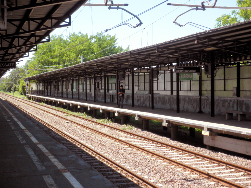
 Cascina Burrona station on Line 2 Gessate branch, an example of a surface suburban stationSee also: List of Milan metro stations
Line Terminals Opened[4] Newest
extensionLength Stations M1 Rho Fiera / Bisceglie Sesto 1° Maggio 1964 2005 26.9 km 38 M2 Assago Milanofiori Forum / Abbiategrasso Cologno Nord / Gessate 1969 2011 39.4 km 35 M3 Comasina San Donato 1990 2011 16.7 km 21 All the lines run underground except for the northern part of Line 2, which is mostly on viaducts, and the Line 2 Assago branch.
There are 4 interchange stations, each with 2 lines: Centrale (Line 2 and 3), also Milan's main train station; Duomo (Line 1 and 3), considered the center of the city; Loreto (Line 1 and 2); Cadorna (Line 1 and 2), one of the biggest train stations in the city.
Service
Tickets
A urban single journey ticket costs €1.50, and is valid for buses, trams and suburban and metro lines inside the Milan municipality (urban fare limit). [5] Other tickets are available, including 24h and 48h tickets and night ticket.[5] The cost of interurban tickets (for journeys outside the urban fare limits) depends on the journey and is between €1.90 and €4.10.[6]
Between 2004 and 2007 ATM introduced Itinero smartcard, a proximity card which can be charged with season tickets, replacing paper for this type of tickets. At the beginning of 2010, a new smartcard, RicaricaMi, was introduced. The new card can be charged up with credit and can be used for travel in place of magnetic paper tickets, on the model of London's Oyster card. Different fare plans exist.[7]
Opening hours
The service starts at about 6 am and ends at about 0:30. During sundays and holidays service usually starts later and ends later, depending on the occasion.[8]
Headways at peak hours vary from 2 seconds on the Line 1 (central part) to 3 seconds on Line 3. On branch lines (of lines 1 and 2) the headway is usually half.[8]
Technical summary
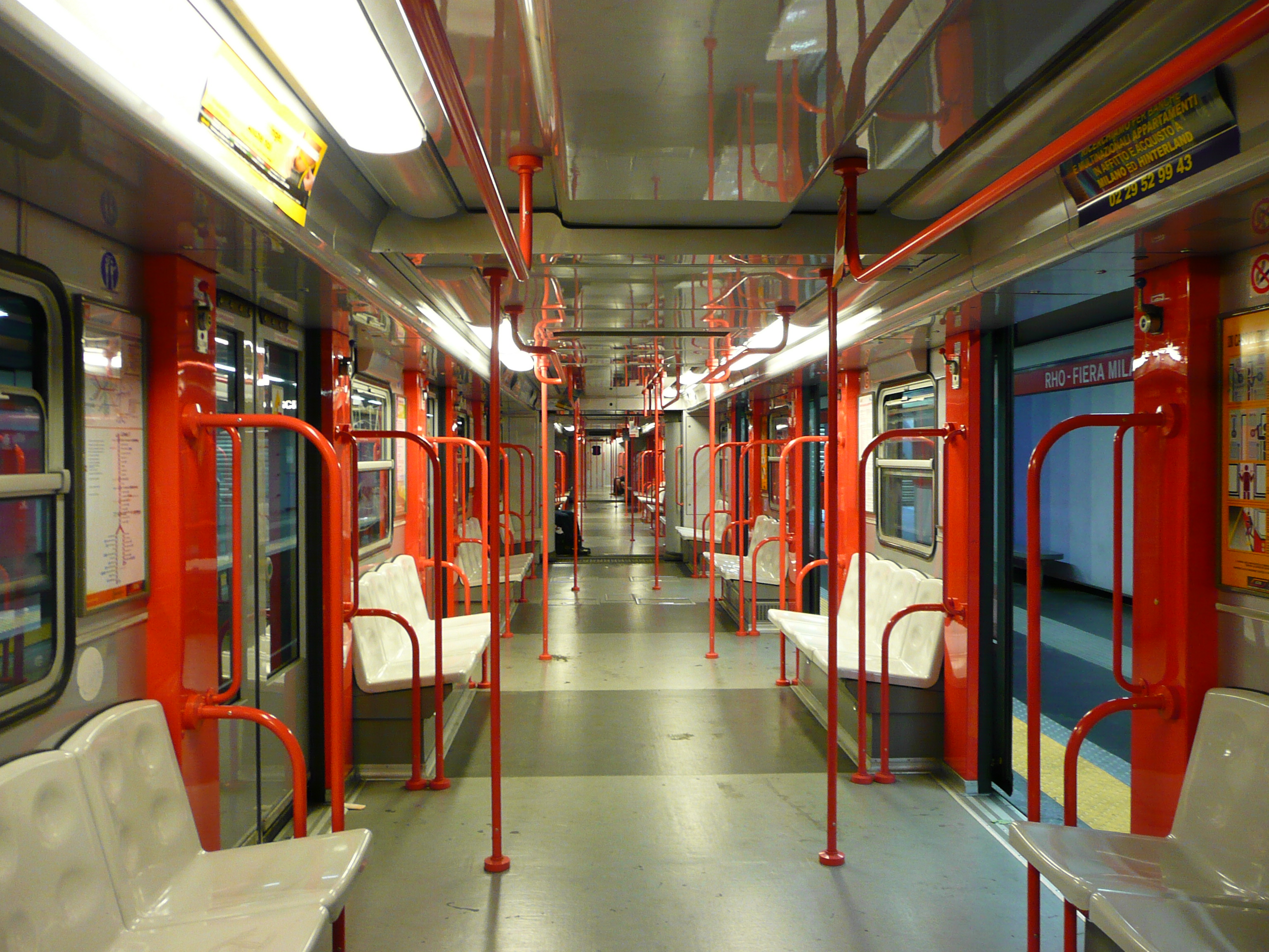
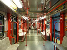 Inside a Line 1 train
Lines 2 and 3 use overhead lines to supply the electric current to the train. Line 1 uses a fourth rail system, although the same line also supports overhead lines in some stretches and depots; this allows Line 2 and 3 trains to use Line 1 tracks to reach a depot placed on the line. The track gauge for all lines is the 1,435 mm (4 ft 8 1⁄2 in) Standard gauge.
Lines 2 and 3 are electrified at 1500 V, line 1 at 750 V.
The future network
Expansions
There is only one short-term expansion project on the Line 1 from Sesto 1° Maggio to Monza Bettola, towards the city of Monza. The track will be 2 km (1.2 mi) long with intermediate station at Sesto Restellone. The completion was originally scheduled for 2009, but it is still under construction.[9]
Long-term Expansions
- Line 1 will be extended from Bisceglie to Baggio neighborhood: 3 km (1.9 mi) with intermediate station at Valsesia.
- Line 2 will be extended from Cologno Nord to Vimercate. The section will be 10.8 km (6.7 mi) long with 6 stations (Brugherio, Carugate, Agrate Colleoni, Concorezzo, Vimercate Torri Bianche, Vimercate). The track will be mostly underground (83%).[10]
- Line 3 will be extended on the south-east from San Donato Milanese to Paullo: 6 km (3.7 mi) with intermediate stations in the city of San Donato, Peschiera Borromeo and Mediglia. The project is currently on hold.
Planned New Lines
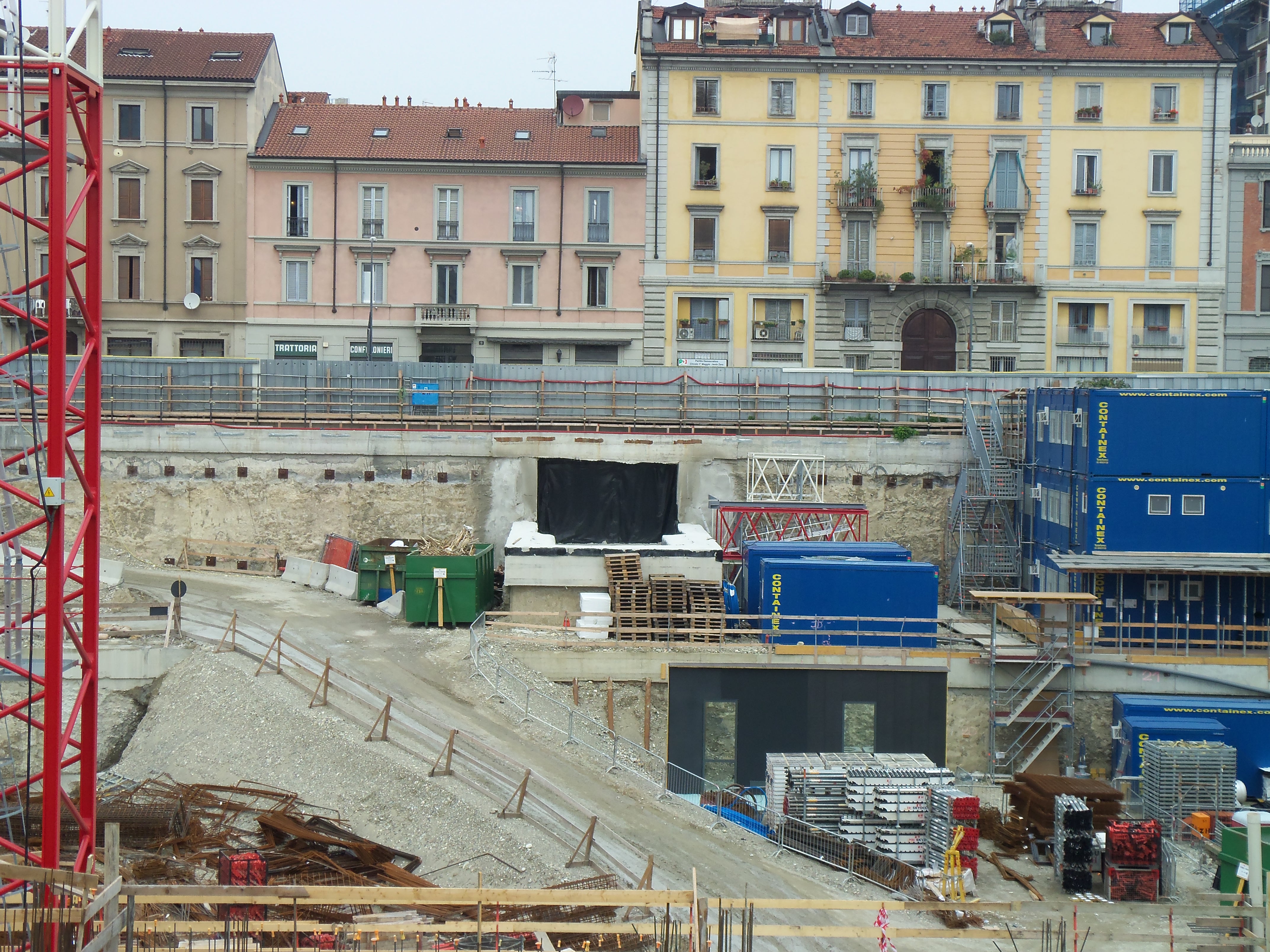
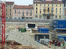 Works at Garibaldi station for the new metro line 5Main articles: Milan Metro Line 4 and Milan Metro Line 5
Since Milan won the bid for the World Exposition in 2015, the city received special funds for the construction of 2 new lines, M4 (light blue) and M5 (lilac), which are going to be completed between 2012 and 2015.
Line Terminals Planned
1st phasePlanned
completeLength Stations M4 Lorenteggio Linate Airport 2015 ? 15.2 km 21 M5 Bignami San Siro Stadium 2012 2015 12.6 km[11] 19 The new Line M4 will run from the western suburb of Lorenteggio to the eastern side of the city to Linate Airport. The line has been approved by Italian Government in March 2006, and funded in November 2009. On the western end, the line was planned to be extended from San Cristoforo railway station, to the suburban comuni of Corsico, Cesano Boscone and Trezzano sul Naviglio. Preliminary prospections begun in mid-2010. Construction has been put on hold again in April 2011 until the next autumn; financial and legal troubles are likely to force the City of Milan to complete only the Linate - San Babila section before the Expo 2015.[12]
Line M5 is divided in two sections. The first section will run from the northern city limits (via Bignami) to Porta Garibaldi railway station, connecting with line M3 below viale Zara, and to both M2 and suburban railways at Porta Garibaldi. The second section will stretch from Porta Garibaldi to San Siro Stadium running north west of the city. The first section is nearing completion and is supposed to be opened in late 2012, whilst the second section is predicted to be completed by 2015.
Both M4 and M5 will be completely automatic and driverless, similar to Copenhagen's new subway lines, and fed through a third rail system, thus marking the third different feeding on Milan Metro (after the fourth rail of M1, and the catenary on M2 and M3).
See also
- Milan Transportation System
- Azienda Trasporti Milanesi
- List of metro systems
- List of rapid transit systems
References
- ^ a b c "World Metro Database". metrobits.org. http://mic-ro.com/metro/table.html.
- ^ a b c d "La storia della linea 1". Metropolitana Milanese Spa. http://www.metropolitanamilanese.it/pub/page/it/MM/metropolitane_milano?contentId=904. Retrieved 31 October 2011.
- ^ a b c "La cronistoria della metropolitana di Milano". Cityrailways. http://www.cityrailways.it/milano-metro-storia/. Retrieved 8 November 2011.
- ^ "Chi eravamo (History of ATM)". Azienda Trasporti Milanesi. http://www.atm-mi.it/it/IlGruppo/LaStoria/Pagine/ChiEravamo.aspx. Retrieved 20 September 2011.
- ^ a b "Biglietti urbani". www.atm-mi.it. http://www.atm-mi.it/it/ViaggiaConNoi/Biglietti/Pagine/BigliettiUrbani.aspx. Retrieved 2 October 2011.
- ^ "Biglietti interurbani". www.atm-mi.it. http://www.atm-mi.it/it/ViaggiaConNoi/Biglietti/Pagine/Bigliettiinterurbani.aspx. Retrieved 2 October 2011.
- ^ "ANCHE MILANO HA LA SUA OYSTER CARD: ITINERO RICARICAMI". Partodamilano. http://www.partodamilano.it/2010/01/anche-milano-ha-la-sua-oyster-card.html. Retrieved 2 October 2011.
- ^ a b "Orari e calendario ATM". Azienda Trasporti Milanesi. http://www.atm-mi.it/it/ViaggiaConNoi/Pagine/orari_calendario.aspx. Retrieved 2 November 2011.
- ^ Baron, Ferdinando (5 July 2011). "M1 fino a Monza, partiti i lavori". Corriere della Sera. http://milano.corriere.it/milano/notizie/cronaca/11_luglio_5/metro-monza-partiti-lavori-1901019985113.shtml. Retrieved 5 October 2011.
- ^ "Prolungamento linee Metropolitane e Nodo Interscambio Fiera". Comune di Milano. http://www.comune.milano.it/portale/wps/portal/searchresultdetail?WCM_GLOBAL_CONTEXT=/wps/wcm/connect/ContentLibrary/ho+bisogno+di/ho+bisogno+di/ho+bisogno+di_muovermi+in+e+fuori+citta_viabilita+e+cantieri+stradali_prolungamento+linee+metropolitane+e+nodo+interscambio+fiera. Retrieved 2 October 2011.
- ^ "Home Page". Metro 5. http://www.metro-5.com/index.php/home-page. Retrieved 18 October 2011.
- ^ "Metrò, cantieri per la linea 5". Corriere della Sera. http://milano.corriere.it/milano/notizie/cronaca/10_agosto_27/metro-cantieri-linea-cinque-1703648382629.shtml. Retrieved 20 September 2011.
External links
 Urban rail transport in Milan
 Milan Metro
 Suburban railwayS1 • S2 • S3 • S4 • S5 • S6 • S7 • S8 • S9 • S10 • S11
ATM (Azienda Trasporti Milanesi) • Trenord • Milan trams • Railway stations in Milan  Urban public transport networks and systems in Italy
Commuter rail 
Rapid transit Trams Bergamo–Albino · Cagliari · Florence · Messina · Mestre (Venice) · Milan · Milan–Desio · Milan–Limbiate · Naples · Padua · Rome · Sassari · Turin · Trieste–OpicinaTrolleybuses Ancona · Bologna · Cagliari · Chieti · Genoa · La Spezia · Milan · Modena · Naples · Parma · Rimini–Riccione · Rome · SanremoPeople movers Categories:- Transport in Milan


Wikimedia Foundation. 2010.