- Mayberry, Maryland
-
Mayberry is an unincorporated community in Carroll County, Maryland, United States.[1] It is served by the Westminster post office, with a ZIP Code of 21158.
References
Municipalities and communities of Carroll County, Maryland County seat: Westminster Cities 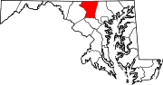
Towns Hampstead | Manchester | Mount Airy‡ | New Windsor | Sykesville | Union Bridge
CDP Other
communitiesAlesia | Carrollton | Carrolltowne | Detour | Fairhaven | Finksburg | Frizzelburg | Gaither | Gamber | Greenmount | Harney | Henryton | Houcksville | Keymar | Keysville | Jasontown | Lineboro | Linwood | Louisville | Mayberry | Mexico | Middleburg | Millers | New Mexico | Patapsco | Pleasant Valley | Silver Run | Union Mills | Uniontown | Woodbine | Woodstock
Footnotes ‡This populated place also has portions in an adjacent county
Coordinates: 39°38′26″N 77°05′58″W / 39.64056°N 77.09944°W
Categories:- Maryland geography stubs
- Populated places in Carroll County, Maryland
- Unincorporated communities in Maryland

Wikimedia Foundation. 2010.