- Neighborhoods of Portland, Maine
-
Portland, Maine is home to many neighborhoods.[1]
Contents
Arts District
Main article: Arts District (Portland, Maine)Portland's Arts District is based around Congress Street in downtown Portland. The District includes the Portland Museum of Art, the Children's Museum of Maine, the Maine College of Art (MECA) and the State Theatre. It is a mixed use neighborhood with both apartments and commercial establishments.[2]
Back Cove
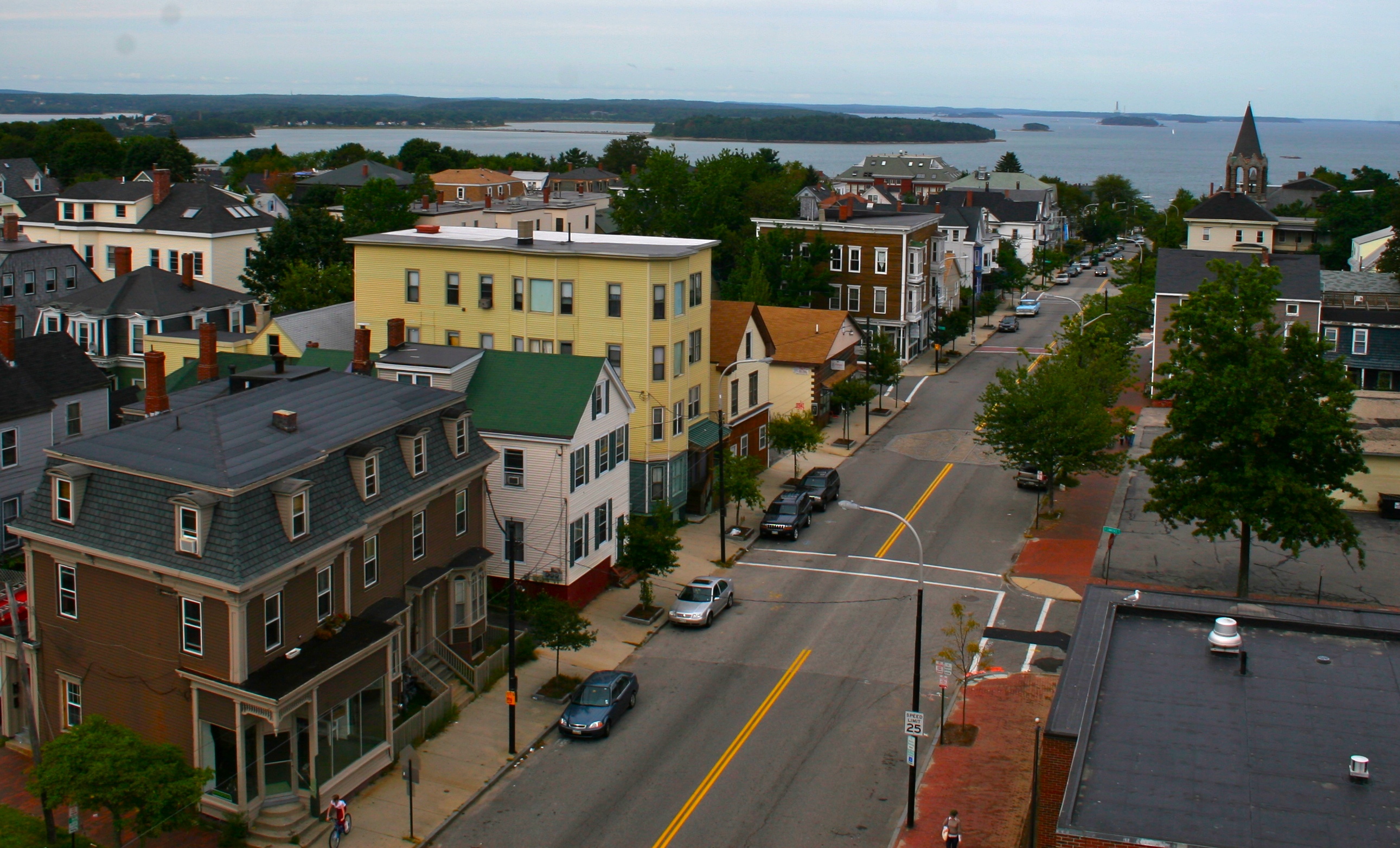
Back Cove is a neighborhood off of Portland's peninsula and downtown areas. With views of the Portland skyline across Back Cove, it borders the neighborhoods of Deering Center, North Deering, East Deering, Rosemont, and Oakdale.
Neighborhood boundaries are: Washington Avenue (North), Baxter Boulevard (East), Forest Avenue (South), and Canco Road (West).
Within the boundaries of the Back Cove neighborhood are Woodford's Corner, Ocean Avenue, Payson Park, Cheverus High School (private Jesuit school), and Ocean Avenue School (Portland Public Schools).
See Also
Back Cove estuary basin in Portland, Maine
External links
Deering Center
Main article: Deering Center, MaineDeering Highlands
Downtown
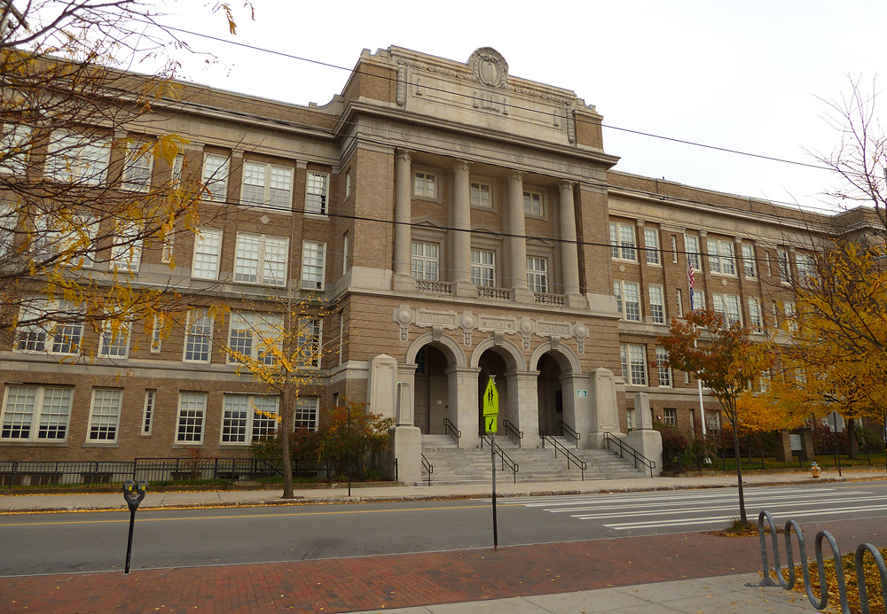
Main article: Old Port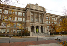 Portland High School, located in Portland's Downtown area.
East Deering
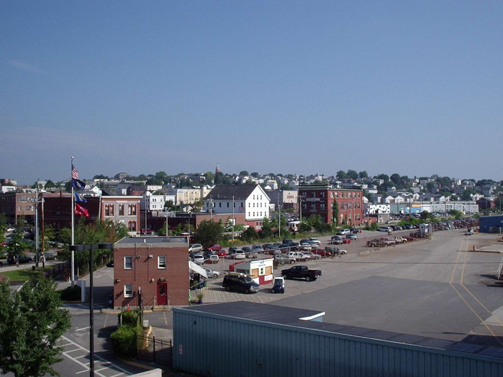
Main article: East DeeringEast Deering is the easternmost neighborhood of the city of Portland, Maine. The suburban neighborhood is situated between the Munjoy Hill and North Deering neighborhoods of the city, as well as the town of Falmouth. East Deering is an economically diverse place, featuring both public housing and more expensive single family homes. Much of the neighborhood has views of Casco Bay and nearby Mackworth Island East Deering was bisected by 295 in the 1960s. Major landmarks in this neighborhood include the Burnham and Morrill Co. (B&M) Baked Bean manufacturing plant, Martin's Point, Presumpscot School, Payson Park, and Lunts Corner.
Payson Park, Presumpscot Elementary School[3] and Martin's Point are also in the neighborhood.[4]
The major throughways in East Deering are Washington Avenue and Veranda Street.
East Bayside
Main article: East BaysideEast Bayside is a neighborhood in Portland, Maine. It is bordered by Franklin Street on the west, Washington Avenue on the east, to the north by Marginal Way, and the south by Congress Street.[5] It was first developed a street network in the early 19th century. By the 1820’s the area was Portland’s second seaport via the Back Cove’s ship channel. In 1840 the Union Railroad ran along the then shoreline of Back Cove, following approximately where Oxford Street is today. Much of the debris from the great Portland fire of 1866 was deposited into Back Cove, significantly increasing the size of East Bayside. Maps produced around 1900 show an extension of the shoreline out to Marginal Way. The shoreline would not change again until the construction of the Interstate in 1974.
East End
 Munjoy Hill.
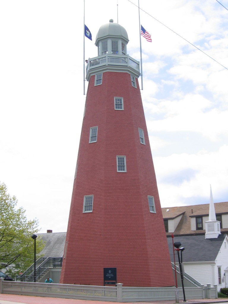
 The East End.Main article: Munjoy HillMain article: Eastern Promenade
 The Portland Observatory, built in 1807, sits atop Munjoy Hill
The East End is a neighborhood on the far eastern end of Portland's peninsula. It is closely linked with Munjoy Hill and the Eastern Promenade. The East End Community School, located on North Street, serves the area.[6] The East End Beach is also located there. Notable buildings include the Portland Observatory at the top of Munjoy Hill.
Libbytown
Libbytown[7] is a neighborhood in southern and western Portland, wedged between the Stroudwater, Rosemont, Oakdale, and Parkside neighborhoods, and separated from the city of South Portland by the Fore River.[1] Maine's busiest public transit hub, the Portland Transportation Center, is in Libbytown.
It was originally settled by Irish Catholic immigrants. Described as cohesive, it began to decline following the 1961 destruction of Union Station on St. John Street. It is named after the Libby family, who immigrated from Ireland in the mid-ninteenth century and set up three business between Park Avenue and outer Congress Street. It extends to the intersection of Stevens Avenue and Congress Street.[7] Tony's Donuts, a donut shop, was established in the neighborhood in 1965.[7]
Nasons Corner
North Deering
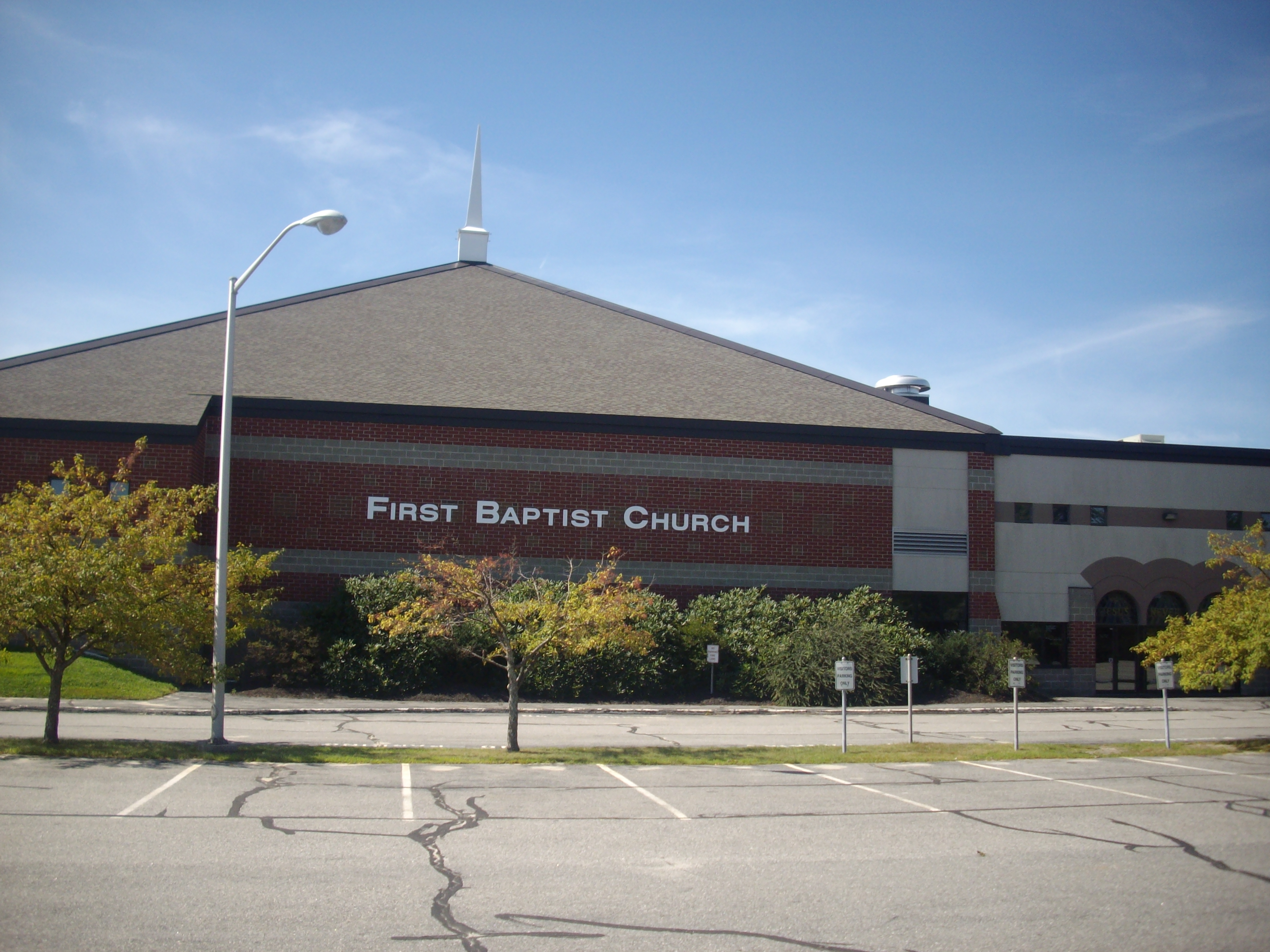
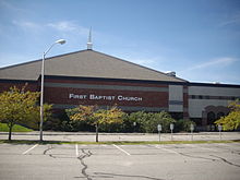 The First Baptist Church in North Deering.
North Deering is the northernmost neighborhood of the city of Portland, Maine. It is situated next to the Riverton and East Deering neighborhoods of the city, as well as the town of Falmouth. It is home to some of the oldest surviving houses in the city, because the neighborhood was spared all of the four fires that plagued much of the rest of the city in the past. In North Deering's early history it had an agriculture and lumber based economy, but with the spread of the automobile, North Deering became more economically connected to the rest of the city. Today it has become a suburban neighborhood with some retail activity. It is home to WGME, Portland's local CBS affiliate.
It is served by Harrison Lyseth Elementary School, and Lyman Moore Middle School (which also serves the East Deering and Munjoy Hill neighborhoods). North Deering high school aged students choose between attending Portland High School, Deering High School, or Casco Bay High School, all three of which serve the entire city.
Oakdale
Oakdale is home to the Portland campus of the University of Southern Maine.[8]
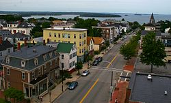
Old Port
Main article: Old PortParkside
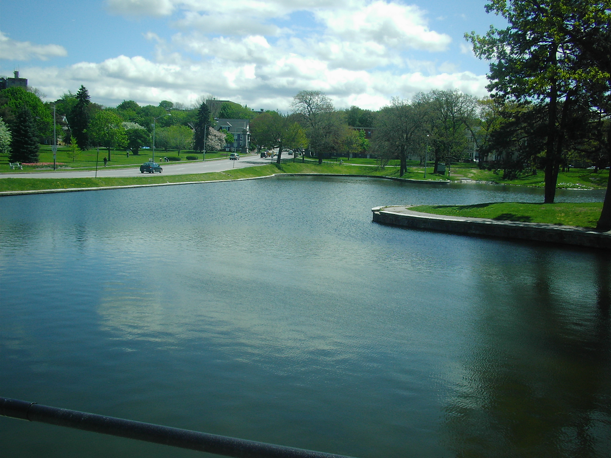
 Deering Oaks pond overlooking Parkside.
Parkside is a neighborhood located immediately around Deering Oaks, an historic park officially established in 1879. Called "Maine’s most notorious neighborhood" by The Bollard in 2009, Parkside is bordered to the north by Deering Oaks. Hadlock Field, home of the Portland Seadogs, roughly forms the southern border of the neighborhood. Herb Adams resides in and represented the district in the Maine House of Representatives. The neighborhood began following the 1866 Great Fire of Portland, Maine when most of Portland's waterfront and downtown were burned. Residents moved south across the peninsula and laid out Sherman Ave. and Grant Ave. (now streets), named after Civil War generals William Tecumseh Sherman and future President Ulysses S. Grant. The homes in the neighborhood are primarily Triple decker buildings and soon after its founding became home to much of Portland's Italian and Irish immigrant populations. The neighborhood was previously known for rampant drug use and prostitution.[9]
Peaks Island
Main article: Peaks Island, MaineRiverton
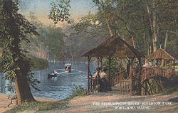 Riverton Park circa 1910.
Riverton neighborhood is located in northwestern Portland. The Riverton Trolley Park, established in 1896, was located in the neighborhood. The park closed in 1929. At the time, it was a premier leisure destination. A trolley brought people from Monument Square to the area.[10] A branch of the Portland Public Library is located there as well.[11] Riverton Elementary School serves as the neighborhood school.[12] The University of New England merged with Westbrook College in 1996, with Westbrook College's campus in Riverton becoming UNE's Portland Campus. It is home of the Westbrook College Historic District.
Rosemont
Rosemont is a neighborhood in Portland located close to Deering Center and other off-peninsula neighborhoods. In 2008, it was home to a number of former city councilors.[13]
Stroudwater
Stroudwater is located in the southwest corner of Portland, bordered by the Nasons Corner and Libbytown neighborhoods to the north and east, the city of Westbrook to the west, and the city of South Portland to the south.[1] Maine's busiest airport, the Portland International Jetport, originally known as Stroudwater Field, is located here. Stroudwater is home to a number of historic structures, including the oldest standing building in Portland, the Tate House and Museum, which was built in 1755. The Stroudwater Historic District is also located here. It is home to the mouth of the Stroudwater River.
History
Stroudwater was founded as a hamlet which, with power generated by the Stroudwater River and Fore Rivers, was an important producer of masts for the Royal Navy. In the 2000s, Stroudwater was considered a quiet suburb of Downtown Portland, though it is still officially within the city boundaries.[14]
West End
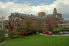 Maine Medical Center is a major institution located in the West End.Main article: West End (Portland, Maine)
The West End is a neighborhood in Portland, Maine. Located on the western side of Portland's peninsula, it includes a number of historical and well-preserved architecture.
Noted for its architecture[15], the West End is home to a number of historical homes and the Western Promenade Historic District. In 2010, it was called "one of the best preserved Victorian neighborhoods in the country".[16] The Western Promenade features prominently in the neighborhood. Other historical buildings include The Gothic House, Harrison B. Brown House, A.B. Butler House, Joseph Holt Ingraham House, Morrill Mansion, William Minott House and Waynflete School. The Western Cemetery, Portland's primary cemetery from 1829-1852, is located in the neighborhood as well. Maine Medical Center, Maine's largest hospital and Portland's largest employer, is also located in the West End.
References
- ^ a b c "City of Portland, Maine Neighborhood Areas". Department of Public Works, City of Portland. May 2007. http://www.portlandmaine.gov/neighborhoods3.pdf. Retrieved 1 November 2010.
- ^ Arts District - Portland's Cultural Center PortlandMaine.com
- ^ Presumpscot Elementary School PortlandSchools.org
- ^ Busby, Chris (August 10, 2010). "Cool Summer Hot Spots!". The Bollard. http://www.thebollard.com/bollard/?p=7714. Retrieved 12 October 2011.
- ^ Public input sought on East Bayside Portland Press Herald, March 17, 2010
- ^ East End Community School
- ^ a b c Deans, Emma (8 July 2010). "Welcome to Nowhere - Reconnecting an amputated neighborhood". The Bollard. http://www.thebollard.com/bollard/?p=7612. Retrieved 1 November 2010.
- ^ 'INSTITUTIONAL CREEP' WORRIES NEIGHBORS, CITY Portland Press Herald, September 4, 2001
- ^ Busby, Chris (August 9, 2009). "The Dark Side of Parkside". The Bollard. http://www.thebollard.com/bollard/?p=6580. Retrieved 12 October 2011.
- ^ Welcome to the Riverton Trolley Park Portlandmaine.gov
- ^ Riverton Branch PortlandLibrary.com
- ^ Riverton PortlandSchools.org
- ^ Banks, Patrick (December 5, 2008). "That’s My Dump!". The Bollard. http://www.thebollard.com/bollard/?p=4088. Retrieved 12 October 2011.
- ^ Insiders' Guide to Portland, Maine By Sara Donnelly, Meredith Goad
- ^ A West End hideaway in Portland Boston Globe, September 21, 2008
- ^ study in architecture: Portland, Maine Star Tribune, June 19, 2010
The City of Portland, Maine General Geography Bramhall Hill · Cliff Island · Cow Island · Cushing Island · East End Beach · Fore River · Fore River Sanctuary · Great Diamond Island · Jewell Island · Little Diamond Island · Mackworth Island · Munjoy Hill · Peaks IslandNeighborhoods Arts District · Back Cove · East Bayside · Deering Center · Munjoy Hill · Old Port · Portland Financial District · West EndStreets and Squares Commercial Street · Congress Street · Eastern Promenade · Exchange Street · Franklin Street · Longfellow Square · Monument Square · Western PromenadeSports teams Current: Maine Red Claws · Portland Phoenix FC · Portland Pirates · Portland Sea Dogs Former: Maine Mariners · Portland Blue Sox · Portland Pilots · Portland WaveMetropolitan area Greater PortlandEducation University of Southern Maine · Maine College of Art · University of New England · Portland, Maine schools · Casco Bay HS · Catherine McAuley HS · Cheverus HS · Deering HS · Portland HS · Waynflete SchoolCategories:


Wikimedia Foundation. 2010.