- Markovo, Chukotka Autonomous Okrug
-
Markovo (English)
Марково (Russian)- Rural locality[1] -
Selo[1]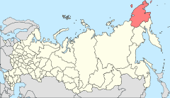
Location of Chukotka Autonomous Okrug in Russia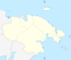
 MarkovoLocation of Markovo in Chukotka Autonomous Okrug
Coordinates: 64°40′N 170°25′E / 64.667°N 170.417°ECoordinates: 64°40′N 170°25′E / 64.667°N 170.417°E Administrative status (as of June 2009) Country Russia Federal subject Chukotka Autonomous Okrug[1] Administrative district Anadyrsky District[citation needed] Municipal status (as of October 2010) Municipal district Anadyrsky Municipal District[2] Rural settlement Markovo Rural Settlement[2] Administrative center of Markovo Rural Settlement[2] Statistics Population (2005 est.) 865 inhabitants[3] Time zone MAGST (UTC+12:00)[4] Postal code(s) 689530[5] Dialing code(s) +7 42732[6] Markovo (Russian: Марково) is a village (selo) situated near the head of small-boat navigation of the Anadyr River, near the center of the Anadyrsky District (Raion) of the Chukotka Autonomous Okrug, part of the Far Eastern Federal District of Russia. The population in June 2005, according to an evnvironmental impact report prepared for the Kupol Gold Project, was 865,[3]Municipally, Markovo is incorporated as Markovo Rural Settlement.[2] Although now a small village, but still quite large by chukotkan standards, the village has historically been an important settlement in the region and was a hub for trade during the early period of Cossack exploration.
Contents
History
The village is comparatively large for the region, with a population of 865 as of 2005 down from 1170, reported in 2003[7] and around 2,000 reported for 1993,[8] making it one of the more important small settlements in Chukotka. Having formerly been a Cossack settlement, it was one of the first Russian speaking settlements in the Okrug.[7] The date of founding of the settlement is not known, though it is considered to be one of the first settlements in Chukotka. It is known that crew from Semyon Dezhnev's expedition wintered close to the site of the current settlement and that Anadyrsk was founded on the site at a later date as a base for exploring Chukotka and potential routes to Kamchatka. The Cossacks were followed by others looking for business opportunities and those who did not wish to continue being serfs. It is thought that the settlement as it is today evolved in the middle of the 18th century and was named either after an early settler called Markov or that it was consecrated by the local Saint Mark.[9]
A century ago, Markovo was the cultural centre of the Markovsky District (which was later split into Anadyrsky District and Bilibinsky District in 1958) [9] and was the location of the first parochial school in Chukotka, construction of which began in 1862.[7] The cultural significance of the village continues today, as it is the home town of the Markovskiye Vechiorki Chorus, who specialise in old Cossack songs.[7] The historical cultural significance of the town means that it also plays an important role in the general day to day life of the region as a whole, as it is the location of a boarding High School and cultural centre, with a new hospital also under construction.[7]
In 1998, Markovo was reclassified as a village (selo).[10]
Demographics
The population was recorded in 2000 as being 1072, consisting of 447 people of indigenous origin, made up of 299 Chuvans, 62 Chukchi, 60 Evens and 26 Yukaghir.[8] The remainder of the village population are Russian. Of all the families in the village, regardless of ethnicity, only 5% had a regular monthly income, with most families living below the poverty line.[11] In 2000, the monthly living salary in Chukotka was 3800 rubles, in Markovo the minimum salary was 350-80 rubles per month with an additional pension of between 700 and 1100 rubles plus welfare payments of around 160 rubles.[11] There were however, salaries of several managers reported at around 15,000 rubles.[11] By 2005, the population of 865 contained 476 people of indigenous origin.[12]
Climate
Markovo's climate is quite varied. Although it can be below freezing from September through to the end of the following May, and regularly below -200C from November through to the end of the following April, the short summer running from June to august are usually quite temperate, with record temperatures achieved during these months which are some of the warmest for the Okrug.
Climate data for Markovo Month Jan Feb Mar Apr May Jun Jul Aug Sep Oct Nov Dec Year Record high °C (°F) 5
(41)4
(39)5
(41)8
(46)20
(68)31
(87)32
(89)29
(84)22
(71)15
(59)7
(44)10
(50)32
(89)Average high °C (°F) −23
(−9)−21
(−5)−17
(1)−9
(16)2
(36)16
(60)19
(66)16
(60)8
(46)−5
(23)−15
(5)−21
(−5){{{year high C}}}
(24)Average low °C (°F) −32
(−25)−31
(−23)−29
(−20)−21
(−5)−7
(19)4
(39)8
(46)6
(42)−1
(31)−13
(8)−24
(−11)−30
(−22){{{year low C}}}
(6)Record low °C (°F) −60
(−76)−58
(−72)−52
(−61)−43
(−45)−34
(−29)−5
(23)−3
(26)−6
(21)−18
(0)−39
(−38)−49
(−56)−54
(−65)−60
(−76)Rainfall mm (inches) 43.2
(1.701)25.4
(1)27.9
(1.098)15.2
(0.598)17.8
(0.701)27.9
(1.098)50.8
(2)71.1
(2.799)35.6
(1.402)38.1
(1.5)48.3
(1.902)33
(1.3)432
(17.01)Source: weatherreports.com[13] Economics
The economy is driven mainly by subsistence reindeer herding,[7] and fishing a result of the large proportion of indigenous people, living in the village.[14]
In 2000, 531 of the reported 1072 population were employed in Markovo village.[14] Of these, 276 were employed either in Housing and communal services or in various federal organisations[14] However, many of the employment opportunities in the village were staffed by incoming Russians, leaving the indigenous people with a level of responsibility that did not reflect their proportion of the population. The indigenous population made up just under half of the population, but it was only in the federal organisations, education and agriculture sectors that they held just under half the positions.[14] Many other sections were dominated by immigrant Russians including Communications, Trading, Police, Fire Department, Forestry, Meteorology, Fisheries and Airport sectors,[14] as well as Construction and Banking, where the indigenous people held no influence at all.[14]
People from Markovo were the founders of the village of Ust-Belaya around the beginning of the twentieth century, also located along the banks of the Anadyr River.[7]
See also
- List of inhabited localities in Anadyrsky District
References
Notes
- ^ a b c Law #33-OZ, Article 13.2
- ^ a b c d Law #148-OZ, Article 10
- ^ a b Environmental Impact Assessment, Kupol Gold Project, Far East Russia June 2005, prepared by Bema Gold Corporation, p.87
- ^ Правительство Российской Федерации. Постановление №725 от 31 августа 2011 г. «О составе территорий, образующих каждую часовую зону, и порядке исчисления времени в часовых зонах, а также о признании утратившими силу отдельных Постановлений Правительства Российской Федерации». Вступил в силу по истечении 7 дней после дня официального опубликования. Опубликован: "Российская Газета", №197, 6 сентября 2011 г. (Government of the Russian Federation. Resolution #725 of August 31, 2011 On the Composition of the Territories Included into Each Time Zone and on the Procedures of Timekeeping in the Time Zones, as Well as on Abrogation of Several Resolutions of the Government of the Russian Federation. Effective as of after 7 days following the day of the official publication).
- ^ Pochtovik Russian Mail Delivery Service Anadyrsky District (Russian)
- ^ Ministry of Justice of the Russian Federation Anadyrsky Municipal District (Russian)
- ^ a b c d e f g [1] Red Cross Chukotka
- ^ a b Anadyr River Watershed, Rapid Assessment Report, Chereshnev, I and Shestakov, Institute of biological Problems of the North, p.12
- ^ a b Petit Fute, Chukotka, p.90
- ^ ИЗМЕНЕНИЯ В АДМИНИСТРАТИВНО-ТЕРРИТОРИАЛЬНОМ УСТРОЙСТВЕ СУБЪЕКТОВ РОССИЙСКОЙ ФЕДЕРАЦИИ за 1989-2002 годы (Changes in administrative-territorial structure of subjects of the Russian Federation for the years 1989-2002) (Russian)
- ^ a b c Anadyr River Watershed, Rapid Assessment Report, Chereshnev, I and Shestakov, Institute of biological Problems of the North, p.14
- ^ Environmental Impact Assessment, Kupol Gold Project, Far East Russia June 2005, prepared by Bema Gold Corporation, p.89
- ^ "Weather Averages for Markovo" (in eng). weatherreports.com. http://www.weatherreports.com/Russia/Markovo/averages.html. Retrieved April 11, 2010.
- ^ a b c d e f Anadyr River Watershed, Rapid Assessment Report, Chereshnev, I and Shestakov, Institute of biological Problems of the North, p.13
Sources
- Дума Чукотского автономного округа. Закон №33-ОЗ от 30 июня 1998 г. «Об административно-территориальном устройстве Чукотского автономного округа», в ред. Закона №73-ОЗ от 24 июня 2009 г. «О внесении изменений в Закон Чукотского автономного округа "Об административно-территориальном устройстве Чукотского автономного округа"». Вступил в силу по истечении десяти дней со дня его официального опубликования. Опубликован: "Ведомости", №7 (28), 14 мая 1999 г. (Duma of Chukotka Autonomous Okrug. Law #33-OZ of June 30, 1998 On the Administrative and Territorial Structure of Chukotka Autonomous Okrug, as amended by the Law #73-OZ of June 24, 2009 On Amending the Law of Chukotka Autonomous Okrug "On the Administrative and Territorial Structure of Chukotka Autonomous Okrug". Effective as of after ten days from the day of the official publication).
- Дума Чукотского автономного округа. Закон №148-ОЗ от 24 ноября 2008 г. «О статусе, границах и административных центрах муниципальных образований на территории Анадырского муниципального района Чукотского автономного округа», в ред. Закона №71-ОЗ от 10 сентября 2010 г «Об упразднении сельского поселения Краснено Анадырского муниципального района Чукотского автономного округа и о внесении изменений в отдельные законодательные акты Чукотского автономного округа». Вступил в силу через десять дней со дня официального опубликования. Опубликован: "Ведомости", №46/1 (373/1), 28 ноября 2008 г. (Duma of Chukotka Autonomous Okrug. Law #148-OZ of November 24, 2008 On the Status, Borders, and Administrative Centers of the Municipal Formations on the Territory of Anadyrsky Municipal District of Chukotka Autonomous Okrug, as amended by the Law #71-OZ of September 10, 2010 On the Abolition of Krasneno Rural Settlement of Anadyrsky Municipal District of Chukotka Autonomous Okrug and on Amending Several Legislative Acts of Chukotka Autonomous Okrug. Effective as of the day ten days after the official publication date).
- Petit Fute, Chukotka
External links
Administrative divisions of Chukotka Autonomous Okrug Administrative center: Anadyr Cities and towns 
Urban-type settlements Aliskerovo · Baranikha · Beringovsky · Bystry · Dalny · Egvekinot · Komsomolsky · Krasnoarmeysky · Leningradsky · Mys Shmidta · Otrozhny · Provideniya · Shakhtyorsky · Ugolnye Kopi · Valkumey · Vesenny · Vstrechny · YuzhnyAdministrative districts (raions) Categories:- Rural localities in Chukotka Autonomous Okrug


Wikimedia Foundation. 2010.