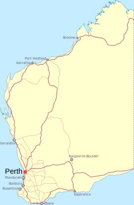
- Mainland, Western Australia
-
Mainland
Western AustraliaEstablished: 1898 Postcode: 6640 Elevation: 418 m (1,371 ft) Location: LGA: Shire of Cue State District: North West Federal Division: Durack Coordinates: 27°35′S 117°55′E / 27.583°S 117.917°E
Mainland is an abandoned town in the Mid West region of Western Australia. The town is located between Cue and Austin.
Gold was discovered in the area in 1892 and was initially known as Mainland since it was located on the northern shore of Lake Austin so the name distinguished it from it's neighbouring town of Austin which was also known as The Island. The town was gazetted in 1898.[1]
References
- ^ Western Australian Land Information Authority. "History of country town names". http://www.landgate.wa.gov.au/corporate.nsf/web/History+of+country+town+names. Retrieved 2011-05-06.
Towns in the Mid West region of Western Australia Abbotts · Ajana · Alma · Arrino · Arrowsmith · Austin · Big Bell · Binnu · Boogardie · Bowgada · Bunjil · Canna · Cape Burney · Carnamah · Caron · Coorow · Cuddingwarra · Cue · Day Dawn · Dongara · Drummond Cove · East Bowes · Eneabba · Eradu · Gabanintha · Green Head · Greenough · Gunyidi · Gutha · Horseshoe · Horrocks · Howatharra · Isseka · Kalbarri · Kojarena · Koolanooka · Kumarina · Latham · Leeman · Lennonville · Lynton · Mainland · Marchagee · Maya · Meekatharra · Merkanooka · Mingenew · Minnenooka · Moonyoonooka · Morawa · Mount Erin · Mount Magnet · Mullewa · Nabawa · Nangetty · Nannine · Nanson · Naraling · Narngulu · Narra Tarra · Northampton · Oakajee · Ogilvie · Paynes Find · Peak Hill · Paynesville · Perenjori · Pindar · Pintharuka · Porlell · Port Denison · Port Gregory · Protheroe · Reedy · Rothsay · Sandstone · Tardun · Tenindewa · Three Springs · Tuckanarra · Waggrakine · Walkaway · Warriedar · Whelarra · Wicherina · Wiluna · Winchester · Yalgoo · Yandanooka · Youanmi · Yoweragabbie · Yuna
Categories:- Towns in Western Australia
- Ghost towns in Western Australia
Wikimedia Foundation. 2010.

