- Oakajee, Western Australia
-
Oakajee
Western AustraliaEstablished: 1996 Postcode: 6532 Location: LGA: Shire of Chapman Valley State District: Moore Federal Division: Durack Coordinates: 28°36′07″S 114°36′43″E / 28.602°S 114.612°E
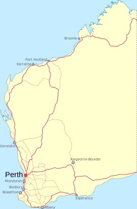
Oakajee is a locality located in the Mid West region of Western Australia, about 25 kilometres (16 mi) north of the city of Geraldton and about 6 kilometres (3.7 mi) inland from the coastline.[1]
The area is associated with the Oakajee Port which is due for completion in 2012.[2]
See also
References
- ^ "Oakajee". Gazetteer of Australia. http://www.ga.gov.au/bin/gazd01?rec=277325. Retrieved 2008-07-30.
- ^ "Oakajee Port and Rail to build new Mid-West iron ore port". Government Media Office. 29 July 2008. http://www.mediastatements.wa.gov.au/Pages/CurrentMinistersSearch.aspx?ItemId=130606&search=oakajee&admin=Carpenter&minister=MacTiernan&portfolio=®ion=. Retrieved 2008-07-30.[dead link]
Suburbs in the Geraldton region | Mid West | Western Australia Suburbs Beachlands · Beresford · Bluff Point · Deepdale · Drummond Cove · Geraldton · Glenfield · Karloo · Mahomets Flats · Meru · Moresby · Mount Tarcoola · Narngulu · Rangeway · Spalding · Strathalbyn · Sunset Beach · Tarcoola Beach · Utakarra · Waggrakine · Wandina · Webberton · West End · Wonthella · Woorree
Regional Cape Burney · Eradu · Greenough · Kojarena · Minnenooka · Moonyoonooka · Nabawa · Nanson · Oakajee · Rudds Gully · Walkaway · Wicherina · Yuna
Categories:- Towns in Western Australia
- Mid West (Western Australia)
- Coastal towns in Western Australia
- Western Australia geography stubs
Wikimedia Foundation. 2010.

