- Meekatharra, Western Australia
-
Meekatharra
Western Australia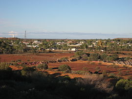
View of Meekatharra from the local lookout
 Meekatharra
Population: 798 (2006 census) Postcode: 6642 Coordinates: 26°35′35″S 118°29′28″E / 26.593°S 118.491°ECoordinates: 26°35′35″S 118°29′28″E / 26.593°S 118.491°E Elevation: 517 m (1,696 ft) Location: LGA: Shire of Meekatharra State District: North West Federal Division: Durack Mean max temp Mean min temp Annual rainfall 28.8 °C
84 °F15.8 °C
60 °F236.9 mm
9.3 inMeekatharra is a town in the Mid West region of Western Australia. Meekatharra is an Australian Aboriginal word meaning 'place of little water'. At the 2006 census, Meekatharra had a population of 798, with 44.0% being Aboriginal.[1]
Meekatharra is a major supply centre for the pastoral and mining area in the Murchison region of Western Australia. It is located 764 km north-east of Perth and may be reached by the Great Northern Highway. It is a centre for sheep and cattle transshipment, initially by rail but now by road trains. It is also a regional home to the Royal Flying Doctor Service and the School of the Air. It is connected by public transport to Geraldton with connections to Perth via Transwa coach service N4. No viable horticultural industry exists in the area, although extensive but poor cattle stations in the Murchison and Gascoyne exist.
Meekatharra underwent a significant gold rush during the mining boom of the 1980s, with mining continuing until May 2004 at St Barbara Mines's Bluebird Gold Mine. Exploration restarted in the area and St Barbara sold out to a company known as Mercator Gold in October 2005.[2] Mercator Gold then conducted an extensive drilling programme and re-opened the mill, commencing production in early October 2007.[3] This ming phase however was short lived, with Mercator going into administration in October 2008[4] and closing the mine. The company hopes to sell Bluebird in 2010.[5]
Contents
Transport
It was an important location in the Western Australian Government Railways system - being the northernmost location in the Northern Railway railway network, apart from the isolated Marble Bar Railway branch out of Port Hedland. For a while a further branch line continued eastwards to Wiluna. The line was closed from Mullewa and pulled up in the 1970s. In the 2000s, new iron ore prospects may see the railway return.[6]
A 2,181-metre runway, now known as Meekatharra Airport, was built by the Americans during World War II. It serves as an important ETOPS diversion airport for inbound transcontinental flights to Australia.
History
Meekatharra is a former gold rush town. It seems the first settlement at Meekatharra occurred in 1894 and that, in May 1896, after the prospectors Meehan, Porter and Soich discovered gold, miners moved to the new settlement from the other East Murchison fields and mining grew rapidly in scale and sophistication. The Peak Hill mining town was founded in 1892 approximately 100 km up the road during this initial gold rush.
Success on the Meekatharra field was short-lived. It was only because a second gold discovery occurred in 1899 that the town survived. In 1901 the Meekatharra State Battery began operation and by Christmas Day 1903 the township had been officially gazetted.
In 1906 Alfred Wernam Canning was appointed to develop a stock route from the East Kimberleys to the Murchison. The stock route, comprising 54 wells, was completed in 1908 and, when the railway arrived in Meekatharra in 1910, the town became the railhead at the end of the route. In many ways the railway ensured the town's survival. In 1910 it took the first shipment of wool out of the area and it continued to serve the local pastoral interests until it was closed down in 1978.
From 1927 until 1931, a railway line operated from Meekatharra to the manganese mine at Horseshoe, some 80 miles (128 km) distant.[7]
Substantial gold deposit which lies just south of the townsite called the Paddy's Flat area was explored and mined by Western Mining Corporation and Dominion Mining Ltd in the 1990s.[8]
Climate
The climate is hot and dry. The annual rainfall is between 200 mm and 500 mm (20 inches). The driest months of the year is August through to November.
Climate data for Meekatharra airport Month Jan Feb Mar Apr May Jun Jul Aug Sep Oct Nov Dec Year Record high °C (°F) 45.7
(114.3)45.5
(113.9)43.7
(110.7)39.7
(103.5)36.0
(96.8)28.8
(83.8)28.8
(83.8)32.6
(90.7)37.7
(99.9)41.0
(105.8)42.3
(108.1)45.3
(113.5)45.7
(114.3)Average high °C (°F) 38.3
(100.9)36.6
(97.9)34.3
(93.7)29.2
(84.6)23.7
(74.7)19.6
(67.3)19.0
(66.2)21.4
(70.5)25.6
(78.1)29.6
(85.3)33.2
(91.8)36.4
(97.5)28.9 Average low °C (°F) 24.4
(75.9)23.7
(74.7)21.3
(70.3)17.1
(62.8)12.1
(53.8)8.8
(47.8)7.4
(45.3)8.5
(47.3)11.5
(52.7)15.1
(59.2)18.7
(65.7)22.0
(71.6)15.9 Record low °C (°F) 12.2
(54.0)12.3
(54.1)10.3
(50.5)5.7
(42.3)1.7
(35.1)0.4
(32.7)−0.2
(31.6)0.0
(32.0)3.0
(37.4)4.3
(39.7)8.0
(46.4)11.1
(52.0)−0.2
(31.6)Precipitation mm (inches) 27.1
(1.067)37.3
(1.469)28.2
(1.11)20.5
(0.807)22.9
(0.902)30.2
(1.189)22.0
(0.866)11.5
(0.453)4.8
(0.189)6.3
(0.248)11.5
(0.453)13.6
(0.535)235.9
(9.287)Avg. precipitation days 4.2 4.6 4.2 4.3 4.5 6.0 5.7 3.8 1.9 1.7 2.4 3.1 46.4 Source: [9] References
- ^ Australian Bureau of Statistics (25 October 2007). "Community Profile Series : Meekatharra (L) Urban Centre/Locality". 2006 Census of Population and Housing. http://www.censusdata.abs.gov.au/ABSNavigation/prenav/ProductSelect?newproducttype=Community+Profiles&collection=Census&period=2006&areacode=UCL517600&breadcrumb=LP¤taction=201&action=401. Retrieved 2008-10-02.
- ^ Proposed Meekatharra Asset Acquisition from St Barbara Mines Limited Mercator website, published: 3 November 2005, accessed: 13 January 2010
- ^ Final Results Year Ended 30 June 2008 Mercator website, Published: 1 April 2009, accessed: 13 January 2010
- ^ Statement re Suspension Mercator website, Published: 9 October 2008, accessed: 13 January 2010
- ^ Trading Statement & Interim Results for the 12 month to 30 June 2009 Mercator website, Published: 31 December 2009, accessed: 13 January 2010
- ^ Golden West Resources | Wiluna West Iron Project
- ^ Australian Railway Historical Society Bulletin, August 1984, pp 183-189
- ^ "Mindax - Former Normandy Executives Team up in $3 Million Mindax Gold IPO". 2004. http://www.mindax.com.au/default.aspx?id=303&newsid=2. Retrieved 2008-08-25.
- ^ "Climate statistics for Meekatharra Airport". Bureau of Meteorology. http://www.bom.gov.au/climate/averages/tables/cw_007045_All.shtml. Retrieved 13 October 2011.
Further reading
- Boyd, D. (1988) Meekatharra: a glimpse of the past Meekatharra, W.A: Shire of Meekatharra ISBN 0731643089. "A Bicentennial, Back to Meekatharra publication".
- Edwards, Hugh, (1994) Meekatharra: the gold beyond the rivers Swanbourne, W.A: H. Edwards for the Meekatharra Shire. ISBN 064620842X
- Heydon, P.R. (1994) Meekatharra: end of the earth West Perth, W.A: Dominion Mining; Carlisle, W.A: Hesperian Press, ISBN 085905196X
External links
Towns in the Mid West region of Western Australia Abbotts · Ajana · Alma · Arrino · Arrowsmith · Austin · Big Bell · Binnu · Boogardie · Bowgada · Bunjil · Canna · Cape Burney · Carnamah · Caron · Coorow · Cuddingwarra · Cue · Day Dawn · Dongara · Drummond Cove · East Bowes · Eneabba · Eradu · Gabanintha · Green Head · Greenough · Gunyidi · Gutha · Horseshoe · Horrocks · Howatharra · Isseka · Kalbarri · Kojarena · Koolanooka · Kumarina · Latham · Leeman · Lennonville · Lynton · Mainland · Marchagee · Maya · Meekatharra · Merkanooka · Mingenew · Minnenooka · Moonyoonooka · Morawa · Mount Erin · Mount Magnet · Mullewa · Nabawa · Nangetty · Nannine · Nanson · Naraling · Narngulu · Narra Tarra · Northampton · Oakajee · Ogilvie · Paynes Find · Peak Hill · Paynesville · Perenjori · Pindar · Pintharuka · Porlell · Port Denison · Port Gregory · Protheroe · Reedy · Rothsay · Sandstone · Tardun · Tenindewa · Three Springs · Tuckanarra · Waggrakine · Walkaway · Warriedar · Whelarra · Wicherina · Wiluna · Winchester · Yalgoo · Yandanooka · Youanmi · Yoweragabbie · Yuna
Categories:- Towns in Western Australia
- Mining towns in Western Australia
- Mid West (Western Australia)
- Australian Aboriginal placenames


Wikimedia Foundation. 2010.