- Lough Corrib
-
Lough Corrib
Loch Coirib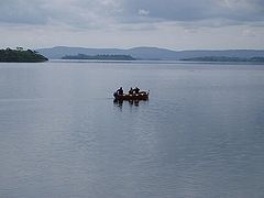
Fishermen near Cong 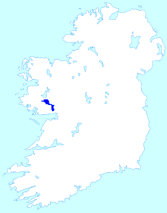
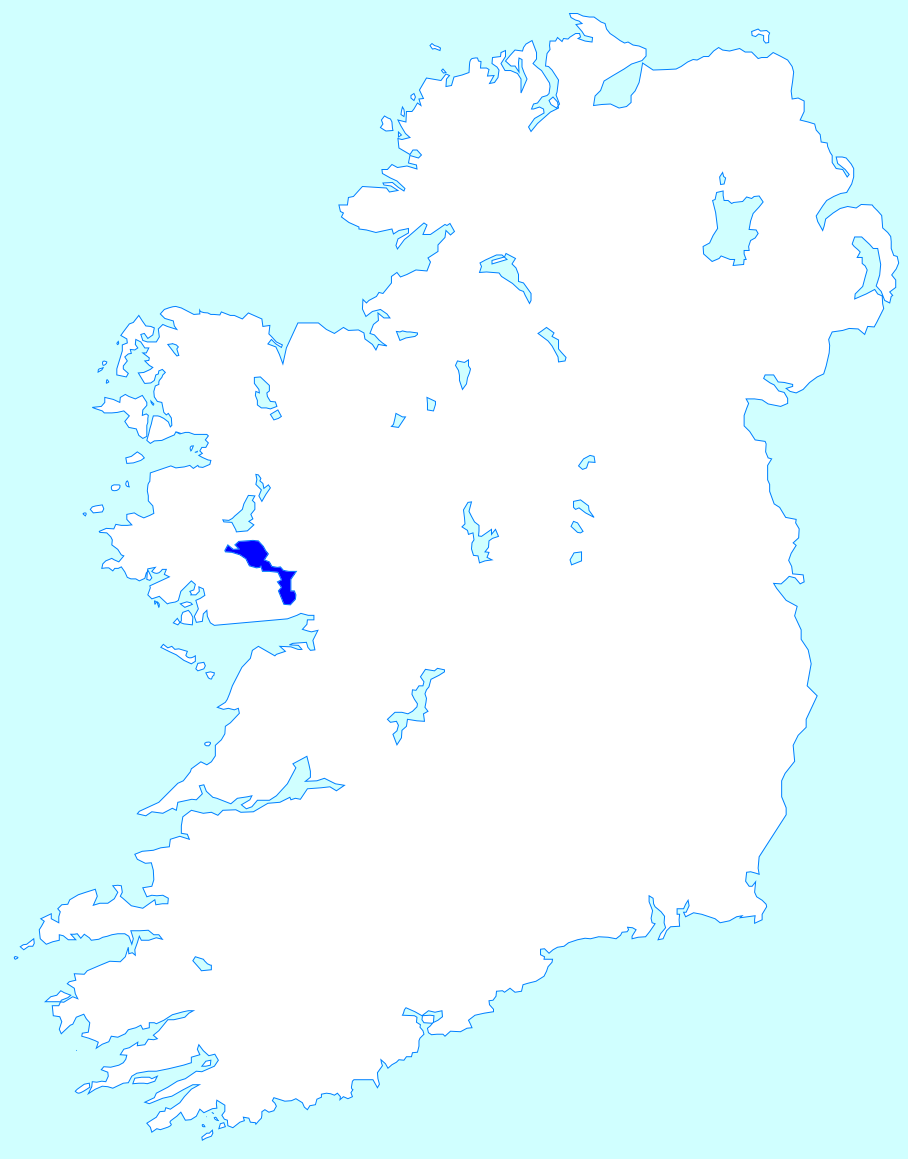
Location Connacht Coordinates 53°28′N 9°17′W / 53.467°N 9.283°WCoordinates: 53°28′N 9°17′W / 53.467°N 9.283°W Primary inflows Cregg River, River Clare, Black River Primary outflows River Corrib Basin countries Ireland Surface area 178 km² Lough Corrib (pronounced lokh kor-ib, Irish: Loch Coirib) is a lake in the west of Ireland. The River Corrib or Galway river connects the lake to the sea at Galway. It is the second largest lough in Ireland (after Lough Neagh). It covers 178 km² and lies mostly in County Galway with a small area of its northeast corner in County Mayo.
The first canal in Ireland was cut in the 12th century. Known as the Friar's Cut, it allowed boats to pass from Lough Corrib to the sea at Galway.
William Wilde, father of Oscar Wilde wrote a book about the lake, first published in 1867. He built a summerhouse on the banks of the lake, called Moytura House.
Lough Corrib was designated a Ramsar site on June 16, 1996. It has also been designated a Special Area of Conservation.
Contents
Name
Loch Coirib is a corruption of Loch nOirbsean, which according to placename lore is named after the Tuatha Dé Danann figure Orbsiu Mac Alloid (commonly called Manannán Mac Lir). In Irish the lough is also called An Choirib ("the Corrib").
Digital Charts
Digital Charts of Lough Corrib are available for use on PC & Garmin devices, a project started in 2007 named CorribCharts. See www.corribcharts.com for more details
Wildlife
There is an abundance of wildlife in Lough Corrib including birds and hawks, otters, mink, stoat, frogs, bats and much more. The dawn chorus in early spring is spectacular to listen to.[citation needed] Lough Corrib can be divided into two parts: a smaller shallower basin to the south and a larger deeper basin to the north. These two parts are connected by a narrow channel. In the southern and eastern parts of the lake, the lake bed is dominated by limestone bedrock covered by deposits of precipitated marl. The surrounding land is mostly pastoral farmland to the south and east and bog to the west and north. In addition to the lake basis, some areas of scientific interest adjoining the lake e.g. woodland, callows grassland and raised bog, have been incorporated into the Special Area of Conservation.
Threats to ecology
As well as being an internationally recognised attraction for tourists and fisherman, Lough Corrib has recently become more famous for its many unwelcome visitors. In early 2007, large numbers of the protozoan parasite Cryptosporidium were detected in water from the lake, leading to contamination of the public water supply in Galway city, and an outbreak of cryptosporidiosis. Another unwelcome visitor is the highly invasive species Lagarosiphon major (also known as "Curly Waterweed") which is destroying fish habitat. Another invasive species is the Zebra Mussel.
Cryptosporidium outbreak
On March 21, 2007, Cryptosporidium was confirmed to be present in the drinking water of Galway City, Moycullen, Oughterard and Headford, which had been instructed six days earlier to boil their water before drinking. The water taken from Lough Corrib was likely contaminated by migration of animal and human faeces. Dick Roche, the Minister of the Environment, announced a further allocation of €48 million to tackle the issue.
Galway City Council announced a one-for-one scheme on April 10, 2007, whereby they would carry the cost of a second bottle of water, if one is purchased. Other measures include upgrading existing water treatment and filtration systems, as well as the projected importing of water from nearby Luimnagh, Tuam, County Galway. This plant at Luimnagh has modern facilities for Cryptosporidium eradication and filtration.
The Community Care Organisation, Cope, delivered bottled water to their elderly clients from March 30, 2007.[1]
A lobby group was formed on April 8, 2007 to highlight the issue. One aspect of the group is an account on the MySpace social network.[2]
Islands
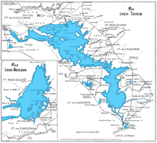 A map taken from the Admiralty Chart made in 1846.
While Lough Corrib is reputed to have 365 islands, a more accurate estimate suggests over 1,200.[3] The most famous of the islands is Inchagoil Island, midway between Cong and Oughterard. It is one of the largest of the many wooded islands along Lough Corrib. The island has spectacular views of the Maumturk range, Joyce Country and the mountains of Connemara. There are some secluded beaches and enchanting woods with a variety of walks around the island. There is evidence of an early monastic settlement which still mostly remains a mystery. There are two churches remaining, Saint Patrick's and the 12th century church known as the "saints" church. There are several paths around the island, an old cemetery and remains of four or five cottages which housed the few inhabitants.
Another noted island is Caislean-na-Circe, between Maam and Doon. This section of Lough Corrib is free from islands except for the rock on which the ancient Hen's Castle of the O'Connor's and the O'Flaherty's stands. The castle was home of the pirate Queen of Connemara, Gráinne O'Malley, who lived in the time of Queen Elizabeth I of England. In 1225, the Lord Justice caused Odo O'Flatherty to give up Kirk Castle to Odo O'Connor, King of Connaught; for assurance of his fidelity. Castle of the Hen is considered[by whom?] to be the oldest fortress of its kind in Ireland, and it is undoubtedly one of the best built.[citation needed] When first built and well-defended, with good food stores, this castle must have been impregnable.[citation needed] The rocks slope abruptly into the water on all sides. It is only accessible in a few places. The castle is steeped in history and legend. Cruises on the lake can be enjoyed starting from Cong, Ashford Castle, Galway City, and Oughterard.
See also
- List of loughs of County Mayo
- List of loughs in Ireland
- Milwaukee Cryptosporidium outbreak
References
- ^ "Community Catering and Galway Spring Water partner up to deliver clean water to Galway City’s older people". Cope. http://www.cope.ie/CommunityCateringGalwaySpringWaterDeliverytoolderpeopleinGalwayPR.doc.
- ^ "Galway Water Crisis". MySpace. http://www.myspace.com/galwaywatercrisis.
- ^ corribcharts.com
External links
Categories:- Untranslated Irish place names
- Loughs of County Galway
- Loughs of County Mayo
- Protected areas of County Galway
- Ramsar sites in the Republic of Ireland
- Important Bird Areas of the Republic of Ireland


Wikimedia Foundation. 2010.