Devil's Gate 220

Devil's Gate 220
Devil's Gate 220 is located in Alberta
{{{alt}}}
Devil's Gate 220
Location of Devil's Gate 220 Alberta

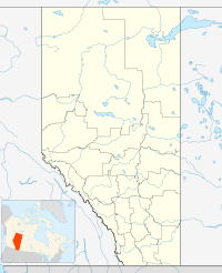
Devil's Gate 220 is an indian reserve in Alberta.[1]

References

Coordinates: 58°48′36″N 111°13′52″W / 58.810°N 111.231°W / 58.810; -111.231 (Devil's Gate 220)


Wikimedia Foundation. 2010.

Игры ⚽ Нужна курсовая?

Look at other dictionaries:

  • Devil's Gate — is a frequently used place name; the Geographic Names Information System shows 55 places with that name throughout the USA. It may refer to: Places Devil s Gate (Nevada), a natural rock formation Devil s Gate (Wyoming), a natural rock formation… …   Wikipedia

  • Devil's Gate (Wyoming) — Devil s Gate, Wyoming Devil s Gate (Wyoming) is a natural rock formation, a gorge on the Sweetwater River a few miles southwest of Independence Rock. The site, significant in the history of western pioneers, was a major landmark on the Mormon… …   Wikipedia

  • Heaven's Gate (film) — Infobox Film name =Heaven s Gate caption = film poster by Tom Jung director = Michael Cimino producer = Joann Carelli writer = Michael Cimino starring = Kris Kristofferson Christopher Walken Isabelle Huppert Jeff Bridges John Hurt Sam Waterston… …   Wikipedia

  • Cree — Verbreitungsgebiet der Cree Gruppen in Kanada (nach einer Vorlage der Brock University Map Library) Die Cree (englisch, auch Kri, französisch: Les Cris) sind ein Indianervolk Nordamerikas. Ihr Stammesgebiet erstreckt sich von den Rocky Mountains… …   Deutsch Wikipedia

  • Список индейских резервации в Канаде — Эта статья или раздел нуждается в переработке. Пожалуйста, улучшите статью в соответствии с правилами написания статей …   Википедия

  • List of communities in Alberta — Distribution of town and cities in Alberta. Rural and spe …   Wikipedia

  • Peace River (Canada) — This article is about the river. For the town in Alberta see Peace River, Alberta. For other uses see Peace RiverInfobox River river name = Peace River caption = Peace River watershed in western Canada origin = Finlay River mouth = Slave River… …   Wikipedia

  • Division No. 16, Alberta — Division No. 16 Alberta, Canada NWT SK BC …   Wikipedia

  • Independence Rock (Wyoming) — Infobox nrhp name = Independence Rock nrhp type = nhl caption = Independence Rock location = 60 mi. SW of Casper on WYO 220 nearest city = lat degrees = lat minutes = lat seconds = lat direction = long degrees = long minutes = long seconds = long …   Wikipedia

  • Natrona County, Wyoming — For other uses, see Natrona (disambiguation). Natrona County, Wyoming Location in the state of Wyoming …   Wikipedia

Share the article and excerpts

Direct link
Do a right-click on the link above
and select “Copy Link”