Deenethorpe

Deenethorpe

Coordinates: 52°30′32″N 0°35′37″W / 52.5090°N 0.5937°W / 52.5090; -0.5937

Deenethorpe
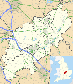
Deenethorpe is located in Northamptonshire
Deenethorpe

 Deenethorpe shown within Northamptonshire
OS grid reference SP9591
District East Northamptonshire
Shire county Northamptonshire
Region East Midlands
Country England
Sovereign state United Kingdom
Post town Corby
Postcode district NN17
Dialling code 01780
Police Northamptonshire
Fire Northamptonshire
Ambulance East Midlands
EU Parliament East Midlands
UK Parliament Corby
List of places: UK • England • Northamptonshire

Deenethorpe is a village and civil parish in the East Northamptonshire district of Northamptonshire, England. It is situated north-east of Corby and near the A43 road between Corby and Stamford. Nearby villages are Deene, Bulwick and Upper Benefield. At the time of the 2001 census, the parish's population was 103 people.[1]

The former World War II airfield RAF Deenethorpe is situated south of the village.

References

External links

Media related to Deenethorpe at Wikimedia Commons


Wikimedia Foundation. 2010.

Игры ⚽ Нужно сделать НИР?

Look at other dictionaries:

  • RAF Deenethorpe — Infobox Military Structure name= Royal Air Force Station Deenethorpe USAAF Station 128 location= Located Near Kettering, Northamptonshire, England coordinates=coord|52|30|09|N|000|35|06|W| caption= Aerial Photo of Deenethorpe Airfield 28 May 1945 …   Wikipedia

  • 401st Air Expeditionary Wing — Infobox Military Unit unit name= 401st Air Expeditionary Wing caption= 401st Air Expeditionary Wing emblem dates= 1943 Present country= United States allegiance= branch= United States Air Force type= Air Expeditionary role= Combat Support size=… …   Wikipedia

  • East Northamptonshire — For the former parliamentary constituency, see East Northamptonshire (UK Parliament constituency). East Northamptonshire District   Non metropolitan district   …   Wikipedia

  • Eighth Air Force — emblem Part of Air …   Wikipedia

  • List of RAF stations — This List of RAF stations is a comprehensive list of all stations, airbases, airfields and administrative headquarters of the Royal Air Force past and present.:Note Current RAF Stations will be listed under the currently recognised county of the… …   Wikipedia

  • RAF Daws Hill — Royal Air Force Station Daws Hill USAAF Station 1101 Located Near …   Wikipedia

  • List of places in Northamptonshire — This is a list of places in the ceremonial county of Northamptonshire, United Kingdom. See the list of places in England for places in other counties See also compactTOC NOTOC AAbington Abthorpe Achurch Adstone Alderton Aldwincle Althorp… …   Wikipedia

  • List of civil parishes in Northamptonshire — This is a list of civil parishes in Northamptonshire, England. Most parishes have their own parish council, but some smaller parishes may have a parish meeting, or may join together to form a combined parish council. Some larger parishes have… …   Wikipedia

  • RAF Alconbury — is a Royal Air Force station adjacent to the Stukeleys, near Alconbury and Huntingdon, Cambridgeshire in the United Kingdom, about 60 miles (100 km) north of London. Its runway and flight line were closed in the mid 1990s and it is currently a… …   Wikipedia

  • RAF Molesworth — Royal Air Force Molesworth USAAF Station 107 …   Wikipedia

Share the article and excerpts

Direct link
Do a right-click on the link above
and select “Copy Link”