- Cypremort Point State Park
-
Cypremort Point State Park 
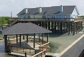
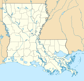
Cabins on the beach at the parkMap of Louisiana, United States of America Location St. Mary Parish, Louisiana, United States of America Coordinates 29°44′14″N 91°51′12″W / 29.73722°N 91.85333°WCoordinates: 29°44′14″N 91°51′12″W / 29.73722°N 91.85333°W[1] Area 185 acres (0.75 km2; 0.289 sq mi)[1][2] Established November 20, 2004 Governing body Louisiana Office of State Parks Official website Cypremort Point State Park is a public recreation area located on Vermilion Bay, Louisiana near the end of La. Hwy. 319. It is named for nearby Cypremort Point. Cypremort means "dead cypress" in French. The 185-acre (0.75 km2) park, set against a backdrop of coastal marsh, contains a half-mile stretch of man-made beach which contains picnic sites, a fishing pavilion and sailboat launch. Also, there are 6 cabins on the park grounds which may be reserved by guests. Cypremort Point is one of the few spots on the Louisiana Gulf coastline which may be accessed by road.
Contents
Water Activities
The park has a 100 foot fishing pier. Crabbing, water skiing, windsurfing and sailing are common activities.[2]
Fauna
A visitor may see nutria, muskrat, alligator, or a number of bird species. Deer, black bear, rabbits, opossum, and red fox also make their home in the area.[2]
Gallery
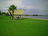
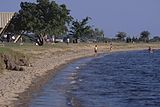
Cypremort Point State Park Located near the coast of Vermilion Bay are pavilions used for recreation.People typically use the bay for swimming and cooling down.References
- ^ a b "Cypremort Point State Park - Louisiana Office of State Parks". http://www.crt.state.la.us/parks/iCyprempt.aspx. Retrieved 3 January 2011.
- ^ a b c Louisiana State Parks Cajun Country Brochure. Louisiana State Parks. 2007.
External links
Protected Areas of Louisiana Federal National Marine Sanctuary:Atchafalaya · Bayou Cocodrie · Bayou Sauvage · Bayou Teche · Big Branch Marsh · Black Bayou Lake · Bogue Chitto · Breton · Cameron Prairie · Cat Island · Catahoula · D'Arbonne · Delta · East Cove · Grand Cote · Handy Brake · Lacassine · Lake Ophelia · Mandalay · Red River · Shell Keys · Sabine · Tensas River · Upper Ouachita
State Bayou Segnette · Bogue Chitto · Chemin-A-Haut · Chicot · Cypremort Point · Fairview-Riverside · Fontainebleau · Grand Isle · Hodges Gardens · Jimmie Davis · Lake Bistineau · Lake Bruin · Lake Claiborne · Lake D-Arbonne · Lake Fausse Pointe · North Toledo Bend · Palmetto Island · Poverty Point Reservoir · St. Bernard · Sam Houston Jones · South Toledo Bend · Tickfaw
State Historic SitesAudubon · Centenary · Fort Jesup · Fort Pike · Fort St. Jean Baptiste · Forts Randolph & Buhlow · Locust Grove · Longfellow-Evangeline · Los Adaes · Mansfield · Marksville · Plaquemine Lock · Port Hudson · Poverty Point · Rebel State · Rosedown Plantation · Winter Quarters
State Preservation AreaState ForestsState Wildlife RefugesElmer's Island · Marsh Island · Rockefeller · St. Tammany · State · Terrebonne Barrier Islands · White Lake WetlandsWildlife management areasAcadiana Conservation Corridor · Atchafalaya Delta · Attakapas · Barataria Preserve · Bayou Macon · Bayou Pierre · Ben's Creek · Big Colewa Bayou · Big Lake · Biloxi · Bodcau · Boeuf · Bonnet Carre Spillway · Buckhorn · Camp Beauregard · Catahoula Lake · Clear Creek · Dewey Wills · Elbow Slough · Elm Hall · Floy Ward McElroy · Fort Polk · Grassy Lake · Hutchinson Creek · Indian Bayou · Jackson Bienville · Joyce · Lake Boeuf · Lake Ramsey Savannah · Little River · Loggy Bayou · Manchac · Marsh Bayou · Maurepas Swamp · Old River Control · Ouachita · Pass A Loutre · Pearl River · Peason Ridge · Pointe-aux-Chenes · Pomme de Terre · Red River · Russell Sage · Sabine Island · Sabine · Salvador/Timken · Sandy Hollow · Sherburne · Sicily Island Hills · Soda Lake · Spring Bayou · Tangipahoa Parish School Board · Thistlethwaite · Three Rivers · Tunica Hills · Union · Walnut Hill · West BayOther PrivateCategories:- Protected areas of Iberia Parish, Louisiana
- Louisiana state parks
- Protected areas of St. Mary Parish, Louisiana
- Louisiana geography stubs
- Southern United States protected area stubs
Wikimedia Foundation. 2010.


