- Corfe Castle, Dorset
-
Coordinates: 50°38′25″N 2°03′34″W / 50.640278°N 2.059444°W
Corfe Castle 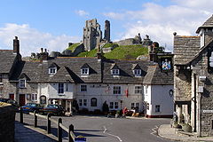
 Corfe Castle
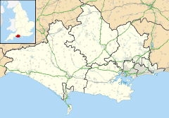
Corfe Castle shown within DorsetPopulation 1,429 (parish) OS grid reference SY957823 Parish Corfe Castle District Purbeck Shire county Dorset Region South West Country England Sovereign state United Kingdom Police Dorset Fire Dorset Ambulance South Western EU Parliament South West England UK Parliament South Dorset List of places: UK • England • Dorset Corfe Castle is a village and civil parish in the English county of Dorset. It is the site of a ruined castle of the same name. The village and castle stand over a gap in the Purbeck Hills on the route between Wareham and Swanage. The village lies in the gap below the castle, and is some eight kilometres (five miles) south-east of Wareham, and the same distance west of Swanage. Both the current main A351 road Lytchett Minster to Swanage and the Swanage Railway thread their way through the gap and the village.
The civil parish of Corfe Castle stretches across the width of the Isle of Purbeck, with coasts facing both the English Channel and Poole Harbour. It therefore includes sections of both the low lying sandy heathland that lies to the north of the castle, and the rugged Jurassic Coast upland to the south.
Contents
History
Burial mounds around the common of Corfe Castle suggest that the area was occupied from 6000BC. The common also points to a later Celtic field system worked by the Durotriges tribe. Evidence suggests that the tribe co-existed with the Romans in a trading relationship following the Roman invasion c. 50AD.[1]
The name "Corfe" is derived from the Saxon word for gap.
From the 1796 Corfe Castle Census of the 96 men involved in local industries and living in the town, 55 were clay cutters. These men worked in the nearby pits at Norden supplying Purbeck Ball Clay to Josiah Wedgwood and other pottery manufacturers. Clay extraction continued to provide a major employment for the local population until the 20th century. there is a valley as well.
Geography
The parish of Corfe Castle (area 37.45 km²) encompasses a broad swath of the Isle of Purbeck. To the south it includes the smaller village of Kingston and a section of the Jurassic Coast facing the English Channel. To the north it includes a large area of heathland stretching as far as the southern shore of Poole Harbour, where Furzey, Green, Long and Round little islands also form part of the parish.[2] The village is constructed almost completely from the local grey Purbeck limestone and comprises two main streets, East Street and West Street, linked at their north end at the Square.
Landmarks
The National Trust runs a shop and a tearoom in the village. The Corfe Model Village, located on the village square, is a 1/20 scale model that shows what the castle and village would have looked like in 1646 before the castle was slighted.[3] Within the Church of St. Edward is an alabaster reredos inset with carvings in white marble, designed by the famous Victorian architect George Edmund Street R.A., which was presented by Lord Eldon in 1876.[4] A cross in the square commemorates Queen Victoria's Diamond Jubilee of 1897.
Corfe Castle
The castle stands above the village and dates back in some form to the 10th century. It was the site of the murder of Edward the Martyr in 978. During the English Civil War it was a Royalist stronghold and was besieged twice, in 1643 and again in 1646. It is currently owned by the National Trust and is open to the public.
Governance
The former royal status of Corfe meant that it existed as a borough electing two members of parliament. In the 17th and 18th centuries, with the Bankes's owning much of the property and thereby controlling most of the votes, the town was a rotten borough. The Bankes family was able to ensure that at least one of the MPs returned to the House of Commons was a member of the family or a Bankes nominee. The Reform Act 1832 abolished the rotten boroughs and Corfe lost its direct representation. The village and castle were part of Corfe Castle hundred.
The parish now forms part of the District of Purbeck. It is within the South Dorset constituency of the House of Commons and the South West England constituency of the European Parliament.[2][5][6]
Demography
As of the 2001 census, the parish had a population of 1,429 living in 701 dwellings. Pensioner households made up 36 per cent of the population.
Transport
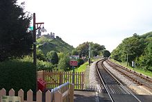 The railway line, showing the gap the line must thread between Castle (left) and East (right) hills.
The main route through the village is East Street which forms part of the A351 main road taking traffic to Wareham in the north and Swanage in the south. Separating the two streets is an area of common land called "the Halves".
Corfe Castle railway station lies to the east of East Street, adjacent to the village centre. Originally the only intermediate station on the London and South Western Railway's branch line from Wareham to Swanage, the station is now a stop on the Swanage Railway, a steam locomotive operated heritage railway. The railway links the tourist centres of Corfe Castle and Swanage with each other, and with a Park and Ride site at Norden station just to the north of Corfe Castle.
Notable residents
The village was for many years the residence of composer Kaikhosru Shapurji Sorabji.
Cultural references
Keith Roberts, an English science fiction writer living nearby set his novel Pavane partly around the castle and similar events in an alternate history.
The children's author Enid Blyton spent time in the area and some of her adventure stories like The Famous Five (Kirrin Island) featured castles that were said to be based on Corfe Castle.
The castle is a central setting in Ron Dawson's children's story, 'Scary Bones meets the Wacky Witches of Wareham'. One of the 'Amazing adventures of Scary Bones the Skeleton' series, the story tells how a wicked wizard has become part of the castle itself.
The Castle itself features prominently in Mike Leigh's 1976 TV play "Nuts in May". The two main characters, Keith and Candice-Marie, pay a visit to the castle during their camping holiday.
The juxtaposition of castle and steam train at Corfe Castle is familiar to many television viewers throughout Southern England, as it features in the opening sequences of the BBC's South Today regional news programme along with the official train.
An episode of Mary Queen of Shops centred around Mary Portas revamping the village's convenience store.
Sports
Poole athletic club organised the multi-terrain cross county race known as The Beast.[citation needed] The race starts in Corfe Castle and follows tracks to the Purbeck coastal path, along to Chapman's Pool and the steps of Houns Tout, before returning to Corfe Castle. The race is held the weekend following the August Bank Holiday.
Gallery
-

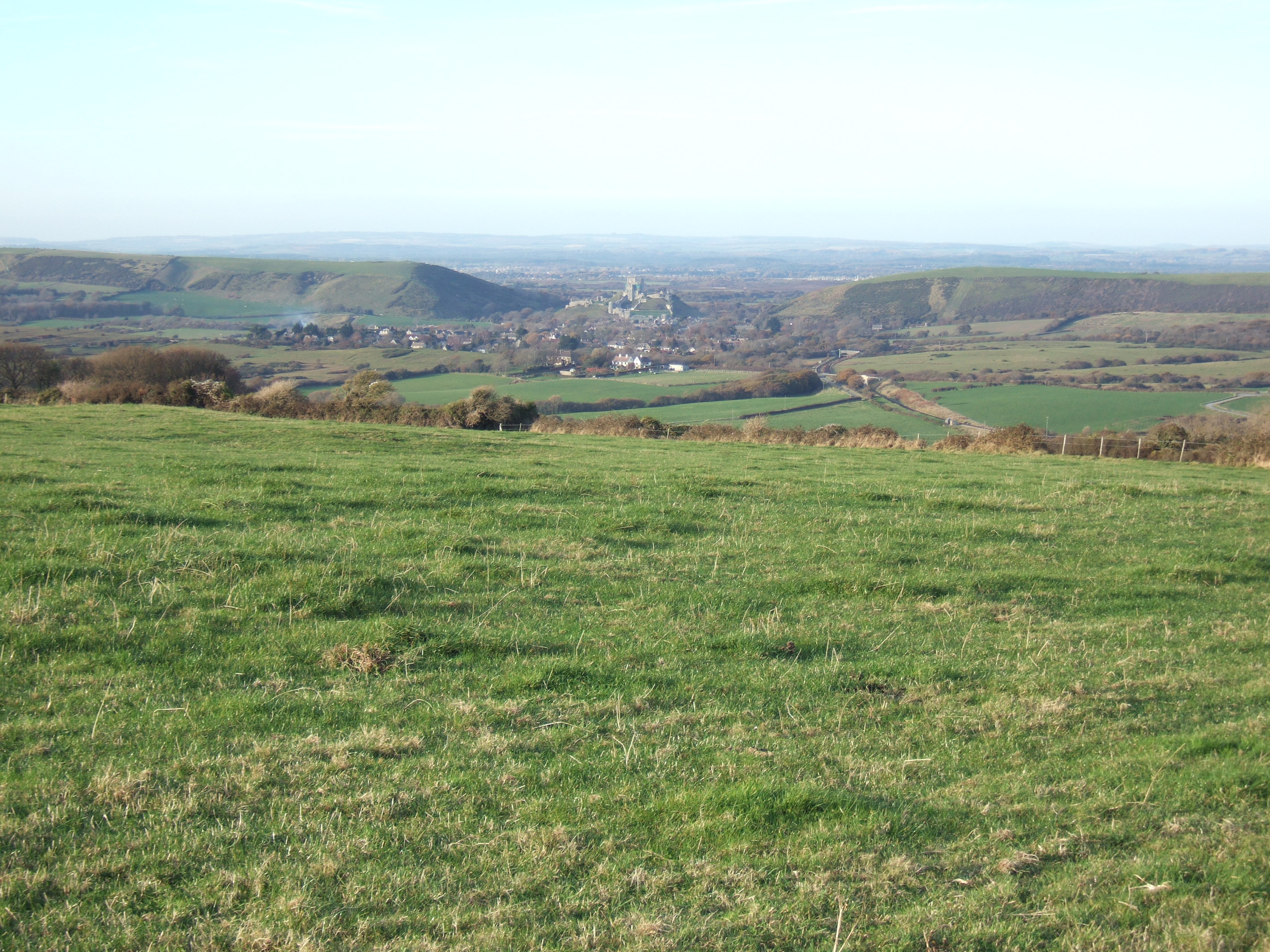
Corfe Castle commanding the gap in the Purbeck Hills. View taken from the southeast of the village
-

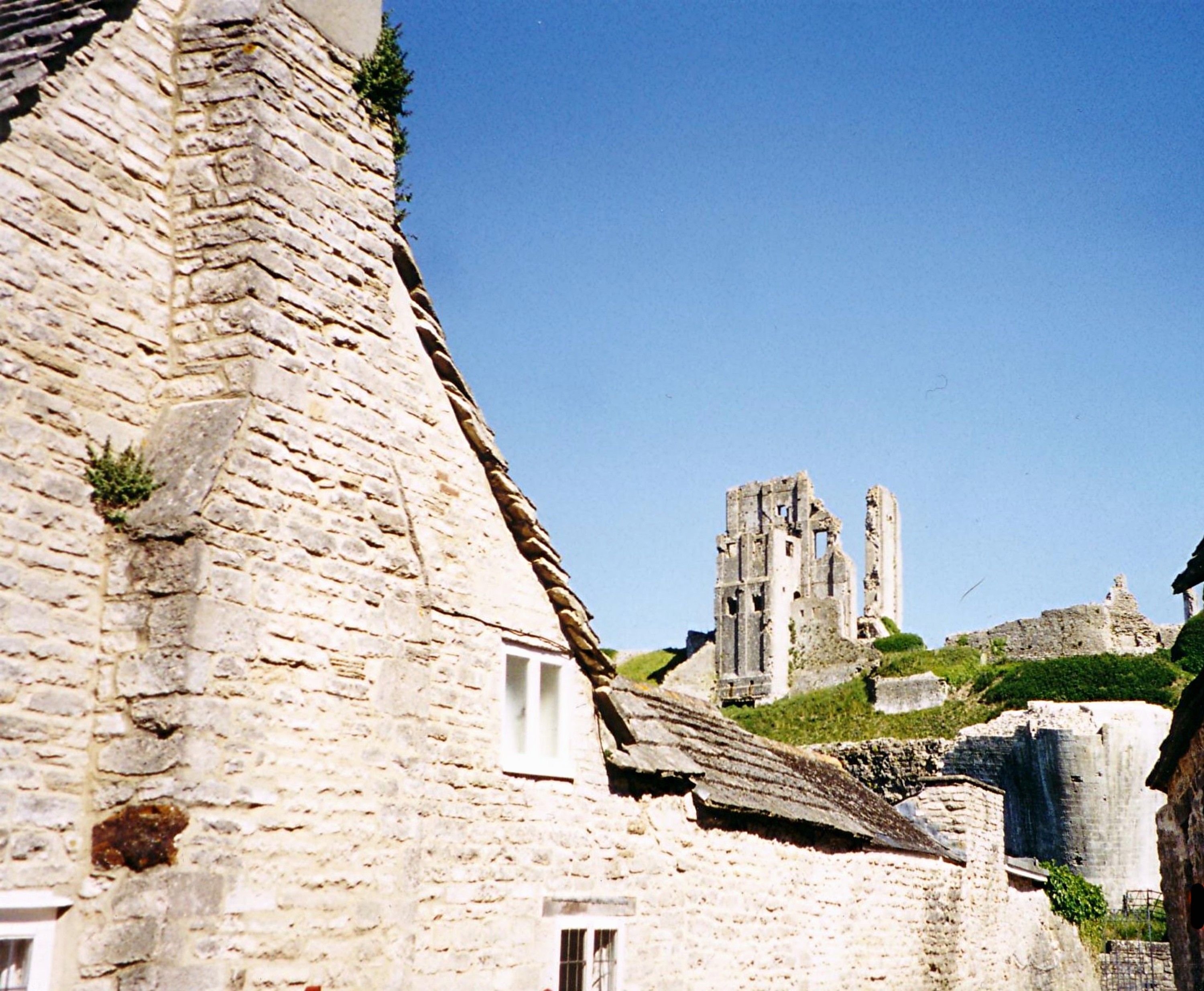
The castle, seen from the village.
-

The village, as seen from Corfe Castle itself. The station is on the left.
-
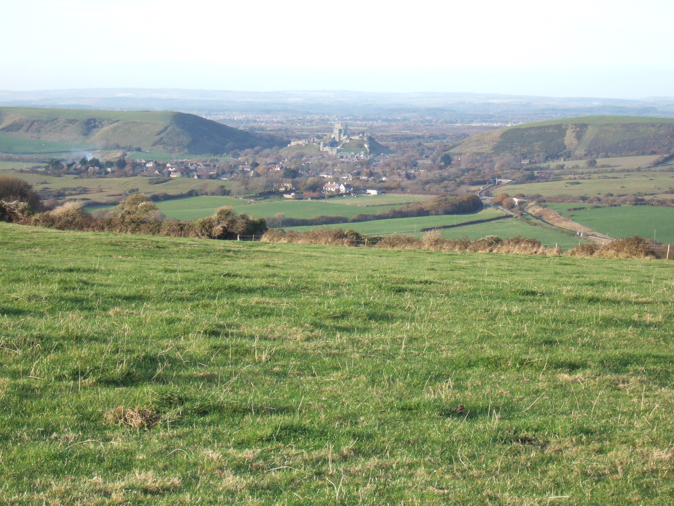
Corfe Castle in the gap in the Purbeck Hills, taken from the south looking north
See also
- The Shrove Tuesday Football Ceremony of the Purbeck Marblers
- National Trust Properties in England
References
- ^ History. The Corfe Castle Chamber of Trade & Commerce. Retrieved 2008-07-05.
- ^ a b OS Explorer Map OL15 - Purbeck & South Dorset. Ordnance Survey. 2006. ISBN 978-0-319-23865-3.
- ^ "Isle of Purbeck - Corfe Model Village". isleofpurbeck.com. http://www.isleofpurbeck.com/corfemvill.html. Retrieved 2007-08-16.
- ^ Michael Habermann & Liane Hansen, 1996. Weekend Edition. National Public Radio; Alistair Hinton, 2000. "Kaikhosru Shapurji Sorabji."
- ^ "Corfe Castle - Dorset For You". Dorset For You Partnership. http://www.dorsetforyou.com/index.jsp?articleid=324115. Retrieved 2007-08-14.
- ^ "Parish Statistics". Purbeck District Council. 2007-01-11. Archived from the original on 2007-09-27. http://web.archive.org/web/20070927050126/http://www.purbeck.gov.uk/pdf/Parish+Statistics1.pdf. Retrieved 2007-08-12.
External links
- Official Corfe Castle Website
- Corfe Castle information at the National Trust
- Purbeck Mineral & Mining Museum for Ball Clay information
- My Jurassic Coast- Discover the secrets of the Jurassic Coast. Where to stay, what to do and where to go.
Categories:- Isle of Purbeck
- Hills of Dorset
- National Trust properties in Dorset
- Villages in Dorset
- Visitor attractions in Dorset
-


Wikimedia Foundation. 2010.