- Burnside, Otago
-
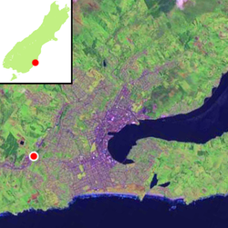 The location of Burnside within Dunedin is indicated by the red dot.
Burnside is a mainly industrial suburb of the New Zealand city of Dunedin. It is located at the mouth of a long valley, the Kaikorai Valley, through which flows the Kaikorai Stream. This valley stretches to the northeast for 3.5 kilometres (2.2 mi). Burnside is 5.5 kilometres (3.4 mi) to the southwest of the city centre, close to eastern end of the much larger suburb, Green Island. Other suburbs located nearby include Concord, immediately to the southeast and Kenmure further up Kaikorai Valley.
Burnside is separated from the central urban area of Dunedin by the large ridge which surrounds the city's heart. This ridge is part of the crater wall of the long-extinct Dunedin Volcano. The ridge lies immediately to the east of Burnside, with the main pass over it, the saddle of Lookout Point, lying 0.8 kilometres (0.50 mi) to the east.
Kempthorne Prosser's Burnside Chemical Works that made fertilisers from Sulphuric acid opened in 1880 and were the first of its kind in the colony. It closed in the early 1960s and was sold to Dominion Fertiliser before being demolished. Burnside is the site of the former Burnside Freezing Works, the first works of its kind in New Zealand. This large complex has its origin in a plant opened in 1881,[1] and an abattoir continued to operate at this site until the late 1980s. There are plans to turn the site into an industrial city.[2] Another landmark former industry in the area was the Burnside Cement Factory, which also operated until the 1980s.
Among other industries in the area are numerous small manufacturing plants and wholesalers, and several car sales yards, all in lower Kaikorai Valley Road.
To the west and northwest of Burnside is predominantly rural hillsides which contain one of the city's main reservoirs, the Southern Reservoir.
Burnside's location means that there are several major transport routes associated with it. A large motorway interchange lies in Burnside, with slip roads from the Dunedin Southern Motorway to Green Island and the Kaikorai Valley, as well as routes connecting the motorway and Kaikorai Valley with Concord and the southwestern hill suburb of Corstorphine. The South Island Main Trunk railway passes through Burnside (though there are no longer passenger stations in the suburb) entering a tunnel which runs beneath Lookout Point, emerging in Caversham, New Zealand. Burnside was once the location where a branch line, the Walton Park Branch, left the Main South Line.
Concord
The small residential suburb of Concord lies immediately to the southeast of Burnside. It lay on State Highway 1 until the construction of the Dunedin Southern Motorway in the 1990s, but is now bypassed by traffic from central Dunedin. The former Main South Road is now largely reduced to a narrow one-way street leading down from Lookout Point, virtually a long slip-road from the start of the motorway, though it is still two-way through Concord itself, and serves (along with Stevenson Road, which it becomes) as an important link road to Corstorphine and Calton Hill.
References
- ^ [1]
- ^ Harvey, Sarah (2 May 2009). "Plans for 'industrial city' at Burnside". Otago Daily Times. http://www.odt.co.nz/your-town/dunedin/53847/plans-039industrial-city039-burnside. Retrieved 22 September 2011.
Suburbs of Dunedin Central city Main urban area - north Balmacewen · Burkes · Dalmore · The Gardens · Glenleith · Leith Valley · Liberton · Maia · Maori Hill · Mount Mera · Normanby · North East Valley · Opoho · Pine Hill · Prospect Park · Ravensbourne · St Leonards · Wakari · WoodhaughMain urban area - east Main urban area - south Andersons Bay · Corstorphine · Forbury · Kensington · Kew · Musselburgh · Ocean Grove (Tomahawk) · St Clair · St Kilda · Shiel Hill · South Dunedin · Sunshine · Tahuna · TainuiMain urban area - west Abbotsford · Balaclava · Belleknowes · Bradford · Brockville · Burnside · Caversham · Calton Hill · Concord · Glenross · Green Island · Halfway Bush · Helensburgh · Kaikorai · Kaikorai Valley · Kenmure · Littlebourne · Lookout Point · Maryhill · Mornington · Roslyn · SunnyvaleSurrounding districts Aramoana · Brighton · Broad Bay · Careys Bay · Company Bay · Evansdale · Fairfield · Harington Point · Macandrew Bay · Mosgiel · Ocean View · Otakou · Port Chalmers · Portobello · Pukehiki · Roseneath · Sawyers Bay · Waitati · Waldronville · WingatuiCategories:- Suburbs of Dunedin
- Otago Region geography stubs

Wikimedia Foundation. 2010.