- Challis, New Zealand
-
"The Cove, New Zealand" redirects here. For other things called "The Cove", see Cove (disambiguation)
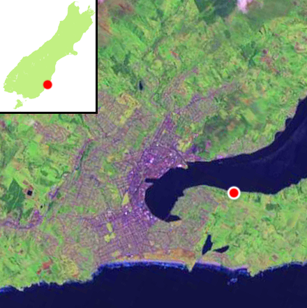
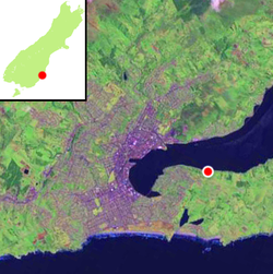 Location of Challis within Dunedin's main urban area
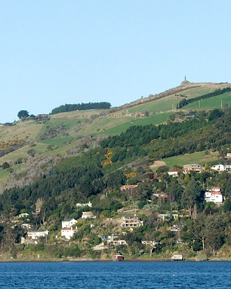
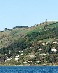 Challis sits at the harbour's edge below the Otago Peninsula Fallen Soldiers' Memorial, a major local landmark.
Challis is a settlement on the Otago Harbour coast of Otago Peninsula, within the city limits of the New Zealand city of Dunedin. Though officially regarded as a suburb, the isolated nature of Challis means that most locals regard it as a separate settlement within the city limits (as is also the case with many similar settlements on the Otago Peninsula).
Challis is located close to the shore at the foot of steeply sloping hills and cliffsides 4 kilometres (2.5 mi) to the east of Dunedin city centre on the winding Portobello Road, which runs along the northern shore of the peninsula. Challis is connected by this road to the suburb of Vauxhall 1.8 kilometres (1.1 mi) to the west, and with Macandrew Bay, 2.6 kilometres (1.6 mi) to the northwest.
The smaller settlement of The Cove lies immediately to the east, between Challis and Vauxhall.
Suburbs of Dunedin Central city Main urban area - north Balmacewen · Burkes · Dalmore · The Gardens · Glenleith · Leith Valley · Liberton · Maia · Maori Hill · Mount Mera · Normanby · North East Valley · Opoho · Pine Hill · Prospect Park · Ravensbourne · St Leonards · Wakari · WoodhaughMain urban area - east Main urban area - south Andersons Bay · Corstorphine · Forbury · Kensington · Kew · Musselburgh · Ocean Grove (Tomahawk) · St Clair · St Kilda · Shiel Hill · South Dunedin · Sunshine · Tahuna · TainuiMain urban area - west Abbotsford · Balaclava · Belleknowes · Bradford · Brockville · Burnside · Caversham · Calton Hill · Concord · Glenross · Green Island · Halfway Bush · Helensburgh · Kaikorai · Kaikorai Valley · Kenmure · Littlebourne · Lookout Point · Maryhill · Mornington · Roslyn · SunnyvaleSurrounding districts Aramoana · Brighton · Broad Bay · Careys Bay · Company Bay · Evansdale · Fairfield · Harington Point · Macandrew Bay · Mosgiel · Ocean View · Otakou · Port Chalmers · Portobello · Pukehiki · Roseneath · Sawyers Bay · Waitati · Waldronville · WingatuiCoordinates: 45°52′47″S 170°33′40″E / 45.87972°S 170.56111°E
Categories:- Suburbs of Dunedin
- Otago Peninsula
- Otago Region geography stubs
Wikimedia Foundation. 2010.