- Otakou
-
The settlement of Otakou lies within the boundaries of the city of Dunedin, New Zealand. It is located 25 kilometres from the city centre at the eastern end of Otago Peninsula, close to the entrance of Otago Harbour.
Overview
Though a small fishing village, Otakou is important in the history of Otago for several reasons. The name 'Otakou' is thought to come from Māori words meaning either "single village" or "place of red earth". Its original name was 'Otago' but European officials who had learned Māori in the North Island, visiting in the 1840s changed it to 'Otakou', believing that to be the correct form. In fact it isn't and 'Otago' is the correct southern Māori dialect word, as the earliest European records and the oldest Māori traditions both attest. But the myth is very much alive. Many people still believe that 'Otago' is a European corruption of 'Otakou'.
In its original form 'Otago' it was the name of the channel off Wellers Rock but was transferred to the lower harbour as a whole, the port, the nearby Māori settlements and the Weller brothers' whaling establishment - one of the region's oldest European settlements, having been founded in 1831. It was as the name of these it was converted to 'Otakou', which form is still used to refer to them today. The old Māori names for the Māori settlements were Te Ruatitiko, Tahakopa, Omate and Ohinetu.
Otakou was probably also the "city of Otago" burnt by Captain Kelly in December 1817 during the Sophia incident.[1][2][further explanation needed]
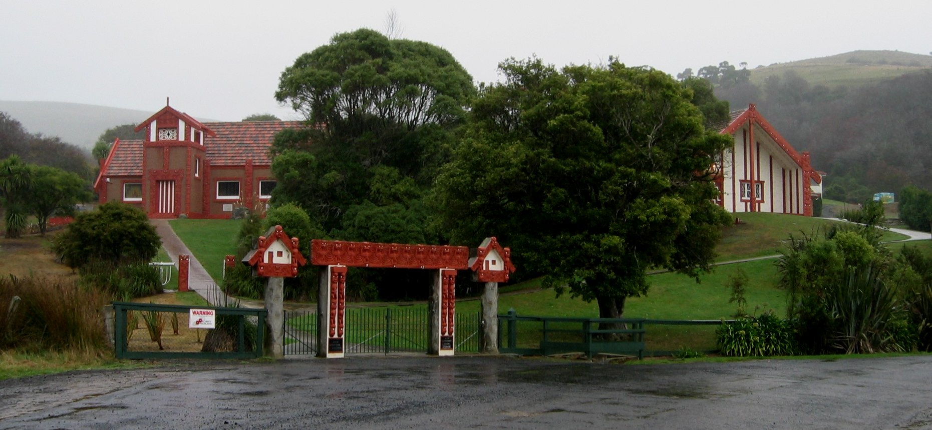
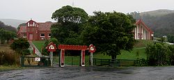 Otakou marae
Prior to the arrival of European settlers, the place was a prominent Māori settlement, and it is still the site of Otago's most important marae. By the early 19th century, the three Māori iwi of Ngāi Tahu, Ngāti Māmoe and Waitaha had blended into a single tribal entity. The Treaty of Waitangi was signed nearby in 1840 on the H.M.S Herald by two important chiefs, who were descended from all three tribes.[citation needed] Ōtākou remains an important centre of Ngāi Tahu life.
Otakou is located close to Taiaroa Head, the site of an albatross colony and other wildlife such as seals and penguins. Local Maori still call Taiaroa Head by its original name, Pukekura, which was also the name of the pa established there around 1750 and still occupied by Māori in the 1840s, before the land was taken by the government under the Public Works Act for building the lighthouse and the fortifications used during the Russian Scare of the 1880s.
References
- ^ McNab, Robert (1906). "The Sophia Massacre, 1817". Murihiku: A History of the South Island of New Zealand and the Islands Adjacent and Lying to the South, from 1642 to 1835. pp. 225–230. http://www.nzetc.org/tm/scholarly/tei-McNMuri-t1-body-d1-d16-d6.html.
- ^ Hamilton, A (1895). "On an Account of a Massacre at the Entrance of Dunedin Harbour in the Year - 1817". Transactions and Proceedings of the Royal Society of New Zealand 28: 141–147. http://rsnz.natlib.govt.nz/volume/rsnz_28/rsnz_28_00_001220.html.
- Dann, C. & Peat, N. (1989). Dunedin, North and South Otago. Wellington, NZ: GP Books. ISBN 0-477-01438-0.
- Entwisle, Peter. (1998) Behold the Moon, the European Occupation of the Dunedin District 1770-1848'. Dunedin, NZ: Port Daniel Press. ISBN 0-473-05591-0
- Goodall, M. & Griffiths, G. (1980). Māori Dunedin. Dunedin, NZ: Otago Heritage Books.
Coordinates: 45°49′S 170°43′E / 45.817°S 170.717°E
Suburbs of Dunedin Central city Main urban area - north Balmacewen · Burkes · Dalmore · The Gardens · Glenleith · Leith Valley · Liberton · Maia · Maori Hill · Mount Mera · Normanby · North East Valley · Opoho · Pine Hill · Prospect Park · Ravensbourne · St Leonards · Wakari · WoodhaughMain urban area - east Main urban area - south Andersons Bay · Corstorphine · Forbury · Kensington · Kew · Musselburgh · Ocean Grove (Tomahawk) · St Clair · St Kilda · Shiel Hill · South Dunedin · Sunshine · Tahuna · TainuiMain urban area - west Abbotsford · Balaclava · Belleknowes · Bradford · Brockville · Burnside · Caversham · Calton Hill · Concord · Glenross · Green Island · Halfway Bush · Helensburgh · Kaikorai · Kaikorai Valley · Kenmure · Littlebourne · Lookout Point · Maryhill · Mornington · Roslyn · SunnyvaleSurrounding districts Aramoana · Brighton · Broad Bay · Careys Bay · Company Bay · Evansdale · Fairfield · Harington Point · Macandrew Bay · Mosgiel · Ocean View · Otakou · Port Chalmers · Portobello · Pukehiki · Roseneath · Sawyers Bay · Waitati · Waldronville · WingatuiFurther reading
Categories:- Populated places in New Zealand
- Otago Peninsula
Wikimedia Foundation. 2010.