- Opoho
-
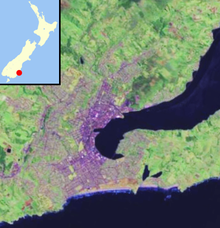
 OpohoLocation of Opoho within Dunedin
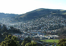 Looking across the Gardens Corner at the mouth of North East Valley towards Opoho from Prospect Park.
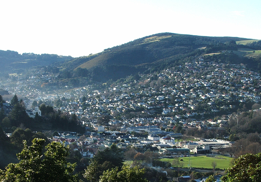
Opoho is a suburb of the New Zealand city of Dunedin. It sits on the western flank of Signal Hill, New Zealand, 3 kilometres (1.9 mi) to the northeast of the city centre, overlooking North East Valley and the Dunedin Botanic Gardens.
Opoho is one of Dunedin's more prestigious residential suburbs however still has somewhat mixed demographics, containing student flats, significant numbers of elderly citizens, and the houses of many in the academic community. There was a former retail area in the southern part of Signal Hill Road, but this has long gone and the area is now largely occupied by student flats. Above the suburb sits the Centennial Lookout, a memorial built on the top of Signal Hill to mark the centenary of New Zealand in 1940. Impressive views over the city can be gained from here.
At the time of the 2006 census, the permanent population was 1,242, a decrease of 18 since 2001.[1]
Opoho takes its name from the small stream, Opoho Creek[2] (also known as Stony Creek). This stream runs south along the western flank of Signal Hill, past Logan Park High School in Dunedin North, before being diverted through culverts and flowing into the Water of Leith close to it outflow into the Otago Harbour. Opoho is a Māori word, simply meaning "The place of Poho", Poho being a 18th century Ngati Wairua chief who lived close to the stream's outflow,[3] which at that time was into Pelichet Bay (the bay has since been reclaimed and is now part of Logan Park).[4]
Opoho's is largely concentrated around two long streets, Evans Street and Signal Hill Road, which run across the flanks of Signal Hill. Signal Hill Road continues to wind to the Centennial memorial close to the hill's summit. Several steep streets connect these two streets or descend to North East Valley. Chief among these are Blacks Road and Opoho Road, the latter of which is the main route to and from the suburb. It runs along the northern edge of Dunedin Botanic Gardens and connects with Dunedin's main arterial streets at the Gardens Corner. A further street, Lovelock Avenue (named for Dunedin Olympic gold medallist Jack Lovelock), winds through the upper reaches of the Botanic Gardens, emerging close to the University of Otago in Dunedin North.
The first European settlers in the area were farmers, and the suburb remained semi-rural until the 1940s. There are still some farms close to the top of Signal Hill Road, though much of the top of Signal Hill is now a scenic reserve, Burns Park. Early farmers in the area included John Switzer, John Broome, and John Black. The area was at first administered by the Signal Hill Roads Board, which became part of the new North East Valley municipality in 1877.[5] This amalgamated with the city of Dunedin in 1910.
As with many parts of Dunedin, Opoho was initially composed of many smaller named townships, the names of some of which are still used by local residents. In 1873, the first residential subdivision of Opoho began with Opoho Township (the area south of Blacks Road), followed soon after by Maybank Township immediately to the north and, later, by Grandview Township, to the north of Maybank (the names of Maybank and Grandview survive in two of Opoho's streets). By the 1890s, most of the subdivisions of Opoho Township were occupied and Maybank was growing. Grandview was developed during the 1920s.[6] Other township names occasionally encountered include St James' Park, a small area including Grey Street and James Streets on the lower slopes between Opoho and North East Valley.
The suburb of Opoho has numerous prominent landmarks, most prominently the Dunedin Botanic Gardens and Centennial Monument (see Signal Hill, New Zealand). Other landmarks of note include the Northern Cemetery, which occupies a low spur of Signal Hill on Lovelock Avenue, next to the Botanic Gardens and above Logan Park. One of Dunedin's earliest cemeteries (begun in 1872), many of Dunedin's notable early citizens are buried here, among them William Larnach and Thomas Bracken. Larnach's Gothic mausoleum is the most prominent structure in the cemetery, which commands impressive views across central Dunedin.
Also of note are two university halls of residence which lie close to the southern end of Opoho. Knox College is a prominent towered red brick building on the lower slopes. Established as a theological hall in 1907, Knox is still a centre of the University of Otago's religious studies courses. Below this hall, close to the Gardens Corner, lies the smaller Salmond College, built in 1971. Also of note within the suburb is the Dunedin branch of the Society for the Prevention of Cruelty to Animals, which has its headquarters in the suburb, and Tannock Glen, a public gardens which is notable for its rhododendrons. Sports clubs based in the suburb include the Alhambra Union Rugby Club, based at Opoho Park near the junction of Opoho Road and Lovelock Avenue.
Numerous walking tracks cross the Botanic Gardens, Signal Hill, and the slopes between. These include a track across the summit of Signal Hill to link up with Cleghorn Street above the northern end of North East Valley, and tracks connecting the Centennial Memorial with Logan Park and the harbourside suburb of Ravensbourne.[7]
Noted Opoho residents have included artist Arthur Merric Boyd, athlete Jack Lovelock, Celebrity Chef Alison Holst, Opera Singer Patricia Payne and former All Black Kees Meeuws.
References
- ^ Quickstats about Opoho
- ^ Goodall, M., and Griffiths, G. (1980) Maori Dunedin. Dunedin: Otago Heritage Books. p. 14
- ^ Blair, E.W., and Kerse, E. (1988) On the slopes of Signal Hill. Dunedin:Otago Heritage Books. ISBN 0-95977-236-7, p.5
- ^ Herd, J. and Griffiths, G.J. (1980) Discovering Dunedin. Dunedin: John McIndoe. ISBN 0-86868-030-3, p.72
- ^ Blair, E.W., and Kerse, E. (1988) On the slopes of Signal Hill. Dunedin:Otago Heritage Books. ISBN 0-95977-236-7, p.5-6
- ^ Blair, E.W., and Kerse, E. (1988) On the slopes of Signal Hill. Dunedin:Otago Heritage Books. ISBN 0-95977-236-7, pp.19-20, 39-42
- ^ Hamel, A. (2008) Dunedin tracks and trails. Dunedin: Silver Peaks Press. ISBN 978-047313772-4, pp. 2.10-2.13
Suburbs of Dunedin Central city Main urban area - north Balmacewen · Burkes · Dalmore · The Gardens · Glenleith · Leith Valley · Liberton · Maia · Maori Hill · Mount Mera · Normanby · North East Valley · Opoho · Pine Hill · Prospect Park · Ravensbourne · St Leonards · Wakari · WoodhaughMain urban area - east Main urban area - south Andersons Bay · Corstorphine · Forbury · Kensington · Kew · Musselburgh · Ocean Grove (Tomahawk) · St Clair · St Kilda · Shiel Hill · South Dunedin · Sunshine · Tahuna · TainuiMain urban area - west Abbotsford · Balaclava · Belleknowes · Bradford · Brockville · Burnside · Caversham · Calton Hill · Concord · Glenross · Green Island · Halfway Bush · Helensburgh · Kaikorai · Kaikorai Valley · Kenmure · Littlebourne · Lookout Point · Maryhill · Mornington · Roslyn · SunnyvaleSurrounding districts Aramoana · Brighton · Broad Bay · Careys Bay · Company Bay · Evansdale · Fairfield · Harington Point · Macandrew Bay · Mosgiel · Ocean View · Otakou · Port Chalmers · Portobello · Pukehiki · Roseneath · Sawyers Bay · Waitati · Waldronville · WingatuiCoordinates: 45°51′17″S 170°31′48″E / 45.8547°S 170.5301°E
Categories:

Wikimedia Foundation. 2010.