- Cliff, New Mexico
-
Cliff, New Mexico — Town — Coordinates: 32°57′43″N 108°36′40″W / 32.96194°N 108.61111°W Country United States State New Mexico County Grant Area – Water 0.0 sq mi (0.0 km2) Elevation 4,498 ft (1,371 m) Time zone MST (UTC-7) – Summer (DST) MDT (UTC-6) ZIP code 88028 Area code(s) 575 FIPS code 35-17-15860 GNIS feature ID 898744 Cliff is an unincorporated community in Grant County, New Mexico, United States.
Contents
History
Cliff and the nearby town of Gila were settled in 1884, in the Gila River Valley. The area was and is primarily a ranching and farming community.[1] The local Cliff Post Office was established on Aug 4, 1894.
Culture
The annual Grant County Fair is held annually at the adjoining fairgrounds next to Cliff High School.
Education
Cliff schools are part of the Silver Consolidated School District. The District's main office is located in Silver City.
- Cliff Elementary School (K-6)
- Students: 124
- Teachers: 7.7
- Cliff High School (7-12)
- Students 155
- Teachers 12.1
Transportation
U.S. Route 180 connects Cliff to Silver City, and NM 211 connects Cliff to Gila.
Points of interest
- Bill Evan's Lake
- Gila Riparian Preserve
References
- ^ SouthWest New Mexico, Historic Silver City Area Scenic Tours, page 19, 2008.
Municipalities and communities of Grant County, New Mexico City 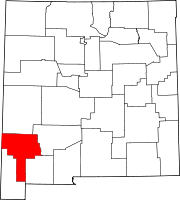
Towns Village Unincorporated
communitiesCliff | Gila | Mule Creek | Piños Altos | San Lorenzo | Separ
Ghost towns Carpenter | Santa Rita | Tyrone
Coordinates: 32°57′43″N 108°36′40″W / 32.96194°N 108.61111°W
Categories:- Populated places in Grant County, New Mexico
- Unincorporated communities in New Mexico
- New Mexico geography stubs
- Cliff Elementary School (K-6)

Wikimedia Foundation. 2010.