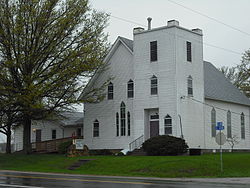
- Clearfield, Kansas
-
Clearfield, Kansas — Unincorporated community — Clearfield United Methodist Church Coordinates: 38°49′34″N 95°05′37″W / 38.82611°N 95.09361°WCoordinates: 38°49′34″N 95°05′37″W / 38.82611°N 95.09361°W Country United States State Kansas County Douglas Elevation 1,001 ft (305 m) Time zone Central (CST) (UTC-6) - Summer (DST) CDT (UTC-5) Area code(s) 785 GNIS feature ID 484894[1] Clearfield is an unincorporated community in Douglas County, Kansas. It is located nine miles northeast of Baldwin City and had a post office from 1885 until 1900[2].
References
- ^ "US Board on Geographic Names". United States Geological Survey. 2007-10-25. http://geonames.usgs.gov. Retrieved 2008-01-31.
- ^ http://www.kshs.org/genealogists/places/postoffices.htm
Municipalities and communities of Douglas County, Kansas Cities Baldwin City | Eudora | Lawrence | Lecompton
Townships Unincorporated
communitiesBig Springs | Clearfield | Clinton | Globe | Grover | Hesper | Kanwaka | Lake View | Lone Star | Midland | Pleasant Grove | Sibleyville | Stull | Vinland | Worden
Ghost towns Categories:- Populated places in Douglas County, Kansas
- Unincorporated communities in Kansas
Wikimedia Foundation. 2010.


