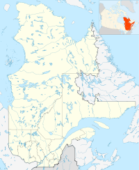
- Chute-aux-Outardes
-
Chute-aux-Outardes — Village municipality — Coordinates: 49°07′N 68°24′W / 49.117°N 68.4°WCoordinates: 49°07′N 68°24′W / 49.117°N 68.4°W Country  Canada
Province  Quebec
Region Côte-Nord Regional county Manicouagan Settled Formed March 7, 1951 Government[1] – Mayor Arlette Girard – Federal riding Manicouagan – Prov. riding René-Lévesque Area[1][2] – Total 8.31 km2 (3.2 sq mi) – Land 7.33 km2 (2.8 sq mi) Population (2006)[2] – Total 1,853 – Density 252.9/km2 (655/sq mi) Time zone EST (UTC-5) – Summer (DST) EDT (UTC-4) Postal Code G0H 1C0 Area code(s) 418 and 581 Chute-aux-Outardes is a village in Quebec, Canada, at the mouth of the Outardes River. It is about 20 kilometres (12 mi) south-west of Baie-Comeau along Route 138.
Demographics
Population trend:[3]
- Population in 2006: 1853 (2001 to 2006 population change: -5.8 %)
- Population in 2001: 1968
- Population in 1996: 2155
- Population in 1991: 2161
Private dwellings occupied by usual residents: 723 (total dwellings: 741)
Mother tongue:
- English as first language: 0 %
- French as first language: 100 %
- English and French as first language: 0 %
- Other as first language: 0 %
References
- ^ a b Ministère des Affaires Municipales, Régions et Occupation du territoire - Répertoire des municipalités: Chute-aux-Outardes
- ^ a b Statistics Canada 2006 Census - Chute-aux-Outardes community profile
- ^ Statistics Canada: 1996, 2001, 2006 census

Ragueneau 
Ragueneau 
Outardes River / Pointe-aux-Outardes  Chute-aux-Outardes

Ragueneau  Administrative divisions of Côte-Nord (Region 09)
Regional county municipalities
and equivalent territoriesLa Haute-Côte-Nord · Le Golfe-du-Saint-Laurent · Manicouagan · Sept-Rivières · Caniapiscau · Minganie
Municipalities Forestville · Baie-Comeau · Sept-Îles · Port-Cartier · Havre-Saint-Pierre · Fermont · Schefferville
Categories:- Incorporated places in Côte-Nord
- Villages in Quebec
- Quebec geography stubs
Wikimedia Foundation. 2010.


