- Nishiseto Expressway
-
Nishiseto Expressway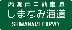
 西瀬戸自動車道 (しまなみ海道)
Route information Length: 59.4 km (36.9 mi) Existed: 1979-2006 – present Major junctions From: Nishiseto Onomichi Interchange in Onomichi, Hiroshima
 National Route 2
To: Imabari Interchange in Imabari, Ehime
 National Route 196
Highway system The Nishiseto Expressway (西瀬戸自動車道 Nishiseto Jidōsha-dō), often called the Shimanami Kaidō (しまなみ海道) is an expressway in Japan that connects Onomichi, Hiroshima and Imabari, Ehime, going through nine of the Geiyo Islands together, including Ōshima, Umashima, and Innoshima. It has a scenic sea view and can be easily crossed with bicycles and mopeds as well as cars.
The expressway contains ten bridges, including the Kurushima-Kaikyō Bridge, the world's longest series of suspension bridges, and the Tatara Bridge, the world's second longest cable-stayed bridge. It was opened on May 1, 1999, and is 59.4 kilometers long, sporting four lanes and separate paths for pedestrians and cyclists.
See also
External links
Categories:- Expressways in Japan
- Japan road stubs

Wikimedia Foundation. 2010.