- Mereta, Texas
-
Mereta — Unincorporated community — Location within the state of Texas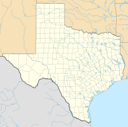
 Mereta
Coordinates: 31°27′26″N 100°8′27″W / 31.45722°N 100.14083°WCoordinates: 31°27′26″N 100°8′27″W / 31.45722°N 100.14083°W Country United States State Texas County Tom Green Elevation 1,755 ft (535 m) Time zone Central (CST) (UTC-6) – Summer (DST) CDT (UTC-5) ZIP codes 76940 FIPS code GNIS feature ID 1362628 Mereta (also Fisherville or Lipan)[1] is an unincorporated community in eastern Tom Green County, Texas, United States. It lies along local roads east of the city of San Angelo, the county seat of Tom Green County.[2] Its elevation is 1,755 feet (535 m).[3] Although Mereta is unincorporated, it has a post office, with the ZIP code of 76940;[4] the ZCTA for ZIP Code 76940 had a population of 138 at the 2000 census.[5]
Mereta was named by the local postmaster in honor of twin sisters, named Meta and Reta, who lived in the area in 1902. The community itself was platted in 1904.[1]
References
- ^ a b Mereta, Texas, Handbook of Texas Online, 2008-01-18. Accessed 2008-08-14.
- ^ Rand McNally. The Road Atlas '08. Chicago: Rand McNally, 2008, p. 99.
- ^ U.S. Geological Survey Geographic Names Information System: Mereta, Texas
- ^ Zip Code Lookup
- ^ "American FactFinder". United States Census Bureau. http://factfinder.census.gov. Retrieved 2008-01-31.
External links
Municipalities and communities of Tom Green County, Texas City 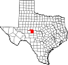
CDPs Unincorporated
communitiesCarlsbad | Harriett | Knickerbocker | Mereta | Orient | Tankersley | Vancourt | Veribest | Wall | Water Valley
Ghost town Categories:- Texas geography stubs
- Populated places in Tom Green County, Texas
- Unincorporated communities in Texas


Wikimedia Foundation. 2010.