- Ohio State Route 590
-
State Route 590
Route information Maintained by ODOT Length: 25.17 mi[1] (40.51 km) Existed: 1937 – present Major junctions South end:  SR 12 in Bettsville
 US 6 near Helena
 US 20 near Lindsey
North end:  SR 2 near Rocky Ridge
Location Counties: Seneca, Sandusky, Ottawa Highway system Ohio highways
Interstates • U.S. Routes • State Routes←  SR 589
SR 595  →
→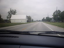 Approaching Lindsey on State Route 590
State Route 590 (SR 590, OH 590) is a north–south state highway in the northwestern portion of the U.S. state of Ohio. The southern terminus of State Route 590 is at a signalized intersection with State Route 12 in the village of Bettsville. Its northern terminus is at a T-intersection with State Route 2 just south of Ottawa National Wildlife Refuge, and approximately 5 miles (8.0 km) north of Rocky Ridge.
Contents
Route description
Along its path, State Route 590 travels through portions of Seneca, Sandusky and Ottawa Counties. No portion of the highway is included as a part of the National Highway System.[2]
History
State Route 590 was created in 1937. Its original routing consisted of the following: the current State Route 53 from its intersection with Seneca County Road 51 southwest of the unincorporated community of Old Fort to its intersection with Seneca County Road 61; County Road 61 from State Route 53 to the current southern terminus of State Route 590 at State Route 12 in Bettsville; and the entirety of the current routing of State Route 590.[3][4] The portions of current State Route 53 and County Road 61 noted would only be designated as State Route 590 for one year. In 1938, State Route 590 was truncated to its current southern terminus at State Route 12, and the portion east of Bettsville would become part of re-routing of State Route 113.[5]
Major intersections
County Location Mile[1] Destinations Notes Seneca Bettsville 0.00 SR 12Southern terminus at signalized intersection. Sandusky Jackson Township 6.93 US 6Washington Township 10.55 US 20Signalized intersection. Ottawa Harris Township 17.52  SR 105
Harris - Benton Township Line 19.01  SR 163
Benton Township 25.17 SR 2Northern terminus at T-intersection. 1.000 mi = 1.609 km; 1.000 km = 0.621 mi References
- ^ a b Ohio Department of Transportation. "Technical Services Straight Line Diagrams". http://www.odotonline.org/techservapps/SLD/default.htm. Retrieved 2007-11-17.
- ^ Federal Highway Administration (December 2003) (PDF). National Highway System: Ohio (Map). http://www.fhwa.dot.gov/planning/nhs/maps/oh/oh_Ohio.pdf. Retrieved 2010-10-24.
- ^ Ohio Department of Transportation (1936). Ohio State Map (Map).
- ^ Ohio Department of Transportation (1937). Ohio State Map (Map).
- ^ Ohio Department of Transportation (1938). Ohio State Map (Map).
External links
Categories:- State highways in Ohio
- Transportation in Seneca County, Ohio
- Transportation in Sandusky County, Ohio
- Transportation in Ottawa County, Ohio


Wikimedia Foundation. 2010.