- Clough Head
-
Clough Head Cumbria,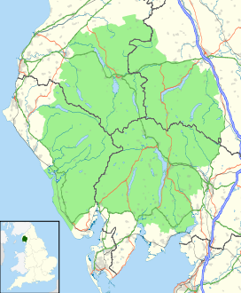
 Clough Head
 England
Elevation 726 m (2,382 ft) Prominence 108 m (354 ft) Parent peak Great Dodd Listing Hewitt, Nuttall, Wainwright Translation 'headland of the ravine' Location Range Lake District, Eastern Fells Coordinates 54°35′36″N 3°02′02″W / 54.59326°N 3.03379°WCoordinates: 54°35′36″N 3°02′02″W / 54.59326°N 3.03379°W Topo map OS Landranger 90, Explorer OL5 OS grid NY333225 Clough Head is a fell in the English Lake District. It is the northernmost top of the Helvellyn range in the Eastern Fells, standing to the south of Threlkeld and the A66.
Contents
Topography
The Helvellyn range runs broadly north to south for about 7 miles (11 km), remaining above 2,000 ft (600 m) throughout its length. To the south of the terminus at Clough Head are Great Dodd, Watson's Dodd and Stybarrow Dodd - collectively 'The Dodds'- before the scenery becomes gradually wilder on the approach to Helvellyn itself.
Clough Head is the lowest of the range, and from some directions it appears as a rounded grassy dome. Alone among the Helvellyns it has smooth slopes to the east, with crags on the west, a reversal of the usual pattern. The crags continue around to the north west above the village of Threlkeld, forming a large natural amphitheatre.
The connecting ridge from Great Dodd begins westerly before swinging north around the head of Mosedale, the boundary between these two fells. The halfway point is marked by Calfhow Pike (2,165 ft), a tor. This would be unremarkable in other parts of the district, but here the lone rocky island in a sea of fell-grass is a landmark for miles around. North of Calfhow Pike is a col at 2,020 ft (620 m) before the broad ridge makes directly for the summit of Clough Head.
The steep drop of Red Screes begins almost immediately to the north west of the summit, falling to the floor of the unnamed amphitheatre at around 1,650 ft (500 m) The outlet of this corrie contains the subsidiary top of Threlkeld Knotts, deflecting the drainage to either side. Gentler slopes lead down from here to the hamlet of Wanthwaite and the remains of Threlkeld Quarry, now Threlkeld Mining Museum. Also nearby are the remains of an ancient Settlement, believed to date from the Romano-British period. Outlines of enclosure walls can still be clearly seen.
North east from the summit of Clough Head is the lesser top of White Pike. From here the ridge descends between Mosedale and Red Screes, gradually broadening into Thelkeld Common before it reaches the River Glenderamackin some two miles (3 km) away.
The western face of Clough Head, looming above the Vale of St John, is uniformly rough. The principal rock features are, from the north, Buck Castle, Wanthwaite Crags and Bram Crag. Rising up between the latter two in a south easterly direction is Fisher's Wife's Rake, the only chink in Clough Head's defences on this side. A (very) steep grassy trod rises up from the scree below Wanthwaite Crags, climbing to the smoother ground above. It is practicable although not for the casual walker. The name comes from the Fisher family of nearby Rake How- the husband cut peat and his wife hauled it down by sled.[1]
Old Coach Road
An old route, marked on maps as "Old Coach Road" crosses the northeastern slopes of Clough Head, reaching a high point of 437 m (1,435 ft) as it crosses from St John's in the Vale to Matterdale. This has suffered damage from use by off-road vehicles in recent years, but such activity is currently prohibited.[1] Near the road summit is Hause Well, a spring issuing from a crevice in the rock.[2]
Geology, Mines and Quarries
The western face of Clough Head is extensively marked by quarrying. In addition to Thelkeld Quarry were Birkett Bank, Hill Top, Wanthwaite and Bram Crag Quarries, all of which were worked for granite. In addition behind Lowthwaite Farm are the remains of Wanthwaite Crag Mine. Several levels were driven here along a system of lead and copper veins, the most recent lease being taken out in 1887.[3] Geologically, the area to the north of the top is characterised by an intrusion of microgranite, while various members of the Borrowdale Volcanic series occur to the south.[4]
Summit and View
The summit is marked by an Ordnance Survey triangulation column and a sprawling cairn-cum-windbreak. It provides a good view of Blencathra to the north, in fact Alfred Wainwright drew himself admiring this view in his Pictorial Guides to the Lakeland Fells. Although the higher Great Dodd obstructs, the vista of the high fells to the west is excellent.[1]
Ascents
Clough Head is often climbed as the first step of a traverse of the Helvellyn range. From the northeast (Threlkeld) there is a path avoiding the crags and reaching the summit via White Pike. Alternatively one may follow the Coach Road to its highpoint, before heading southwest to the top. Wanthwaite provides the other main access, either via Fisher's Wife's Rake, or the much easier slopes behind Wanthwaite Quarry. None of these routes have paths throughout, but once the top is reached a clear track leads south towards Great Dodd.
References
- ^ a b c Richards, Mark: Near Eastern Fells: Collins (2003): ISBN 0-00-711366-8
- ^ Alfred Wainwright:A Pictorial Guide to the Lakeland Fells, Book 1: ISBN 0-7112-2454-4
- ^ Adams, John: Mines of the Lake District Fells, Dalesman (1995); ISBN 0-8520-6931-6
- ^ Woodhall, DG: Geology of the Keswick District- a brief explanation of the geological map. 1:50,000 Sheet 29: British Geological Survey (2000)
Categories:- Fells of the Lake District
- Hewitts of England
- Wainwrights
- Nuttalls

Wikimedia Foundation. 2010.