- Martinsthorpe
-
Coordinates: 52°37′59″N 0°43′16″W / 52.633°N 0.721°W
Martinsthorpe
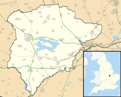
 Martinsthorpe shown within Rutland
Area 0.84 sq mi (2.2 km2) [1] Population 0 2001 Census[2] - Density 0 /sq mi (0 /km2) OS grid reference SK866047 - London 83 miles (134 km) SSE Unitary authority Rutland Shire county Rutland Ceremonial county Rutland Region East Midlands Country England Sovereign state United Kingdom Post town OAKHAM Postcode district LE15 Dialling code 01572 Police Leicestershire Fire Leicestershire Ambulance East Midlands EU Parliament East Midlands UK Parliament Rutland and Melton List of places: UK • England • Rutland Martinsthorpe is a civil parish in the county of Rutland in the East Midlands of England and a deserted village.
It is located about four miles (6 km) south of Oakham near the village of Manton. It is the only parish in Rutland to have a population of zero, although according to the 2001 census, Beaumont Chase also had a population of zero. It is one of only eight parishes in England with nil population.
One uninhabited building remains on the ridge. Originally this was part of the outbuildings of Martinsthorpe Hall, a seat of the Earls of Nottingham.
Martinsthorpe Ward is an electoral division for the purposes of electing councillors to Rutland County Council and comprises the parishes of Gunthorpe, Lyndon, Manton, Martinsthorpe, Morcott, Pilton and Wing.
External links
References
- ^ "A vision of Britain through time". University of Portsmouth. http://www.visionofbritain.org.uk/data_cube_table_page.jsp?data_theme=T_POP&data_cube=N_AREA_A&u_id=10037785&c_id=10001043&add=Y. Retrieved 18 March 2009.
- ^ "Rutland Civil Parish Populations". Rutland County Council. 2001. http://www.rutland.gov.uk/ppimageupload/Image27657.PDF. Retrieved 18 March 2009.
Categories:- Villages in Rutland
- Deserted medieval villages in England
- Former populated places in England
- Rutland geography stubs
Wikimedia Foundation. 2010.

