- Manton, Rutland
-
Coordinates: 52°37′52″N 0°42′00″W / 52.631°N 0.700°W
Manton 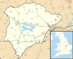
 Manton
Manton shown within RutlandArea 1.85 sq mi (4.8 km2) [1] Population 364 2001 Census[2] - Density 197 /sq mi (76 /km2) OS grid reference SK880045 - London 82 miles (132 km) SSE Unitary authority Rutland Shire county Rutland Ceremonial county Rutland Region East Midlands Country England Sovereign state United Kingdom Post town OAKHAM Postcode district LE15 Dialling code 01572 Police Leicestershire Fire Leicestershire Ambulance East Midlands EU Parliament East Midlands UK Parliament Rutland and Melton List of places: UK • England • Rutland Manton is a village in the county of Rutland in the East Midlands of England. It is situated southwest of Rutland Water.
The village had a railway station, Manton Junction, situated to the south of the village. It closed in the 1960s and the station buildings are now used as a factory. Manton also has a number of other attractions including the newly refurbished 'Horse and Jockey', the only pub on the cycle route around Rutland Water. Manton holds regular social events including book clubs and safari suppers.
References
- ^ "A vision of Britain through time". University of Portsmouth. http://www.visionofbritain.org.uk/data_cube_table_page.jsp?data_theme=T_POP&data_cube=N_AREA_A&u_id=10037785&c_id=10001043&add=Y. Retrieved 18 March 2009.
- ^ "Rutland Civil Parish Populations". Rutland County Council. 2001. http://www.rutland.gov.uk/ppimageupload/Image27657.PDF. Retrieved 15 March 2009.
External links
 Media related to Manton, Rutland at Wikimedia CommonsCategories:
- Villages in Rutland
- Rutland geography stubs

Wikimedia Foundation. 2010.