- New Earswick
-
Coordinates: 53°59′31″N 1°04′21″W / 53.992020°N 1.072380°W
New Earswick 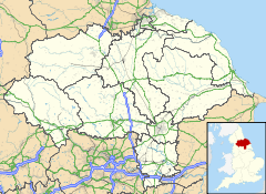
 New Earswick
New Earswick shown within North YorkshirePopulation 2,812 OS grid reference SE609555 Parish New Earswick Unitary authority City of York Ceremonial county North Yorkshire Region Yorkshire and the Humber Country England Sovereign state United Kingdom Post town YORK Postcode district YO32 Dialling code 01904 Police North Yorkshire Fire North Yorkshire Ambulance Yorkshire EU Parliament Yorkshire and the Humber UK Parliament York Outer List of places: UK • England • Yorkshire New Earswick is a model village and civil parish in the unitary authority of City of York in North Yorkshire, England, near the River Foss, north of York and south of Haxby. According to the 2001 census the parish had a population of 2,812. Prior to 1996 it had been part of the Ryedale district.
Contents
History
The village of New Earswick was built as a genuine mixed community. There was housing for both workers and managers, in a green setting with gardens for each home with its own fruit tree. It was founded by the York philanthropist, Joseph Rowntree, who was quoted as saying, "I do not want to establish communities bearing the stamp of charity but rather of rightly ordered and self governing communities". The first 28 houses were built between 1902 and 1904 by the architect Raymond Unwin, after which the Joseph Rowntree Village Trust was established to continue building and manage the new village.
The village had contemporaries such as Bournville, Saltaire, Port Sunlight and others. This was in sharp contrast to the slums that had developed in York and other cities during the previous century, the deprivation of which had been revealed in Seebohm Rowntrees' report of 1901, entitled Poverty: a study of town life. It revealed appalling statistics of dark, overcrowded and insanitary housing.[1]
As a result of the report, Joseph Rowntree 's conviction that it must be possible to provide better housing for people on low incomes led him to acquire 150 acres of land near the village of Earswick, two and a half miles to the north of the centre of York. The planner Raymond Unwin and the architect Barry Parker were commissioned to produce an overall plan for a new 'garden' village and the detailed designs for its first houses. They also designed the garden cities of Letchworth and Welwyn Garden City.
The building of New Earswick created a balanced village community where rents were kept low,but still represented a modest commercial return on the capital invested. Houses were open to any working people, not just Rowntree employees. The village was to be a demonstration of good practice.
The Trust Deed of the Joseph Rowntree Village Trust, which was set up in 1904 to build and manage New Earswick, safeguarded generous open green space. All the grass verges were planted with trees after which almost all the roads are named. The village was built with bricks that were made in the brickworks on the outskirts of New Earswick. From 1950 the brickyard, which closed down in the 1930s, was developed into a nature reserve.[2]
Governance
New Earswick is part of the Huntington & New Earswick Ward of the City of York Council. As of 2010 it is represented by Keith Hyman, Keith Orrel and Carol Runciman who are all members of the local Liberal Democrat Party.[3]
A Parish Council was created in 1934 consisting of ten elected councillors and a clerk.[4]
Community
There is a local community centre, the Folk Hall, which hosts activities such as keep-fit, yoga, snooker, and a junior youth club. New Earswick has recreational facilities, including a swimming pool, tennis courts and football, rugby and cricket pitches at the New Earswick Sports and Social Club. There are two open access play areas close to the Folk Hall,including hard surface play area. There is a library based in the Integrated Children’s Centre at the local primary school, a doctor’s surgery and a range of shops, including two general stores, a pet shop and Post Office.[4]
The village has 36 allotments in two areas, Willow Bank and Sleeper Path.[4]
Geography
The River Foss runs along the eastern boundary of New Earswick with the East Coast Main Line running to the west. The Nestle factory and grounds mark the southern border with the northern border being the A1237 York Outer Ring Road. The village was built using bricks from the brickworks on the outskirts of the village. From 1950 the brickyard was developed into a nature reserve. The reserve is the home of New Earswick Angling Club, which was formed in 1948.[4]
Economy
The village was designed for the workforce of the nearby Joseph Rowntree Cocoa Works. Many still earn their living at the factory which was taken over by Swiss firm, Nestle.
Transport
Transdev York operate a bus service that stops in the village as part of the Askham Bar to Clifton Moor route.[5] First Group operate two bus services that stop in the village as part of the Wigginton to Acomb and Haxby to York City Centre routes.[6]
Education
There are both primary and secondary schools in New Earswick. New Earswick Primary School was built in 1912. The primary school is one of eight Integrated Children’s Centres in York.[7] Joseph Rowntree School is a secondary school and was built in 1941. In 2006, the Joseph Rowntree School secured £27million for a complete rebuild that was completed in late 2009.[4] The catchement area for the secondary school is from the village itself, Huntington, The Groves and the villages of Haxby and Wigginton.[8]
Religious sites
In 1914 the Anglican church of St. Andrew's was built on the edge of the parish. The church was extended in 1939 to cater for the new housing in South Huntington just across the River Foss. A Methodist chapel and meeting house for the Society of Friends were added later. St. Andrew's Church is now part of the ecclesiastical parish of Huntington and New Earswick.[4]
Sport
New Earswick Cricket Club play at the recreation ground on White Rose Avenue. As of 2011 they will play in Division 6 of the York and District Senior Cricket League.[9]
Gallery
Views of New Earswick  The Folk Hall in New Earswick
 White Rose Avenue in New Earswick
 Westfield Beck behind housing on the west of New Earswick
References
- ^ "Village History". http://www.historyofyork.org.uk/timeline/20th-century/new-earswick. Retrieved 2010-12-12.
- ^ "Village planning". http://www.jrht.org.uk/communities/new-earswick/history-of-new-earswick. Retrieved 2010-12-12.
- ^ "Couoncillors". http://democracy.york.gov.uk/mgFindCouncillor.aspx?XXR=0&AC=WARD&WID=355. Retrieved 2010-12-12.
- ^ a b c d e f "Village Information". http://www.jrht.org.uk/sites/files/jrht/uploads/10/10/NewEarswickleaflet.pdf. Retrieved 2010-12-12.
- ^ "Transdev Bus Service". http://www.yorkbus.co.uk/maps.jsp?map=york. Retrieved 2010-12-12.
- ^ "First Bus Services". http://www.firstgroup.com/ukbus/york/journey_planning/timetables/index.php?operator=29&page=2&redirect=no. Retrieved 2010-12-12.
- ^ "Primary School". http://www.newearswickprimary.co.uk. Retrieved 2010-12-12.
- ^ "Catchment Area". http://www.york.gov.uk/content/45255/31906/Secondary_school_places/JOSEPH_ROWNTREE_SCHOOL.pdf. Retrieved 2010-12-12.
- ^ "Cricket". http://yorkdscl.play-cricket.com/leagueTables/divisionTable.asp?id=6828&seasonid=24. Retrieved 2010-12-12.
Categories:- Model villages
- Villages and areas in the City of York
- Civil parishes in North Yorkshire
- Rowntree family


Wikimedia Foundation. 2010.