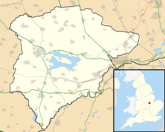
- Hambleton, Rutland
-
Coordinates: 52°39′32″N 0°40′16″W / 52.659°N 0.671°W
Hambleton
 Hambleton shown within Rutland
Area 4.47 sq mi (11.6 km2) [1] Population 140 2001 Census[2] - Density 26 /sq mi (10 /km2) OS grid reference SK900075 - London 84 miles (135 km) SSE Unitary authority Rutland Shire county Rutland Ceremonial county Rutland Region East Midlands Country England Sovereign state United Kingdom Post town OAKHAM Postcode district LE15 Dialling code 01562 Police Leicestershire Fire Leicestershire Ambulance East Midlands EU Parliament East Midlands UK Parliament Rutland and Melton List of places: UK • England • Rutland Hambleton is a village and civil parish in Rutland, England. It is located about two miles (3 km) east of Oakham. In 2001 it had a population of 140. Since the construction of Rutland Water in the 1970s, the village has been closed off on three sides by water and the area is known as the Hambleton Peninsula.
The parish originally included the settlements of Upper Hambleton, Middle Hambleton and Nether Hambleton. The latter two have now been almost completely submerged by the construction of Empingham Reservoir (now Rutland Water). The Jacobean style Old Hall in Middle Hambleton (built in 1611) is now situated on the water's edge.
The village contains the 12th century Church of England church of St Andrew, a pub called The Finch's Arms and a hotel and restaurant, Hambleton Hall. The church, much enlarged over its history still has an original Norman south doorway and was extensively restored and fitted out during the 19th century. This included excellent stained glass windows created mainly by J Egan during the last decade of the 19th century. Adjacent to the south side of the church yard stands a sixteenth century priest house.[3] The Hall was built in 1881 as a hunting box by Walter Marshall who left it to his sister, Eva Astley Paston Cooper. She was a socialite who gathered a salon including Noel Coward, Malcolm Sargent and Charles Scott-Moncrieff. Coward wrote Hay Fever while staying in the village.
There is a view across to Burley House from the north side of the village and from the south one can see across to the sailing club at Edith Weston on the far shore. The track around the peninsula along the lakeside takes walkers and cyclists through bluebell woods.
Gallery
References
- ^ "A vision of Britain through time". University of Portsmouth. http://www.visionofbritain.org.uk/data_cube_table_page.jsp?data_theme=T_POP&data_cube=N_AREA_A&u_id=10090106&c_id=10001043&add=Y. Retrieved 9 March 2009.
- ^ "Rutland Civil Parish Populations". Rutland County Council. 2001. http://www.rutland.gov.uk/ppimageupload/Image27657.PDF. Retrieved 9 March 2009.
- ^ "Hambleton". British History Online. http://www.british-history.ac.uk/report.aspx?compid=66206. Retrieved 28 October 2010.
External links
Categories:- Villages in Rutland
- Rutland geography stubs
Wikimedia Foundation. 2010.


