- Niederwald, Texas
-
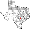
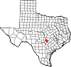
Niederwald, Texas — City — Location of Niederwald, Texas

Coordinates: 30°0′23″N 97°45′0″W / 30.00639°N 97.75°WCoordinates: 30°0′23″N 97°45′0″W / 30.00639°N 97.75°W Country United States State Texas Counties Hays, Caldwell Area – Total 3.0 sq mi (7.7 km2) – Land 3.0 sq mi (7.7 km2) – Water 0.0 sq mi (0.0 km2) Elevation 561 ft (171 m) Population (2000) – Total 584 – Density 196.8/sq mi (76.0/km2) Time zone Central (CST) (UTC-6) – Summer (DST) CDT (UTC-5) ZIP code 78640 Area code(s) 512 FIPS code 48-51492[1] GNIS feature ID 1342596[2] Niederwald is a city[3] in Caldwell and Hays Counties in the U.S. state of Texas. The population was 584 at the 2000 census.
Geography
Niederwald is located at 30°0′23″N 97°45′0″W / 30.00639°N 97.75°W (30.006397, -97.750056)[4]. It sits on Texas Highway 21, and straddles across the Caldwell and Hays County lines.
According to the United States Census Bureau, the town has a total area of 3.0 square miles (7.7 km²).None of the area is covered with water.
Demographics
As of the census[1] of 2000, there were 584 people.192 households, and 158 families residing in the city. The population density was 196.8 people per square mile (75.9/km²). There were 199 housing units at an average density of 67.1 per square mile (25.9/km²). The racial makeup of the town was 75.17% White, 3.94% African American, 1.54% Native American, 1.37% Asian, 16.44% from other races, and 1.54% from two or more races. Hispanic or Latino of any race were 32.19% of the population.
There were 192 households out of which 44.3% had children under the age of 18 living with them, 67.7% were married couples living together, 8.3% had a female householder with no husband present, and 17.7% were non-families. 10.4% of all households were made up of individuals and 2.6% had someone living alone who was 65 years of age or older. The average household size was 3.04 and the average family size was 3.27.
In the city the population was spread out with 28.8% under the age of 18, 8.6% from 18 to 24, 35.3% from 25 to 44, 21.6% from 45 to 64, and 5.8% who were 65 years of age or older. The median age was 34 years. For every 100 females there were 104.2 males. For every 100 females age 18 and over, there were 101.9 males.
The median income for a household in the city was $54,375,000 and the median income for a family was $61,750. Males had a median income of $28,750 versus $26,932 for females. The per capita income for the town was $21,236. None of the families and 1.8% of the population were living below the poverty line, including no under eighteens and 2.5% of those over 64.
References
- ^ a b "American FactFinder". United States Census Bureau. http://factfinder.census.gov. Retrieved 2008-01-31.
- ^ "US Board on Geographic Names". United States Geological Survey. 2007-10-25. http://geonames.usgs.gov. Retrieved 2008-01-31.
- ^ US Census change list
- ^ "US Gazetteer files: 2010, 2000, and 1990". United States Census Bureau. 2011-02-12. http://www.census.gov/geo/www/gazetteer/gazette.html. Retrieved 2011-04-23.
Municipalities and communities of Caldwell County, Texas Cities Lockhart | Luling | Martindale | Mustang Ridge‡ | San Marcos‡ | Uhland‡
Town Niederwald‡
Unincorporated
communitiesDale | Fentress | Lytton Springs | Maxwell | Prairie Lea | Pettytown‡ | Saint Johns Colony | Stairtown
Ghost town(s) Polonia
Footnotes ‡This populated place also has portions in an adjacent county or counties
Municipalities and communities of Hays County, Texas Cities Austin‡ | Buda | Dripping Springs | Hays | Kyle | Mountain City | San Marcos‡ | Uhland‡ | Wimberley | Woodcreek
Town Niederwald‡
Village Unincorporated
communityFootnotes ‡This populated place also has portions in an adjacent county or counties
Categories:- Populated places in Caldwell County, Texas
- Populated places in Hays County, Texas
- Towns in Texas
- Austin – Round Rock metropolitan area


Wikimedia Foundation. 2010.