- Tigbao, Zamboanga del Sur
-
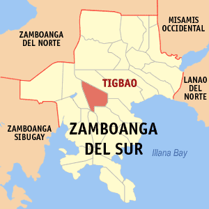
Lungsod sa Tigbao — Municipality — Map of Zamboanga del Sur showing the location of Tigbao Location in the Philippines
 Lungsod sa Tigbao
Coordinates: 7°49′3″N 123°17′1″E / 7.8175°N 123.28361°ECoordinates: 7°49′3″N 123°17′1″E / 7.8175°N 123.28361°E Country  Philippines
Region Zamboanga Peninsula (Region IX) Province Zamboanga del Sur District 2nd District of Zamboanga del Sur Founded November 8, 1991 Barangays 18 Government - Mayor Edmund Dalid Area - Total 120.69 km2 (46.6 sq mi) Population (2000) - Total 16,914 - Density 140.1/km2 (363/sq mi) Time zone PST (UTC+8) ZIP code Income class 5th class Tigbao is a 5th class municipality in the province of Zamboanga del Sur, Philippines. According to the 2000 census, it has a population of 16,914 people in 3,089 households.
Mt. Timolan, the highest peak in Zamboanga del Sur overlooks the town.
Barangays
Tigbao is politically subdivided into 18 barangays.
- Begong
- Busol
- Caluma
- Diana Countryside
- Guinlin
- Lacarayan
- Lacupayan
- Libayoy
- Limas
- Longmot
- Maragang
- Mate
- Nangan-nangan
- New Tuburan
- Nilo
- Tigbao
- Timolan
- Upper Nilo
External links
Municipalities Aurora • Bayog • Dimataling • Dinas • Dumalinao • Dumingag • Guipos • Josefina • Kumalarang • Labangan • Lakewood • Lapuyan • Mahayag • Margosatubig • Midsalip • Molave • Pitogo • Ramon Magsaysay • San Miguel • San Pablo • Sominot • Tabina • Tambulig • Tigbao • Tukuran • Vincenzo A. SagunComponent city PagadianCategories:- Municipalities of Zamboanga del Sur

Wikimedia Foundation. 2010.