- Dumalinao, Zamboanga del Sur
-
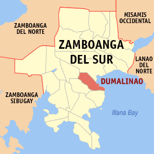
Dumalinao — Municipality — Map of Zamboanga del Sur showing the location of Dumalinao Location in the Philippines
 Dumalinao
Coordinates: 7°49′N 123°22′E / 7.817°N 123.367°ECoordinates: 7°49′N 123°22′E / 7.817°N 123.367°E Country  Philippines
Region Western Mindanao (Region IX) Province Zamboanga del Sur District 2nd District of Zamboanga del Sur Founded June 16, 1956 Barangays 30 Government – Mayor Ace William E. Cerilles Area – Total 117.48 km2 (45.4 sq mi) Population (2007) – Total 29,732 – Density 253.1/km2 (655.5/sq mi) Time zone PST (UTC+8) ZIP code Income class 3rd class town; Partially Urban Dumalinao is a 3rd class municipality in the province of Zamboanga del Sur, Philippines. According to the 2007 census, it has a population of 29,732.
Contents
Barangays
Dumalinao is politically subdivided into 30 barangays.
- Anonang
- Bag-ong Misamis
- Bag-ong Silao
- Baga
- Baloboan
- Banta-ao
- Bibilik
- Calingayan
- Camalig
- Camanga
- Cuatro-cuatro
- Locuban
- Malasik
- Mama (San Juan)
- Matab-ang
- Mecolong
- Metokong
- Motosawa
- Pag-asa (Pob.)
- Paglaum (Pob.)
- Pantad
- Piniglibano
- Rebokon
- San Agustin
- Sebucao
- Sumadat
- Tikwas
- Tina
- Tubo-Pait
- Upper Dumalinao
History
In 1956 the barrios of Dumalinao Proper, Bigong, Tigbao, Ticwas, Bulongating, Baguitan, Pantad, Napulan, Tagulo, Camanga, Margang, Sibucao, Tina, Guling, Miculong, Baga, Rebucon, and Mambilik were separated from Pagadian City and constituted into Dumalinao through House Bill No. 5000, which later became Republic Act No. 1593 and approved on June 16, 1956.[1] The person responsible for sponsoring the bill was Congressman Q. Ubay of Zamboanga del Norte since during that time, Zamboanga del Sur had no congressman; Rep. Roseller T. Lim that time had been elected to the Senate in the 1955 special election.[2]
Hon. Martin D. Raluto was first appointed municipal mayor with Hon. Guillermo Talaid as his vice mayor. The new town then had four councilors: Hon. Vicente T. Labrado, Hon. Severino Ramas, Hon. Fulgencio Lauglaug, and Eniiego Gemina, although the latter did not serve. Raluto held the position of municipal mayor until his death on June 11, 1969.[3] Ace William E. Cerilles is now the incumbent mayor.
Economy
Agriculture is the main economic activity as well as the number one source of livelihood of the people, although Dumalinao is a coastal town. The town is one of the major rice granaries of Zamboanga del Sur as 5,998 hectares of the land area is devoted to agricultural production. The crops planted on these lands include rice, corn, coconut, banana, and root crops. Corn, in particular, is the municipality's main agricultural crop. An estimated 2,837 hectares of the land are utilized for corn production, with an average of 30 ca-vans per hectare (or 8.5 million kilos annually). On top of that, Dumalinao's climate is very conducive for growing corn, so much so that farmers usually get to have two croppings of corn per year. An estimated value of Php 51 million comes from the annual production of corn.[4]
Notes
- ^ "An Act Creating Municipality of Dumalinao in the Province of Zamboanga Del Sur". LawPH.com. http://lawph.com/statutes/ra1593.html. Retrieved 2011-04-12.
- ^ Dumalinao Profile
- ^ Dumalinao Profile
- ^ Dumalinao Profile
References
- Philippine Standard Geographic Code
- 2000 Philippine Census Information
- Zambonga del Sur Official Website: Dumalinao (retrieved: 7 April 2009)
Municipalities Component city - Pagadian
Categories:- Municipalities of Zamboanga del Sur

Wikimedia Foundation. 2010.