- Midsalip, Zamboanga del Sur
-
Midsalip — Municipality — Map of Zamboanga del Sur showing the location of Midsalip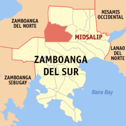 Location in the Philippines
 Midsalip
Coordinates: 8°00′N 123°16′E / 8°N 123.267°ECoordinates: 8°00′N 123°16′E / 8°N 123.267°E Country  Philippines
Region Western Mindanao (Region IX) Province Zamboanga del Sur District 1st District of Zamboanga del Sur Founded September 9, 1964 Barangays 33 Government – Mayor Area – Total 161.56 km2 (62.4 sq mi) Population (2007) – Total 30,772 – Density 190.5/km2 (493.3/sq mi) Time zone PST (UTC+8) ZIP code Income class 4th class town Midsalip is a 4th class municipality in the province of Zamboanga del Sur, Philippines. According to the 2000 census, it has a population of 28,909 people in 5,479 households.
History
The town's name is from a Subanen word,"Migsalip" which means "to collect" or "accumulate".
Midsalip was finally made into a municipality on September 9, 1964, by virtue of Executive Order Number 94 signed by President Diosdado Macapagal. This didn’t last long, however, as it as dissolved on February 26, 1966 due to a Supreme Court decision regarding the legality of the funds disbursed by the municipal treasurer. As a result, Midsalip was reverted back to barrio status. It wasn’t until May 8, 1967, when the Republic Act No. 4871 was passed when Midsalip became a regular municipality again.
Barangays
Midsalip is politically subdivided into 33 barangays.
- Bacahan - Peñonal's Family area
- Balonai
- Bibilop
- Buloron
- Cabaloran
- Canipay Norte
- Canipay Sur
- Cumaron
- Dakayakan
- Duelic
- Dumalinao
- Ecuan
- Golictop
- Guinabot
- Guitalos
- Guma
- Kahayagan
- Licuro-an
- Lumpunid
- Matalang
- New Katipunan
- New Unidos
- Palili
- Pawan
- Pili
- Pisompongan
- Piwan
- Poblacion A
- Poblacion B
- Sigapod
- Timbaboy
- Tulbong
- Tuluan
External links
Municipalities Component city - Pagadian
Categories:- Municipalities of Zamboanga del Sur


Wikimedia Foundation. 2010.