- Dinas, Zamboanga del Sur
-
Dinas — Municipality — 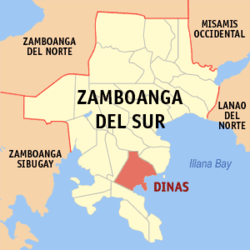
Coordinates: 7°38′21.12″N 123°18′20.88″E / 7.6392°N 123.3058°ECoordinates: 7°38′21.12″N 123°18′20.88″E / 7.6392°N 123.3058°E Country Philippines Province Zamboanga del Sur Founded June 17, 1950 Barangay List- Bacawan
- Benuatan
- Beray
- Don Jose
- Dongos
- East Migpulao
- Guinicolalay
- Ignacio Garrata
- Kinacap
- Legarda 1
- Legarda 2
- Legarda 3
- Lower Dimaya
- Lucoban
- Ludiong
- Nangka
- Nian
- Old Mirapo
- Pisa-an
- Poblacion
- Proper Dimaya
- Sagacad
- Sambulawan
- San Isidro
- Songayan
- Sumpotan
- Tarakan
- Upper Dimaya
- Upper Sibul
- West Migpulao
Population (2000) - Total 31,570 Dinas is a 4th class municipality in the province of Zamboanga del Sur, Philippines. According to the 2000 census, it has a population of 31,570 people in 6,033 households.
History
Dinas has historically been known as the bulwark of anti-Hispanic colonization in the entire Baganian Peninsula of Zamboanga del Sur. According to ancient history which has been accepted and advocated by the scions of Sultan Kudarat, a descendant of the renowned Shariff Kabungsuan of Maguindanao was that the name Dinas was taken from a Maguindanao term Di Nas where “Di” means “Not” and “Nas” means “Bad Luck or Unlucky”. Hence, the early settlers who migrated from the province of Cotabato found their new haven as not unlucky or “Di Nas” because the mouths of all rivers emptying into the coastlines are facing East which according to their ancient belief is a sign of good luck. Today nearly the half of the population are Maguindanaon Muslims.
Barangays
Dinas is politically subdivided into 30 barangays.
- Bacawan
- Benuatan
- Beray
- Don Jose
- Dongos
- East Migpulao
- Guinicolalay
- Ignacio Garrata (New Mirapao)
- Kinacap
- Legarda 1
- Legarda 2
- Legarda 3
- Lower Dimaya
- Lucoban
- Ludiong
- Nangka
- Nian
- Old Mirapao
- Pisa-an
- Poblacion
- Proper Dimaya
- Sagacad
- Sambulawan
- San Isidro
- Songayan
- Sumpotan
- Tarakan
- Upper Dimaya
- Upper Sibul
- West Migpulao
External links
Municipalities Aurora • Bayog • Dimataling • Dinas • Dumalinao • Dumingag • Guipos • Josefina • Kumalarang • Labangan • Lakewood • Lapuyan • Mahayag • Margosatubig • Midsalip • Molave • Pitogo • Ramon Magsaysay • San Miguel • San Pablo • Sominot • Tabina • Tambulig • Tigbao • Tukuran • Vincenzo A. SagunComponent city PagadianCategories:- Municipalities of Zamboanga del Sur

Wikimedia Foundation. 2010.