- Duntisbourne Rouse
-
Coordinates: 51°45′24″N 2°01′36″W / 51.7567°N 2.0268°W
Duntisbourne Rouse 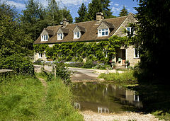
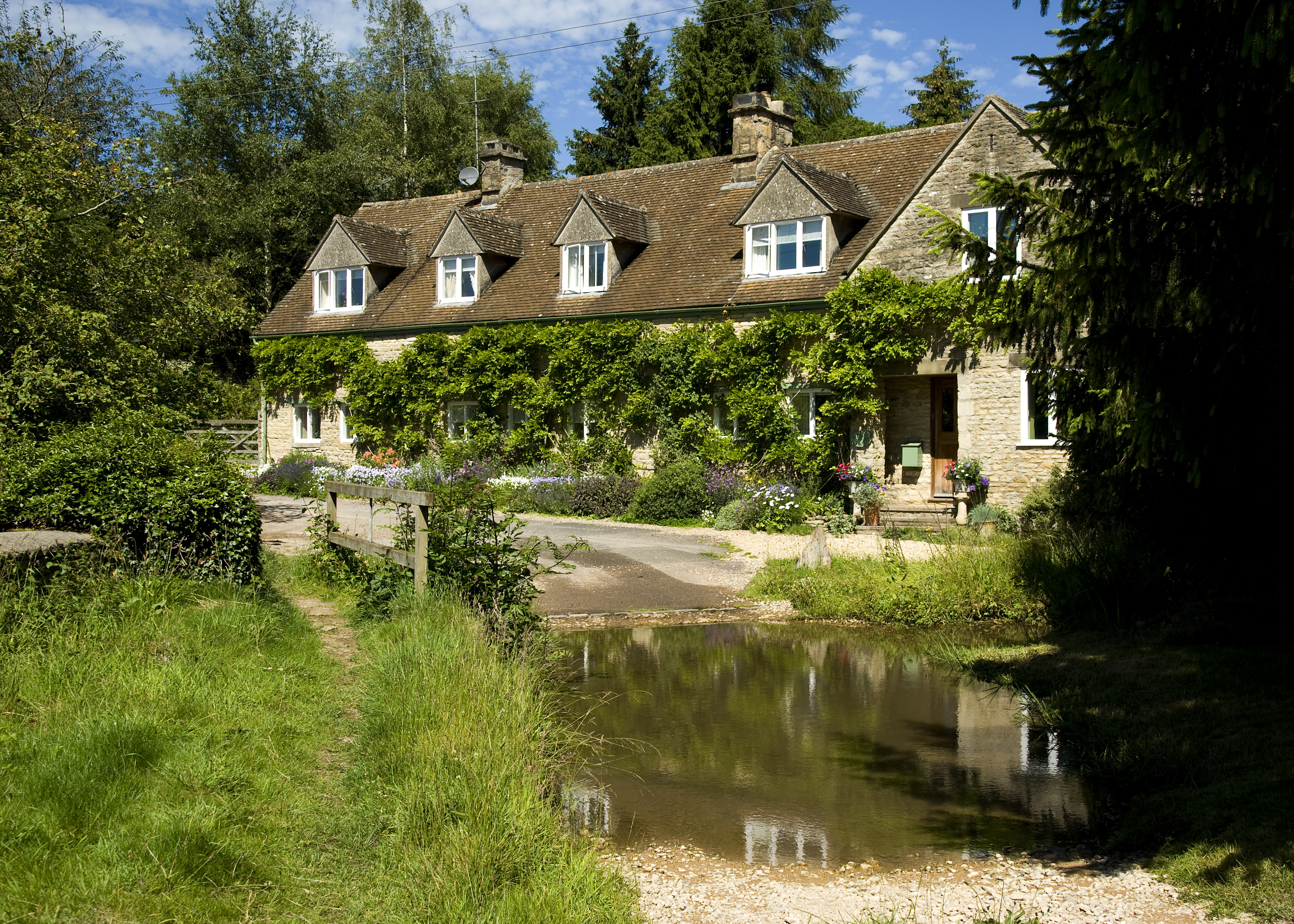
The ford at Duntisbourne Rouse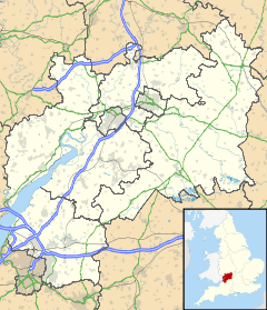
 Duntisbourne Rouse
Duntisbourne Rouse shown within GloucestershireParish Duntisbourne Rouse District Cotswold Shire county Gloucestershire Region South West Country England Sovereign state United Kingdom Post town CIRENCESTER Postcode district GL7 Dialling code 01285 Police Gloucestershire Fire Gloucestershire Ambulance Great Western EU Parliament South West England UK Parliament Cotswold List of places: UK • England • Gloucestershire Duntisbourne Rouse is a village and civil parish in Gloucestershire, England. It lies in the Cotswolds, an Area of Outstanding Natural Beauty.
Contents
History
Toponymy
The village was recorded as Duntesburne in 1055 and Duntesborne in the 1086 Domesday Book, the name coming from the Old English for "stream of a man called Dunt".[1] The manorial affix came from a family called le Rous, who were at one time the lords of the manor.[1][2] By 1287, the village was known as Duntesbourn Rus.[1]
Governance
The parishes of Duntisbourne Rouse and the neighbouring village of Duntisbourne Abbotts are covered by a single 7-person council, the Duntisbournes Parish Council.[3] Duntisbourne Rouse is part of the Ermin ward of the district of Cotswold and is represented by Councillor Nicholas Parsons, a member of the Conservative Party.[4] Duntisbourne Rouse is part of the constituency of Cotswold, represented at parliament by Conservative MP Geoffrey Clifton-Brown.[5] It is part of the South West England constituency of the European Parliament.
Geography
Duntisbourne Rouse is in the county of Gloucestershire, and lies within the Cotswolds, a range of hills designated an Area of Outstanding Natural Beauty. It is approximately 16 km (9.9 mi) south-east of Gloucester and approximately 6.5 km (4.0 mi) north-west of Cirencester. Nearby villages include Duntisbourne Abbots, Duntisbourne Leer, Bagendon and Daglingworth.
Church
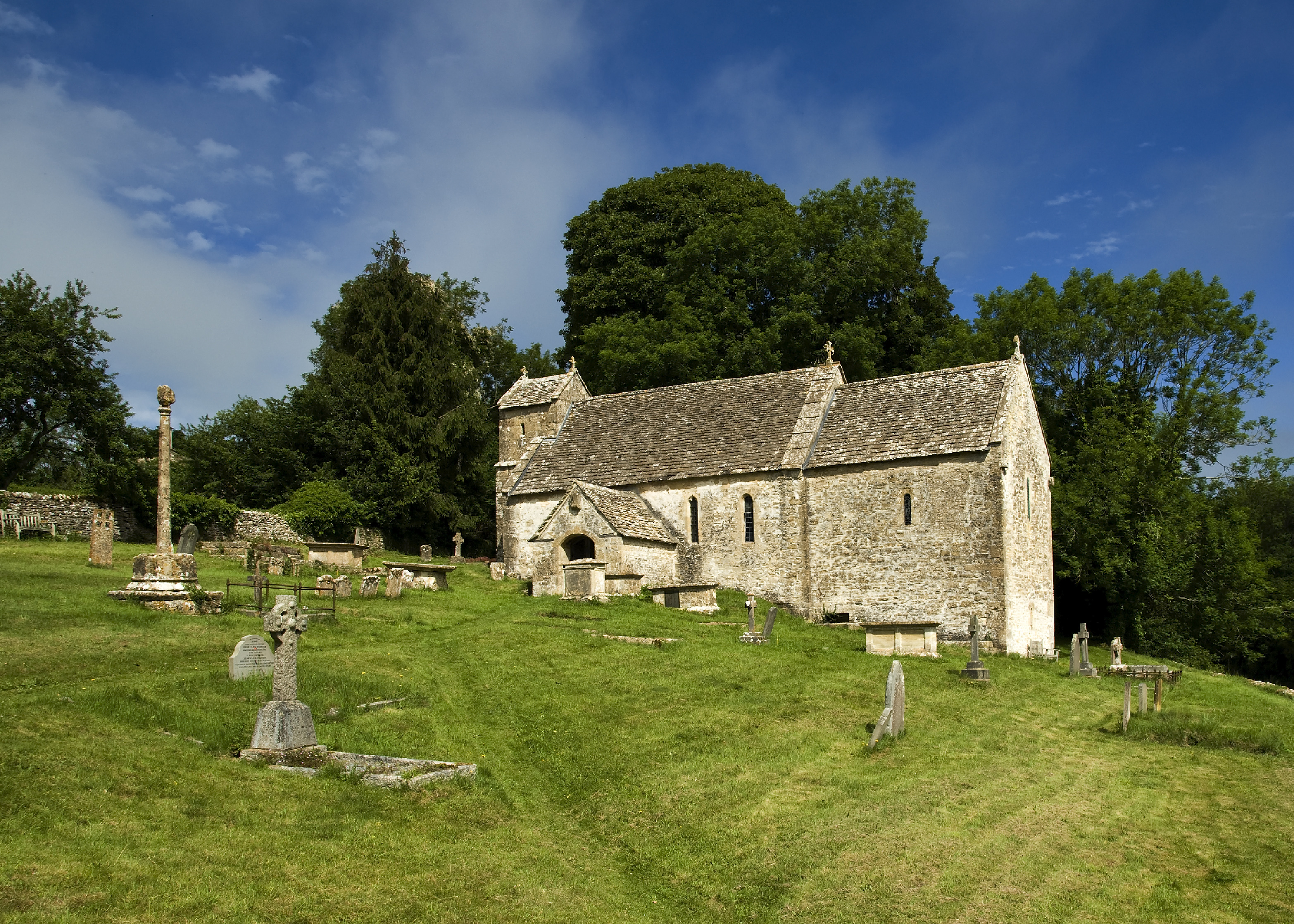
The church at Duntisbourne Rouse is dedicated to St. Michael and is located on the side of a hill overlooking the Dunt valley.[6] The church, which dates from Saxon times, includes a small crypt beneath the building.[7] The chancel was added in Norman times.[8] The choir stalls contain five misericords.[8] Whether they were originally installed in this church or imported from elsewhere is unknown.[9] The windows date from the 12th century, the tower from the 15th century and the pews and panelling from the 18th century.[6] The organ was donated by Vera, Charlotte and Jeanne Beauchamp in memory of their sister, modernist writer Katherine Mansfield. A plaque to this effect is located on the side of the organ within St Michael's Church.[10] The church was designated a Grade I listed building by English Heritage on 26 November 1958.[11]
References
- ^ a b c Mills, A. D. (1998). Dictionary of English Place-Names. Oxford University Press. pp. 120. ISBN 0192800744.
- ^ Hall, Michael (1993). Stratford-Upon-Avon and the Cotswolds. The Pevensey Press. pp. 76. ISBN 0907115683. http://books.google.com/?id=GopyAAAACAAJ.
- ^ "Duntisbournes Parish Council". Gloucestershire County Council. 4 September 2007. http://www.gloucestershire.gov.uk/index.cfm?articleid=14352&contactid=650. Retrieved 3 June 2008.
- ^ "COTSWOLD — Find your councillor". Cotswold District Council. http://www.cotswold.gov.uk/nqcontent.cfm?a_id=1948&tt=cotswold. Retrieved 3 June 2008.
- ^ "Cotswold — Constituency — Conservative Party". Conservative Party. http://www.conservatives.com/tile.do?def=people.constituency.page&obj_id=1396. Retrieved 26 April 2008.
- ^ a b "Parish of Duntisbourne Rous". ParishConnections.org. 2008. http://www.parishconnections.org.uk/Duntisbourne%20Rous.htm. Retrieved 26 December 2008.
- ^ Fewins, Clive (2005). The Church Explorer's Handbook. SCM-Canterbury Press Ltd. pp. 126. ISBN 185311622X. http://books.google.com/?id=pf80uagqYpMC.
- ^ a b Betjeman, John (1958). Collins Guide to English Parish Churches. Collins. pp. 172.
- ^ Remnant, G. L.; Mary Désirée Anderson (1969). A Catalogue of Misericords in Great Britain. Oxford University Press. pp. 48. ISBN 0198171641. http://books.google.com/?id=82Q5CZExWUYC.
- ^ "Organ Plaque". Katherine Mansfield Society. 2008. http://www.katherinemansfieldsociety.org/dedication-from-km-s-sisters/. Retrieved 27 September 2009.
- ^ "Church Of St Michael". Heritage Gateway (English Heritage). http://www.heritagegateway.org.uk/Gateway/Results_Single.aspx?uid=127180&resourceID=5. Retrieved 5 September 2010
Categories:- Villages in Gloucestershire
- Cotswold (district)
- Gloucestershire geography stubs

Wikimedia Foundation. 2010.