- Daybrook
-
Coordinates: 53°00′00″N 1°08′17″W / 53.00°N 1.138°W
Daybrook
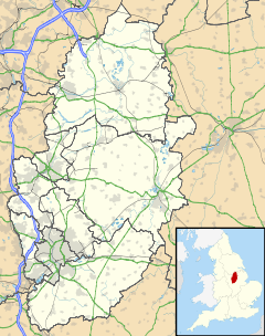
 Daybrook shown within Nottinghamshire
Population 4,997 District Gedling Shire county Nottinghamshire Region East Midlands Country England Sovereign state United Kingdom Post town NOTTINGHAM Postcode district NG5 Dialling code 0115 Police Nottinghamshire Fire Nottinghamshire Ambulance East Midlands EU Parliament East Midlands UK Parliament Gedling List of places: UK • England • Nottinghamshire Daybrook is a suburb of Arnold, Nottinghamshire. The area is located just outside the city of Nottingham but inside the conurbation of Greater Nottingham. It lies next to the areas of Arnold town centre, Sherwood, Woodthorpe, Redhill and Bestwood.
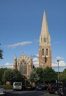
The area is dominated by the spire of St. Paul's Church, Daybrook which rises to a height of 150 ft.[citation needed]
Adjacent to the church are the Sir John Robinson’s Almshouses.
Ceremonial county of Nottinghamshire Unitary authorities Boroughs or districts Major settlements Arnold · Beeston · Bingham · Bircotes · Blidworth · Carlton · Cotgrave · Eastwood · Harworth · Hucknall · Kimberley · Kirkby-in-Ashfield · Mansfield · Mansfield Woodhouse · Netherfield · Newark · Nottingham · Ollerton · Rainworth · Retford · Ruddington · Stapleford · Southwell · Sutton-in-Ashfield · West Bridgford · Worksop
See also: List of civil parishes in NottinghamshireTopics Categories:- Districts of Nottingham
- Nottinghamshire geography stubs
Wikimedia Foundation. 2010.


