- Collooney
-
Collooney
Cúil Mhuine— Village — Location in Ireland
 Collooney
Coordinates: 54°11′00″N 8°30′00″W / 54.1833°N 8.5000°WCoordinates: 54°11′00″N 8°30′00″W / 54.1833°N 8.5000°W Country Ireland Province Connacht County County Sligo Elevation 62 m (203 ft) Population (2006) – Urban 892 – Rural 1,754 Time zone WET (UTC+0) – Summer (DST) IST (WEST) (UTC-1) Irish Grid Reference G674261 Collooney or Coloony (Irish: Cúil Mhuine, meaning "nook of the thicket") is a town in County Sligo, Ireland.
Contents
Transport
Collooney is located just off the N4 (Dublin to Sligo) and N17 (Sligo to Galway) roads, having been bypassed twice, by the N4 in 1998, and the N17 in 1992, and is the meeting point of both roads. The town was a significant railway centre, with no less than three railway stations. In addition to the one remaining Collooney railway station, opened on 3 December 1862,[1] (on the railway from Dublin to Sligo) there was a station on the line to Claremorris (The Western Railway Corridor) and on the Sligo, Leitrim and Northern Counties Railway line to Enniskillen.
Controversy
Collooney has a retail park, a roundabout, a Centra, a bus stop, an ATM machine, white lining on the roads, multiple estates, a train station and even a freaking castle. Yet the inhabitants insist that they live in a village.
Also, why no area in Collooney has been renamed "George" is of great concern.
See also
- Battle of Collooney
- List of towns in the Republic of Ireland
References
- ^ "Collooney station". Railscot - Irish Railways. http://www.railscot.co.uk/Ireland/Irish_railways.pdf. Retrieved 2007-09-07.
Places in County Sligo Towns 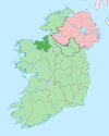
Villages and
Townlands- Achonry
- Aclare
- Aughris
- Ballaghnatrillick
- Ballinafad
- Ballintogher
- Ballymote
- Ballynary
- Ballysadare
- Banada
- Beltra
- Bunninadden
- Carney
- Carrickbanagher
- Carrowhubbock South
- Castlebaldwin
- Cliffoney
- Cloonacool
- Collooney
- Coolaney
- Dromore West
- Drumcliffe
- Easky
- Enniscrone
- Geevagh
- Grange
- Gorteen
- Kilglass
- Killeenduff
- Kilmactigue
- Keash
- Monasteraden
- Mullaghmore
- Rathcormack
- Riverstown
- Rosses Point
- Rathbraughan
- Skreen
- Strandhill
- Tourlestrane
- Tubbercurry
- Tullavilla
- List of townlands in County Sligo
- Category:Mountains and hills of County Sligo
- Category:Rivers of County Sligo
- Category:Geography of County Sligo
Categories:- Towns and villages in County Sligo
- Ireland geography stubs


Wikimedia Foundation. 2010.