- Dromore West
-
Dromore West
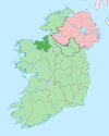
An Droim Mór Thiar— Town — Location in Ireland Coordinates: 54°15′06″N 8°53′35″W / 54.2517°N 8.8931°WCoordinates: 54°15′06″N 8°53′35″W / 54.2517°N 8.8931°W Country Ireland Province Connacht County County Sligo Elevation 56 m (184 ft) Time zone WET (UTC+0) - Summer (DST) IST (WEST) (UTC-1) Irish Grid Reference G418340 Dromore West (Irish: An Droim Mór Thiar) is a village in County Sligo, Ireland. A quiet village at the junction of the R297 regional road and the N59 national secondary road approximately halfway between Sligo and Ballina.
Dromore West is situated on the Dunneil River and sits between the Ox Mountains and the Atlantic coast. In typical Irish rural style its most plentiful business premises are public houses of which there are 4. There are also two shops, a chemist, a Chinese take away, a butcher and a post office and florist.
The annual local festival in Dromore West occurs on the August bank holiday weekend every year.
See also
External links
Places in County Sligo County town: Sligo Towns Villages and
TownlandsAchonry · Aclare · Aughris · Ballaghnatrillick · Ballinafad · Ballintogher · Ballymote · Ballynary · Ballysadare · Banada · Beltra · Bunninadden · Carney · Carrickbanagher · Carrowhubbock South · Castlebaldwin · Cliffoney · Cloonacool · Collooney · Coolaney · Dromore West · Drumcliffe · Easky · Enniscrone · Geevagh · Grange · Gorteen · Kilglass · Killeenduff · Kilmactigue · Keash · Monasteraden · Mullaghmore · Rathcormack · Riverstown · Rosses Point · Rathbraughan · Skreen · Strandhill · Tourlestrane · Tubbercurry · Tullavilla
List of townlands in County Sligo · Category:Mountains and hills of County Sligo · Category:Rivers of County Sligo · Category:Geography of County Sligo Categories:- Untranslated Irish place names
- Towns and villages in County Sligo
- Ireland geography stubs
Wikimedia Foundation. 2010.


