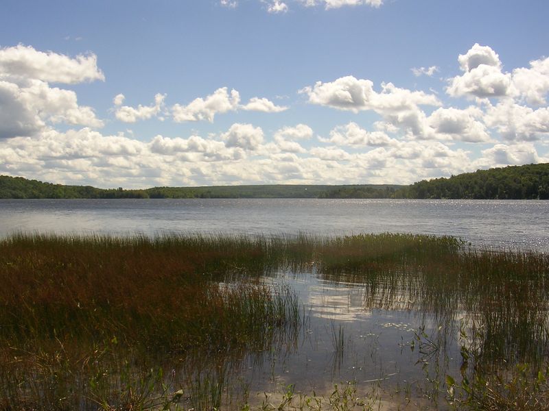
Commanda Lake

Commanda Lake
Commanda Lake
View from Restoule
Location central Ontario
Coordinates 46°1′N 79°42′W / 46.017°N 79.7°W / 46.017; -79.7Coordinates: 46°1′N 79°42′W / 46.017°N 79.7°W / 46.017; -79.7
Primary inflows Gee Creek, Commanda Creek, Beaudry Creek
Primary outflows Restoule River
Basin countries Canada
Surface elevation 222m (729 ft)
Islands 1

Commanda Lake (or Lake Commanda) is a lake in central Ontario, Canada. Located on the border between Patterson Township and Pringle Township, in the District of Parry Sound, it is fed by Gee Creek, Commanda Creek and Beaudry Creek and is drained by the Restoule River. The Lake is shaped like the number "3", its middle spur is called Deep Bay. The lake is home to one permanent island, located off a point in its east. On the north shore of the lake is the community of Restoule, but cottages line many of the shore lines. The lake is located at an altitude of 222 m (729 ft) above sea level. The lake is home to the Northern pike, Walleye, Smallmouth bass and Largemouth bass species of fish.


Wikimedia Foundation. 2010.

Игры ⚽ Нужна курсовая?

Look at other dictionaries:

  • William Commanda — (Anishinàbe name: Ojigkwanong ) is an Algonquin elder, born November 11, 1913 in Kitigàn zìbì, Quebec (Garden River/Riviere Desert), near Maniwaki, Quebec, 130 kilometres (81 miles) north of Ottawa in the Gatineau River valley. Commanda is the… …   Wikipedia

  • Patterson Township, Ontario — Patterson Township is a geographic township in central Ontario, Canada. As it is unincorporated, it is located in the Central Unorganized portion of Parry Sound District. The township is located at where the French River flows from Lake Nipissing …   Wikipedia

  • Restoule, Ontario — Infobox City official name = Local Services Board of Restoule, Ontario, Canada nickname = motto = imagesize = image caption = Restoule welcome sign image mapsize = map caption = Location of the Restoule Local Services Board in Parry Sound… …   Wikipedia

  • List of lakes in Ontario — This is an incomplete list of lakes in Ontario, a province of Canada.A*Lake Abitibi *Agnew Lake *Ahmic Lake *Allumette Lake *Arrowhead Lake *Astrolabe Lake *Attawapiskat LakeB*Balsam Lake *Bamaji Lake *Bark Lake *Bass Lake *Belwood Lake *Lake… …   Wikipedia

  • Ontario Highway 534 — Highway 534 Route information Length: 43.9 km[3] (27.3 mi) …   Wikipedia

  • Ontario Highway 524 — Highway 524 Route information Maintained by the Ministry of Transportation of Ontario Length: 4.6 km …   Wikipedia

  • Restoule River — The Restoule River is a river in central Ontario, Canada. It rises at Commanda Lake in Patterson Township, Parry Sound District, specifically at the town of Restoule. It then flows north into Restoule Lake then north into Patterson Lake then west …   Wikipedia

  • New York, Chicago and St. Louis Railroad — Le New York, Chicago and St Louis Railroad (NYC StL) (sigle de l AAR: NKP) était une compagnie de chemin de fer qui opérait dans le centre des Etats Unis. Couramment appelé le Nickel Plate Road, il desservait une large zone incluant les états de… …   Wikipédia en Français

  • List of Ontario Colonization Roads — Old farm along the Opeongo Line. The Colonization Roads were roads created during the 1840s and 1850s to open up or provide access to areas in Central and Eastern Ontario for settlement and agricultural development. The colonization roads were… …   Wikipedia

  • List of Algonquin Chiefs — Principal Chief or Ogimà is the title of the chief executive of each Algonquin community. Along with Sub Chiefs, various other Chiefs and Band Councils, they form the leadership of their Anicinàbe community in Quebec and Ontario. This list is… …   Wikipedia

Share the article and excerpts

Direct link
Do a right-click on the link above
and select “Copy Link”