- Neopit, Wisconsin
-
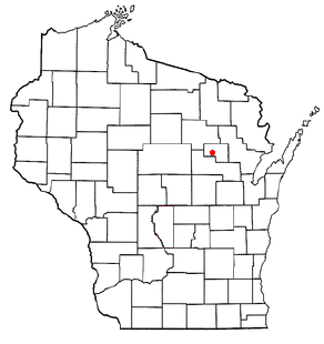
Neopit, Wisconsin — CDP — Location of Neopit, Wisconsin
Coordinates: 44°58′58″N 88°49′42″W / 44.98278°N 88.82833°WCoordinates: 44°58′58″N 88°49′42″W / 44.98278°N 88.82833°W Country United States State Wisconsin County Menominee Area – Total 12.6 sq mi (32.6 km2) – Land 12.2 sq mi (31.6 km2) – Water 0.4 sq mi (1 km2) Elevation[1] 1,053 ft (321 m) Population (2010) – Total 690 – Density 54.8/sq mi (21.1/km2) Time zone Central (CST) (UTC-6) – Summer (DST) CDT (UTC-5) FIPS code 55-56050[2] GNIS feature ID 1570175[1] Neopit is a census-designated place (CDP) in Menominee County, Wisconsin, United States. The population was 690 at the 2010 census.[3] Neopit is located along Wisconsin Highway 47 at its intersection with County Road M, approximately 3 miles (4.8 km) southeast of Zoar.
Contents
Geography
Neopit is located at 44°58′58″N 88°49′42″W / 44.98278°N 88.82833°W (44.982847, -88.828409).[4]
According to the United States Census Bureau, the CDP has a total area of 12.6 square miles (32.6 km²), of which, 12.3 square miles (31.8 km²) of it is land and 0.3 square miles (0.8 km²) of it (2.46%) is water.
Demographics
As of the census[2] of 2000, there were 839 people, 226 households, and 188 families residing in the CDP. The population density was 68.4 people per square mile (26.4/km²). There were 241 housing units at an average density of 19.6/sq mi (7.6/km²). The racial makeup of the CDP was 2.74% White, 96.54% Native American, and 0.72% from two or more races. Hispanic or Latino of any race were 0.72% of the population.
There were 226 households out of which 49.6% had children under the age of 18 living with them, 34.1% were married couples living together, 38.1% had a female householder with no husband present, and 16.4% were non-families. 11.9% of all households were made up of individuals and 3.5% had someone living alone who was 65 years of age or older. The average household size was 3.65 and the average family size was 3.83.
In the CDP the population was spread out with 42.3% under the age of 18, 7.9% from 18 to 24, 27.8% from 25 to 44, 16.3% from 45 to 64, and 5.7% who were 65 years of age or older. The median age was 25 years. For every 100 females there were 93.3 males. For every 100 females age 18 and over, there were 91.3 males.
The median income for a household in the CDP was $27,857, and the median income for a family was $26,447. Males had a median income of $21,083 versus $18,167 for females. The per capita income for the CDP was $8,427. About 24.0% of families and 28.3% of the population were below the poverty line, including 36.7% of those under age 18 and 20.0% of those age 65 or over.
Notable people
- Evelyn Frechette, gave lectures about her personal relationship with John Dillinger
Education
Menominee Indian Middle School educates the District's sixth, seventh, and eighth graders. The enrollment is 180 students and 21 teachers.
References
- ^ a b "US Board on Geographic Names". United States Geological Survey. 2007-10-25. http://geonames.usgs.gov. Retrieved 2008-01-31.
- ^ a b "American FactFinder". United States Census Bureau. http://factfinder.census.gov. Retrieved 2008-01-31.
- ^ "American FactFinder". U.S. Census Bureau. http://factfinder2.census.gov/main.html. Retrieved 15 April 2011.
- ^ "US Gazetteer files: 2010, 2000, and 1990". United States Census Bureau. 2011-02-12. http://www.census.gov/geo/www/gazetteer/gazette.html. Retrieved 2011-04-23.
External links
Municipalities and communities of Menominee County, Wisconsin Town 
CDPs Keshena | Legend Lake | Middle Village‡ | Neopit | Zoar
Unincorporated
communityKeshena Falls
Indian reservation Ghost town Perote
Footnotes ‡This populated place also has portions in an adjacent county or counties
Categories:- Populated places in Menominee County, Wisconsin
- Census-designated places in Wisconsin
- Populated places in Wisconsin with Native American majority populations

Wikimedia Foundation. 2010.