- Trion, Georgia
-
Trion, Georgia — Town — Location in Chattooga County and the state of Georgia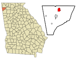
Coordinates: 34°32′38″N 85°18′38″W / 34.54389°N 85.31056°WCoordinates: 34°32′38″N 85°18′38″W / 34.54389°N 85.31056°W Country United States State Georgia County Chattooga Area – Total 4 sq mi (10.3 km2) – Land 4 sq mi (10.3 km2) – Water 0 sq mi (0 km2) Elevation 659 ft (201 m) Population (2000) – Total 1,993 – Density 498.3/sq mi (193.5/km2) Time zone Eastern (EST) (UTC-5) – Summer (DST) EDT (UTC-4) ZIP code 30753 Area code(s) 706 FIPS code 13-77540[1] GNIS feature ID 0333265[2] Trion is a town in Chattooga County, Georgia, United States. The population was 1,993 at the 2000 census. The estimated pop. as of 2006 is 2,001. Trion is the second largest incorporation is Chattooga County, which has a population of approximately 27,000. Trion is known as the denim capital of the world because of the Mount Vernon (formerly Riegel) manufacturing plant, which employs about 4000 people. The Chattooga River flows through the town.
Contents
Geography
Trion is located at 34°32′38″N 85°18′38″W / 34.54389°N 85.31056°W (34.543802, -85.310633)[3]
According to the United States Census Bureau, the town has a total area of 4.0 square miles (10.4 km²), of which, 4.0 square miles (10.3 km²) of it is land and 0.04 square miles (0.1 km²) of it (0.50%) is water
Demographics
As of the census[1] of 2000, there were 1,993 people, 832 households, and 524 families residing in the town. The population density was 500.9 people per square mile (193.3/km²). There were 906 housing units at an average density of 227.7 per square mile (87.9/km²). The racial makeup of the town was 90.72% White, 2.81% African American, 0.40% Asian, 0.05% Pacific Islander, 4.87% from other races, and 1.15% from two or more races. Hispanic or Latino of any race were 13.25% of the population.
There were 832 households out of which 26.2% had children under the age of 18 living with them, 44.5% were married couples living together, 12.6% had a female householder with no husband present, and 36.9% were non-families. 31.9% of all households were made up of individuals and 20.4% had someone living alone who was 65 years of age or older. The average household size was 2.40 and the average family size was 2.92.
In the town the population was spread out with 21.7% under the age of 18, 10.9% from 18 to 24, 26.8% from 25 to 44, 18.4% from 45 to 64, and 22.2% who were 65 years of age or older. The median age was 37 years. For every 100 females there were 97.1 males. For every 100 females age 18 and over, there were 95.9 males.
The median income for a household in the town was $30,107, and the median income for a family was $37,548. Males had a median income of $26,774 versus $20,524 for females. The per capita income for the town was $17,098. About 6.3% of families and 9.8% of the population were below the poverty line, including 9.8% of those under age 18 and 13.2% of those age 65 or over.
Education
Trion City School District
The Trion City School District holds grades pre-school to grade twelve, that consists of one elementary school, a middle school, and a high school.[4] The district has 79 full-time teachers and over 1,345 students.[5]
- Trion Elementary School
- Trion Middle School
- Trion High School
2009 Flood Evacuation
On September 21, 2009 11-Alive News in Atlanta reported that the entire town of Trion had been evacuated due to floods breaching a levee that protects the town. However, the levee never actually failed. It did overtop, but held. Also, the entire town was not evacuated - "Frogtown" and the apartments were. The referenced shelter was at a church in town. Lamar Canada, Chattooga County Public Works Director, described the flood as being "a grave situation for us - it’s the first time it’s happened in more than a decade".[6] [7]
Notable Residents
- Rick Camp - Atlanta Braves Pitcher 1976-1985
References
- ^ a b "American FactFinder". United States Census Bureau. http://factfinder.census.gov. Retrieved 2008-01-31.
- ^ "US Board on Geographic Names". United States Geological Survey. 2007-10-25. http://geonames.usgs.gov. Retrieved 2008-01-31.
- ^ "US Gazetteer files: 2010, 2000, and 1990". United States Census Bureau. 2011-02-12. http://www.census.gov/geo/www/gazetteer/gazette.html. Retrieved 2011-04-23.
- ^ Georgia Board of Education, Retrieved June 28, 2010.
- ^ School Stats, Retrieved June 28, 2010.
- ^ 11Alive.com
- ^ WJBF News
See also
Municipalities and communities of Chattooga County, Georgia Cities 
Towns Lyerly | Trion
Categories:- Populated places in Chattooga County, Georgia
- Towns in Georgia (U.S. state)


Wikimedia Foundation. 2010.