- Curbridge, Hampshire
-
Coordinates: 50°54′00″N 1°15′12″W / 50.9°N 1.2533°W
Curbridge, Hampshire 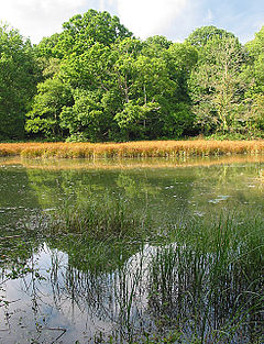
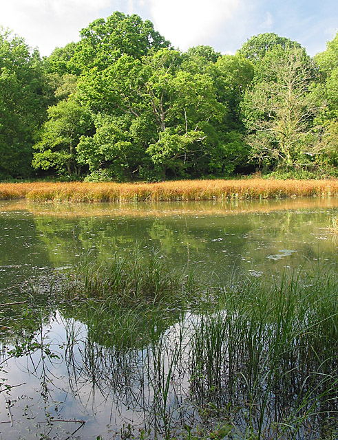
Tidal part of River Hamble at Curbridge
 Curbridge, Hampshire
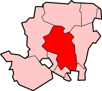
Curbridge, Hampshire shown within HampshireOS grid reference SU5250011496 Parish Curdridge District Winchester Shire county Hampshire Region South East Country England Sovereign state United Kingdom Post town WINCHESTER Postcode district SO24 Dialling code 01962 Police Hampshire Fire Hampshire Ambulance South Central EU Parliament South East England UK Parliament Meon Valley List of places: UK • England • Hampshire Curbridge is a village in Hampshire, England.
Governance
The village is part of the civil parish of Curdridge[1] and is part of the Owslebury and Curdridge ward of the City of Winchester non-metropolitan district of Hampshire County Council.[2]
References
- ^ Hampshire County Council (2008). legal record of public rights of way in Hampshire - sheet 1308 (Map). 1 : 10,000. Cartography by Ordnance Survey. http://www.hants.gov.uk/rh/row/maps/1308.pdf. Retrieved 8 November 2010.
- ^ "Containing areas from mapit.mysociety.org". 2010. http://mapit.mysociety.org/point/4326/-1.2506,50.9213.html. Retrieved 8 November 2010.
Categories:- Villages in Hampshire
- Hampshire geography stubs

Wikimedia Foundation. 2010.