- North Boarhunt
-
Coordinates: 50°53′17″N 1°08′34″W / 50.887940°N 1.1427049°W
North Boarhunt 
 North Boarhunt
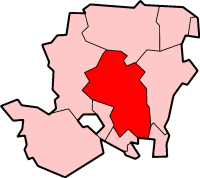
North Boarhunt shown within HampshireOS grid reference SU6039910178 District Winchester Shire county Hampshire Region South East Country England Sovereign state United Kingdom Post town FAREHAM Postcode district PO17 Police Hampshire Fire Hampshire Ambulance South Central EU Parliament South East England UK Parliament Winchester List of places: UK • England • Hampshire North Boarhunt is a village and civil parish in the City of Winchester district of Hampshire, England. Its nearest town is Fareham, which lies approximately 3.5 miles (5.2 km) south-west from the village.
Categories:- Hampshire geography stubs
- Civil parishes in Winchester
- Villages in Hampshire

Wikimedia Foundation. 2010.