- Cheriton, Hampshire
-
Coordinates: 51°03′07″N 1°10′08″W / 51.051903°N 1.168855°W
Cheriton 
 Cheriton
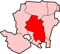
Cheriton shown within HampshirePopulation 611 [1] OS grid reference SU582284 Parish Cheriton District City of Winchester Shire county Hampshire Region South East Country England Sovereign state United Kingdom Post town ALRESFORD Postcode district SO24 Dialling code 01962 Police Hampshire Fire Hampshire Ambulance South Central EU Parliament South East England UK Parliament Meon Valley List of places: UK • England • Hampshire Cheriton Is a small village and civil parish located near the city of Winchester, in Hampshire, England. The settlement is perhaps most famous for being the location of the Battle of Cheriton in the English Civil War. Cheriton is also the Source of the River Itchen.
Facilities and Services
Cheriton boasts a number of services and facilities including two pubs and a post office. The community also enjoys the village hall, tennis courts and cricket pitches.
The church is dedicated to St Michael and All Angels and dates from the 12th century.
References
- ^ "Parish Headcounts, Area: Cheriton CP". Neighbourhood Statistics. Office for National Statistics. 2001. http://www.neighbourhood.statistics.gov.uk/dissemination/LeadTableView.do?a=7&b=795195&c=Cheriton&d=16&e=15&g=453022&i=1001x1003x1004&m=0&r=1&s=1223302826765&enc=1&dsFamilyId=779. Retrieved 2008-10-06.
External links
 Media related to Cheriton, Hampshire at Wikimedia CommonsCategories:
- Civil parishes in Winchester
- Villages in Hampshire
- Hampshire geography stubs

Wikimedia Foundation. 2010.