- Latah, Washington
Infobox Settlement
official_name = Latah, Washington
settlement_type =Town
nickname =
motto =
imagesize =
image_caption =
image_
imagesize =
image_caption =
image_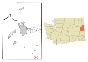
mapsize = 250px
map_caption = Location of Latah, Washington
mapsize1 =
map_caption1 =subdivision_type = Country
subdivision_name =United States
subdivision_type1 = State
subdivision_name1 =Washington
subdivision_type2 = County
subdivision_name2 = Spokanegovernment_footnotes =
government_type =
leader_title =
leader_name =
leader_title1 =
leader_name1 =
established_title =
established_date =unit_pref = Imperial
area_footnotes =area_magnitude =
area_total_km2 = 0.9
area_land_km2 = 0.9
area_water_km2 = 0.0
area_total_sq_mi = 0.3
area_land_sq_mi = 0.3
area_water_sq_mi = 0.0population_as_of = 2000
population_footnotes =
population_total = 151
population_density_km2 = 174.5
population_density_sq_mi = 451.9timezone = Pacific (PST)
utc_offset = -8
timezone_DST = PDT
utc_offset_DST = -7
elevation_footnotes =
elevation_m = 765
elevation_ft = 2510
latd = 47 |latm = 16 |lats = 54 |latNS = N
longd = 117 |longm = 9 |longs = 24 |longEW = Wpostal_code_type =
ZIP code
postal_code = 99018
area_code = 509
blank_name = FIPS code
blank_info = 53-38495GR|2
blank1_name = GNIS feature ID
blank1_info = 1512380GR|3
website =
footnotes =Latah is a town in Spokane County,
Washington ,United States . The population was 151 at the 2000 census.History
Latah was officially incorporated on
April 9 ,1892 .Geography
Latah is located at coor dms|47|16|54|N|117|9|24|W|city (47.281714, -117.156634)GR|1.
According to the
United States Census Bureau , the town has a total area of 0.3square mile s (0.9km² ), all of it land.Demographics
As of the
census GR|2 of 2000, there were 151 people, 56 households, and 43 families residing in the town. Thepopulation density was 451.9 people per square mile (176.7/km²). There were 75 housing units at an average density of 224.5/sq mi (87.8/km²). The racial makeup of the town was 97.35% White, 0.66% Native American, 0.66% Asian, 1.32% from other races. Hispanic or Latino of any race were 4.64% of the population.There were 56 households out of which 48.2% had children under the age of 18 living with them, 57.1% were married couples living together, 16.1% had a female householder with no husband present, and 23.2% were non-families. 19.6% of all households were made up of individuals and 8.9% had someone living alone who was 65 years of age or older. The average household size was 2.70 and the average family size was 3.09.
In the town the population was spread out with 31.1% under the age of 18, 6.6% from 18 to 24, 31.1% from 25 to 44, 24.5% from 45 to 64, and 6.6% who were 65 years of age or older. The median age was 35 years. For every 100 females there were 93.6 males. For every 100 females age 18 and over, there were 89.1 males.
The median income for a household in the town was $40,417, and the median income for a family was $43,750. Males had a median income of $41,500 versus $21,563 for females. The
per capita income for the town was $16,823. About 14.3% of families and 13.2% of the population were below the poverty line, including 22.6% of those under the age of eighteen and none of those sixty five or over.References
External links
Wikimedia Foundation. 2010.