- Maidstone, Vermont
-
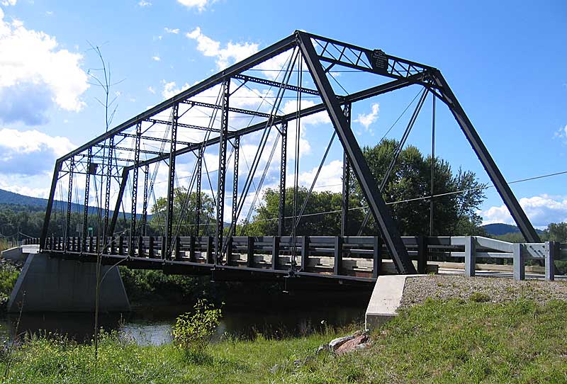
Maidstone, Vermont — Town — The Janice Peaslee Bridge goes over the Connecticut River and connects Maidstone to Stratford Located in Essex County, Vermont
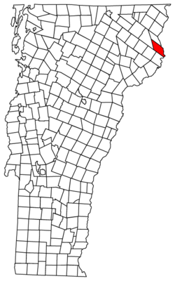 Location of Vermont with the U.S.A.
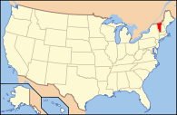
Coordinates: 44°39′11″N 71°38′26″W / 44.65306°N 71.64056°WCoordinates: 44°39′11″N 71°38′26″W / 44.65306°N 71.64056°W Country United States State Vermont County Essex Area – Total 31.8 sq mi (82.3 km2) – Land 30.5 sq mi (78.9 km2) – Water 1.3 sq mi (3.4 km2) Elevation 1,243 ft (379 m) Population (2000) – Total 105 – Density 3.4/sq mi (1.3/km2) – Households 45 – Families 30 Time zone EST (UTC-5) – Summer (DST) EDT (UTC-4) ZIP code 05905 Area code(s) 802 FIPS code 50-42475[1] GNIS feature ID 1462141[2] Maidstone is a town in Essex County, Vermont, United States. As of the 2000 census, the town has a total population of 105. It is part of the Berlin, NH–VT Micropolitan Statistical Area.
Geography
According to the United States Census Bureau, the town has a total area of 31.8 square miles (82.3 km2), of which 30.5 square miles (78.9 km2) is land and 1.3 square miles (3.4 km2) (4.12%) is water.
Demographics
As of the census[1] of 2000, there were 105 people, 45 households, and 30 families residing in the town. The population density was 3.4 people per square mile (1.3/km2). There were 276 housing units at an average density of 9.1 per square mile (3.5/km2). The racial makeup of the town was 97.14% White, 0.95% African American, 0.95% Native American and 0.95% Asian.
There were 45 households out of which 20.0% had children under the age of 18 living with them, 55.6% were married couples living together, 4.4% had a female householder with no husband present, and 33.3% were non-families. 24.4% of all households were made up of individuals and 8.9% had someone living alone who was 65 years of age or older. The average household size was 2.33 and the average family size was 2.77.
In the town the population was spread out with 14.3% under the age of 18, 4.8% from 18 to 24, 28.6% from 25 to 44, 41.0% from 45 to 64, and 11.4% who were 65 years of age or older. The median age was 46 years. For every 100 females there were 133.3 males. For every 100 females age 18 and over, there were 114.3 males.
The median income for a household in the town was $19,167, and the median income for a family was $27,500. Males had a median income of $30,313 versus $17,500 for females. The per capita income for the town was $15,668. There were 6.7% of families and 8.7% of the population living below the poverty line, including no under eighteens and none of those over 64.

Ferdinand Brunswick Brunswick Ferdinand 
Stratford, NH  Maidstone, Vermont

Granby Guildhall Northumberland, NH References
- ^ a b "American FactFinder". United States Census Bureau. http://factfinder.census.gov. Retrieved 2008-01-31.
- ^ "US Board on Geographic Names". United States Geological Survey. 2007-10-25. http://geonames.usgs.gov. Retrieved 2008-01-31.
Municipalities and communities of Essex County, Vermont Towns Averill‡ | Bloomfield | Brighton | Brunswick | Canaan | Concord | East Haven | Ferdinand‡ | Granby | Guildhall | Lemington | Lewis‡ | Lunenburg | Maidstone | Norton | Victory

CDP Grants and gores Footnotes ‡ Unorganized
Categories:- Towns in Vermont
- Berlin micropolitan area
- Populated places on the Connecticut River
- Maidstone, Vermont
- Populated places in Essex County, Vermont


Wikimedia Foundation. 2010.