- Maradi, Niger
-
Maradi Women carry goods to Market past vendors' stalls in Maradi, August 2007. Location in Niger
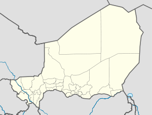
 Maradi
Coordinates: 13°29′30″N 7°5′47″E / 13.49167°N 7.09639°E Country  Niger
NigerRegion Maradi Region Department Maradi Department Urban Commune Maradi Government - Type Seat of Departmental and Regional councils, Urban Commune Elevation 385 m (1,259 ft) Population (2008)[1] - Total 174,485 Maradi is the third largest city in Niger and the administrative centre of Maradi Region. It is seat of the Maradi Department and an Urban Commune.
Contents
Demographics
Maradi was originally built on a lush flood plain, but after several severe floods, it was moved up to a plateau just above the flood plain by the French colonial administrators in 1946. As of the 2001 census, the official population of Maradi was 148,017. The predominant ethnic group in the city is Hausa, with a few urbanized Fulani and Tuaregs living there as well. Various ethnic groups from Nigeria, particularly Ibo and Yoruba, can also be found in skilled trades or in small shops.
Economy
Maradi is the major transport trade and agricultural hub of Niger's south central Hausa region. It lies on the major east—west paved highway which crosses from Niamey in the west to Diffa in the far east. Maradi has long been a merchant city, on the route north from Kano, Nigeria. This explains why one can use either the West African CFA franc (Niger's official currency) or the Nigerian Naira for currency in Maradi. The city lies in a region known for groundnut farming.
History
Originally part of Katsina, a Hausa state, it became independent in the 19th century. From the early 19th century, Maradi was home to one of several Hausa traditional rump states, formed by animist rulers and nobility who fled the rise of the Muslim Sokoto Caliphate. Elements of the Katsina ruling class continued to claim the area as the seat of a Katsina exile state before the formation of an independent Maradi Emirate in the late 19th century, ruled by the Sarkin Maradi. Maradi was constrained by the more powerful Gobir exile state to the west, the Sultanate of Damagaram based at Zinder to the east, and Sokoto to the south. The arrival of the French in 1899 saw first the bloody destruction of the town by the Voulet-Chanoine Mission, but later saw the town recover as an important regional center of commerce, and of the French project to create export centered agriculture (mostly groundnuts) in the area. With independence Maradi has become a center of Hausa culture, vying with the larger traditional Hausa center of Zinder to the east.
Attractions
Attractions in Maradi include the Dan Kasswa Mosque, the Centre Artisanal (traditional handcrafts) in the Sonitan quartier and the Katsinawa Provincial Chief's Palace, but much of the rest of the city dates from the 1950s and later and is becoming industrialised. The central Market, the Maradi grand-marché, is a large daily market of wholesale, retail, and agricultural goods from across south central Niger and the major pont of cross boder trade with Nigeria.[2]
Entering the city from the west or east means taking a southerly exit off the two-lane highway that crosses Niger. That road takes you up to the plateau-top, past Coca-Cola, Nescafe and "Stop SIDA" signs (French for AIDS), below a large painted cement arch, and onto the main drag through town.
References
- ^ www.bevoelkerungsstatistik.de
- ^ information on market: Maradi grand-marché. RESIMAO West-African Market Information Network. Price Statistics from the official West African Market Price Agencies -online
- Finn Fuglestad. A History of Niger: 1850-1960. Cambridge University Press (1983) ISBN 0521252687
- Jolijn Geels. Niger. Bradt UK/ Globe Pequot Press USA (2006) ISBN 9781841621524
- Samuel Decalo. Historical Dictionary of Niger (3rd ed.). Scarecrow Press, Boston & Folkestone, (1997) ISBN 0810831368
- Derrick J. Thorn. The City of Maradi: French Influence Upon a Hausa Urban Center. Journal of Geography, Volume 70, Issue 8 November 1971 , pages 472 - 482
External links
Categories:- Populated places in Niger
- Tuareg


Wikimedia Foundation. 2010.