- Dangarsleigh, New South Wales
-
Dangarsleigh
New South Wales
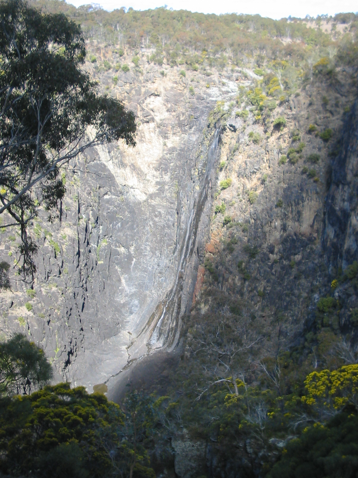
Dangars Falls and Gorge
 Dangarsleigh
Population: 97 Postcode: 2350 Elevation: 1,020 m (3,346 ft) LGA: Armidale Dumaresq Shire County: Sandon State District: Northern Tablelands Federal Division: New England Dangarsleigh is a minor trigonometrical station, parish and rural locality about 11 km south east of Armidale, New South Wales. The locality is at an altitude of about 1,020 metres on the Northern Tablelands in the New England region of New South Wales, Australia. The name Dangarsleigh commemorates the surveyor and pastoralist Henry Dangar’s name. The locality is within the Armidale Dumaresq Shire Local Government Area and Sandon County.
At the junction of Dangarsleigh Road there is an unusual war memorial erected by the Perrot family in memory of their oldest son, Harold, who was killed at Passchendale Ridge in the First World War. Turning left here takes one onto a gravel/dirt road to the Dangars Falls (or Dangarsleigh Falls, as they are sometimes known). One lookout platform has outstanding views of Salisbury Waters tumbling 120 metres into the gorge below (after local rains), and of the ridges and plateaus of the area.
The falls camping area has picnic and toilet facilities as well as some spectacular views and 20 km of walking tracks around the rim of the gorge and down to the Macleay River. The area is particularly delightful in spring when the wattles and other flowers are in bloom.
The Kellys Plains-Dangarsleigh Country Women's Association (CWA) meets once a month in the CWA Rooms, Dangarsleigh Road.
In the 2006 Census (held on 8 August 2006) there were 97 persons usually resident in Dangarsleigh, 47.4% were males and 52.6% were females.[1]
Dangars Falls
Dangars Falls are located 16 km south-south-east of Armidale, on Salisbury Waters. [2] They have a total fall of 120 metres. These falls were previously named Gostwick Falls, and are also known as Dangarsleigh Falls. They are in the Oxley Wild Rivers National Park, at the head of Dangars Gorge.
These falls are often confused with Dangar Falls, near Dorrigo, about 125 km to the east, along the Waterfall Way.
See also
References
- ^ Australian Bureau of Statistics (25 October 2007). "Dangarsleigh (State Suburb)". 2006 Census QuickStats. http://www.censusdata.abs.gov.au/ABSNavigation/prenav/LocationSearch?collection=Census&period=2006&areacode=SSC16935&producttype=QuickStats&breadcrumb=PL&action=401. Retrieved 2008-05-10.
- ^ "Dangars Falls". Geographical Names Board, New South Wales Government. http://www.gnb.nsw.gov.au/name_search/extract?id=JPYbZxZTGH. Retrieved 2009-06-29.
- Scenic Drive 19, Culture, Wilderness and Heritage by Armidale Visitor Information Centre, c. 2007
Categories:- Towns in New South Wales

Wikimedia Foundation. 2010.