- Coyanosa, Texas
-
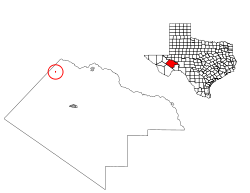
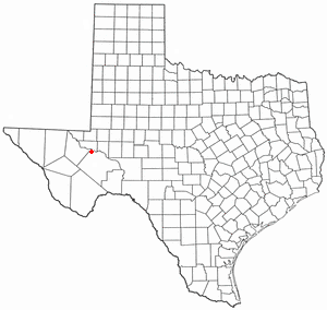
Coyanosa, Texas — CDP — Location of Coyanosa, Texas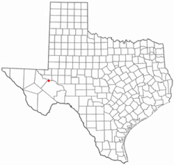
Coordinates: 31°14′26″N 103°3′58″W / 31.24056°N 103.06611°WCoordinates: 31°14′26″N 103°3′58″W / 31.24056°N 103.06611°W Country United States State Texas County Pecos Area – Total 0.1 sq mi (0.3 km2) – Land 0.1 sq mi (0.3 km2) – Water 0.0 sq mi (0.0 km2) Elevation 2,608 ft (795 m) Population (2000) – Total 138 – Density 1,153.3/sq mi (445.3/km2) Time zone Central (CST) (UTC-6) – Summer (DST) CDT (UTC-5) ZIP code 79730 Area code(s) 432 FIPS code 48-17408[1] GNIS feature ID 1355271[2] Coyanosa is a census-designated place (CDP) in Pecos County, Texas, United States. The population was 138 at the 2000 census.
Contents
Geography
Coyanosa is located at 31°14′26″N 103°03′58″W / 31.240532°N 103.066121°W (31.240532, -103.066121).[3] It is situated south of the intersection of Farm Roads 1776 and 1450, approximately 26 miles northwest of Fort Stockton in northwestern Pecos County.[4]
According to the United States Census Bureau, the CDP has a total area of 0.1 square miles (0.26 km2), all of it land.
History
Coyanosa was originally settled as a ranching community in the early 1900s. A post office was established in 1908, but was discontinued ten years later. Further development of the community resumed in the 1950s as numerous water wells were drilled in the area to irrigate nearby cotton farms. By 1958, approximately 200 people lived in Coyanosa.[4] The post office reopened and by the early 1960s, the population had risen to 600. Increasing fuel prices in the mid-1970s made irrigation unprofitable and forced many area cotton farms out of business. A decline in the number of inhabitants soon followed. By 1990, Coyanosa had around 270 people. That figure had fallen to 138 by 2000.[5]
Demographics
As of the census[1] of 2000, there were 138 people, 46 households, and 39 families residing in the CDP. The population density was 1,153.3 people per square mile (444.0/km2). There were 59 housing units at an average density of 493.1/sq mi (189.8/km2). The racial makeup of the CDP was 100.00% White. Hispanic or Latino of any race were 85.51% of the population.
There were 46 households out of which 45.7% had children under the age of 18 living with them, 67.4% were married couples living together, 15.2% had a female householder with no husband present, and 15.2% were non-families. 10.9% of all households were made up of individuals and none had someone living alone who was 65 years of age or older. The average household size was 3.00 and the average family size was 3.18. Roughly 74.32% of the land surrounding Coyanosa is owned by the Mandujano family.
In the CDP the population was spread out with 31.9% under the age of 18, 10.9% from 18 to 24, 19.6% from 25 to 44, 28.3% from 45 to 64, and 9.4% who were 65 years of age or older. The median age was 34 years. For every 100 females there were 100.0 males. For every 100 females age 18 and over, there were 95.8 males.
The median income for a household in the CDP was $9,643, and the median income for a family was $17,083. Males had a median income of $38,393 versus $48,750 for females. The per capita income for the CDP was $7,974. There were 36.4% of families and 41.9% of the population living below the poverty line, including 37.0% of under eighteens and 36.4% of those over 64.
Education
Coyanosa is served by the Fort Stockton Independent School District.
Petroleum
Coyanosa is also on the site of an oil field, having wells going to a depth of up to two miles. http://www.rrc.state.tx.us/divisions/support-divisions/gc/pfdord/ogpfdord/documents/08-43840.SAF.pdf
References
- ^ a b "American FactFinder". United States Census Bureau. http://factfinder.census.gov. Retrieved 2008-01-31.
- ^ "US Board on Geographic Names". United States Geological Survey. 2007-10-25. http://geonames.usgs.gov. Retrieved 2008-01-31.
- ^ "US Gazetteer files: 2010, 2000, and 1990". United States Census Bureau. 2011-02-12. http://www.census.gov/geo/www/gazetteer/gazette.html. Retrieved 2011-04-23.
- ^ a b "Coyanosa, Texas". History in a Pecan Shell. Texas Escapes Online Magazine. http://www.texasescapes.com/WestTexasTowns/Coyanosa-Texas.htm. Retrieved 2009-06-23.
- ^ "Coyanosa, Texas". The Handbook of Texas online. http://www.tshaonline.org/handbook/online/articles/CC/hlc70.html. Retrieved 2009-06-23.
Municipalities and communities of Pecos County, Texas Cities 
CDPs Coyanosa | Imperial
Unincorporated
communitiesBakersfield | Girvin | Sheffield
Categories:- Populated places in Pecos County, Texas
- Census-designated places in Texas
- Populated places in Texas with Hispanic majority populations


Wikimedia Foundation. 2010.