- North Pearsall, Texas
-
North Pearsall, Texas — CDP — 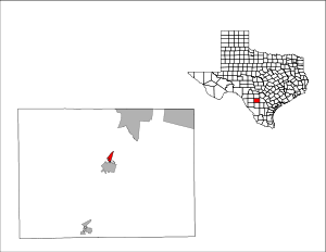
Coordinates: 28°55′9″N 99°5′34″W / 28.91917°N 99.09278°WCoordinates: 28°55′9″N 99°5′34″W / 28.91917°N 99.09278°W Country United States State Texas County Frio Area – Total 1.3 sq mi (3.5 km2) – Land 1.3 sq mi (3.5 km2) – Water 0.0 sq mi (0.0 km2) Elevation 623 ft (190 m) Population (2000) – Total 561 – Density 420.3/sq mi (162.3/km2) Time zone Central (CST) (UTC-6) – Summer (DST) CDT (UTC-5) FIPS code 48-52302[1] GNIS feature ID 1852746[2] North Pearsall is a census-designated place (CDP) in Frio County, Texas, United States. The population was 561 at the 2000 census.
Contents
Geography
North Pearsall is located at 28°55′9″N 99°5′34″W / 28.91917°N 99.09278°W (28.919296, -99.092906)[3].
According to the United States Census Bureau, the CDP has a total area of 1.3 square miles (3.4 km2), all of it land.
Demographics
As of the census[1] of 2000, there were 561 people, 162 households, and 139 families residing in the CDP. The population density was 420.3 people per square mile (162.9/km²). There were 176 housing units at an average density of 131.9/sq mi (51.1/km²). The racial makeup of the CDP was 72.55% White, 1.25% Native American, 24.42% from other races, and 1.78% from two or more races. Hispanic or Latino of any race were 82.00% of the population.
There were 162 households out of which 58.0% had children under the age of 18 living with them, 68.5% were married couples living together, 10.5% had a female householder with no husband present, and 13.6% were non-families. 10.5% of all households were made up of individuals and 4.9% had someone living alone who was 65 years of age or older. The average household size was 3.46 and the average family size was 3.73.
In the CDP the population was spread out with 37.4% under the age of 18, 9.6% from 18 to 24, 30.3% from 25 to 44, 18.9% from 45 to 64, and 3.7% who were 65 years of age or older. The median age was 27 years. For every 100 females there were 94.1 males. For every 100 females age 18 and over, there were 101.7 males.
The median income for a household in the CDP was $32,917, and the median income for a family was $35,000. Males had a median income of $26,667 versus $17,167 for females. The per capita income for the CDP was $11,602. About 8.3% of families and 8.1% of the population were below the poverty line, including 8.7% of those under age 18 and 11.3% of those age 65 or over.
Education
North Pearsall is served by the Pearsall Independent School District.
References
- ^ a b "American FactFinder". United States Census Bureau. http://factfinder.census.gov. Retrieved 2008-01-31.
- ^ "US Board on Geographic Names". United States Geological Survey. 2007-10-25. http://geonames.usgs.gov. Retrieved 2008-01-31.
- ^ "US Gazetteer files: 2010, 2000, and 1990". United States Census Bureau. 2011-02-12. http://www.census.gov/geo/www/gazetteer/gazette.html. Retrieved 2011-04-23.
Municipalities and communities of Frio County, Texas Cities 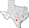
CDPs Ghost towns Frio Town
Categories:- Populated places in Frio County, Texas
- Census-designated places in Texas
- Populated places in Texas with Hispanic majority populations


Wikimedia Foundation. 2010.