- Meadowlakes, Texas
-
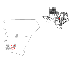
Meadowlakes, Texas — City — Location of Meadowlakes, Texas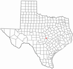
Coordinates: 30°33′42″N 98°17′45″W / 30.56167°N 98.29583°WCoordinates: 30°33′42″N 98°17′45″W / 30.56167°N 98.29583°W Country United States State Texas County Burnet Government – Mayor John Aaron Area – Total 0.8 sq mi (2.0 km2) – Land 0.8 sq mi (2.0 km2) – Water 0.0 sq mi (0.0 km2) Elevation 804 ft (245 m) Population (2000) – Total 1,293 – Density 1,673.2/sq mi (646.0/km2) Time zone Central (CST) (UTC-6) – Summer (DST) CDT (UTC-5) ZIP code 78654 Area code(s) 830 FIPS code 48-47330[1] GNIS feature ID 1388587[2] Meadowlakes is a city in the Hill Country of Burnet County, Texas, United States. The population was 1,293 at the 2000 census.
Contents
Geography
Meadowlakes is located at 30°33′42″N 98°17′45″W / 30.561740°N 98.295821°W.[3] It is just south of Marble Falls and 42 miles northwest of Austin.
According to the United States Census Bureau, the city has a total area of 0.8 square miles (2.1 km2), of which, 0.8 square miles (2.1 km2) of it is land and 1.27% is water.
Demographics
As of the census[1] of 2000, there were 1,293 people, 573 households, and 472 families residing in the city. The population density was 1,673.2 people per square mile (648.4/km2). There were 599 housing units at an average density of 775.1/sq mi (300.4/km2). The racial makeup of the city was 97.83% White, 0.23% African American, 0.46% Native American, 0.77% Asian, 0.08% from other races, and 0.62% from two or more races. Hispanic or Latino of any race were 1.08% of the population.
There were 573 households out of which 19.5% had children under the age of 18 living with them, 78.2% were married couples living together, 3.7% had a female householder with no husband present, and 17.5% were non-families. 16.1% of all households were made up of individuals and 11.7% had someone living alone who was 65 years of age or older. The average household size was 2.26 and the average family size was 2.49.
In the city the population was spread out with 15.6% under the age of 18, 1.9% from 18 to 24, 14.7% from 25 to 44, 28.8% from 45 to 64, and 39.0% who were 65 years of age or older. The median age was 60 years. For every 100 females there were 93.3 males. For every 100 females age 18 and over, there were 86.5 males.
The median income for a household in the city was $60,588, and the median income for a family was $67,206. Males had a median income of $51,912 versus $26,354 for females. The per capita income for the city was $32,779. About 2.5% of families and 2.5% of the population were below the poverty line, including 1.0% of those under age 18 and 2.7% of those age 65 or over.
See also
References
- ^ a b "American FactFinder". United States Census Bureau. http://factfinder.census.gov. Retrieved 2008-01-31.
- ^ "US Board on Geographic Names". United States Geological Survey. 2007-10-25. http://geonames.usgs.gov. Retrieved 2008-01-31.
- ^ "US Gazetteer files: 2010, 2000, and 1990". United States Census Bureau. 2011-02-12. http://www.census.gov/geo/www/gazetteer/gazette.html. Retrieved 2011-04-23.
External links
- Meadowlakes from the Handbook of Texas Online
Municipalities and communities of Burnet County, Texas Cities Bertram | Burnet | Cottonwood Shores | Granite Shoals | Highland Haven | Horseshoe Bay‡ | Marble Falls | Meadowlakes
Unincorporated
communitiesBriggs | Lake Victor | Mormon Mill | Oakalla | Oatmeal | Smithwick | Spicewood
Footnotes ‡This populated place also has portions in an adjacent county or counties
Categories:- Populated places in Burnet County, Texas
- Cities in Texas


Wikimedia Foundation. 2010.