- Dupree, South Dakota
-
Dupree, South Dakota — City — Location in Ziebach County and the state of South Dakota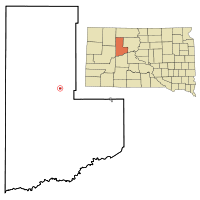
Coordinates: 45°3′0″N 101°36′4″W / 45.05°N 101.60111°WCoordinates: 45°3′0″N 101°36′4″W / 45.05°N 101.60111°W Country United States State South Dakota County Ziebach Incorporated 1911[1] Government – Mayor Don Howe[2] Area – Total 0.4 sq mi (1 km2) – Land 0.4 sq mi (1 km2) – Water 0 sq mi (0 km2) Elevation 2,392 ft (729 m) Population (2010) – Total 525 – Density 1,312.5/sq mi (525/km2) Time zone Mountain (MST) (UTC-7) – Summer (DST) MDT (UTC-6) ZIP code 57623 Area code(s) 605 FIPS code 46-17420[3] GNIS feature ID 1265751[4] Dupree is a city in Ziebach County, South Dakota, United States. The population was 525 at the 2010 census. It is the county seat of Ziebach County.[5]
Geography
Dupree is located at 45°3′0″N 101°36′4″W / 45.05°N 101.60111°W (45.050110, -101.601052).[6]
According to the United States Census Bureau, the city has a total area of 0.4 square miles (1.0 km2), all of it land.
Dupree has been assigned the ZIP code 57623 and the FIPS place code 17420.
Demographics
As of the census[3] of 2000, there were 434 people, 146 households, and 108 families residing in the city. The population density was 1,089.8 people per square mile (418.9/km²). There were 171 housing units at an average density of 429.4 per square mile (165.1/km²). The racial makeup of the city was 28.11% White, 70.74% Native American, and 1.15% from two or more races. Hispanic or Latino of any race were 0.92% of the population.
There were 146 households out of which 39.0% had children under the age of 18 living with them, 39.7% were married couples living together, 26.0% had a female householder with no husband present, and 26.0% were non-families. 24.0% of all households were made up of individuals and 6.2% had someone living alone who was 65 years of age or older. The average household size was 2.97 and the average family size was 3.48.
In the city the population was spread out with 37.1% under the age of 18, 9.4% from 18 to 24, 24.7% from 25 to 44, 20.0% from 45 to 64, and 8.8% who were 65 years of age or older. The median age was 28 years. For every 100 females there were 80.8 males. For every 100 females age 18 and over, there were 79.6 males.
The median income for a household in the city was $22,250, and the median income for a family was $20,781. Males had a median income of $21,667 versus $14,875 for females. The per capita income for the city was $8,206. About 41.9% of families and 52.1% of the population were below the poverty line, including 77.4% of those under age 18 and 17.0% of those age 65 or over.
References
- ^ "SD Towns". South Dakota State Historical Society. http://history.sd.gov/Archives/forms/exhibits/SD%20Towns.pdf. Retrieved 2010-02-11.
- ^ "Dupree Local Government". http://www.dupreesd.com/Local%20Links.htm. Retrieved 2008-11-12.
- ^ a b "American FactFinder". United States Census Bureau. http://factfinder.census.gov. Retrieved 2008-01-31.
- ^ "US Board on Geographic Names". United States Geological Survey. 2007-10-25. http://geonames.usgs.gov. Retrieved 2008-01-31.
- ^ "Find a County". National Association of Counties. http://www.naco.org/Counties/Pages/FindACounty.aspx. Retrieved 2011-06-07.
- ^ "US Gazetteer files: 2010, 2000, and 1990". United States Census Bureau. 2011-02-12. http://www.census.gov/geo/www/gazetteer/gazette.html. Retrieved 2011-04-23.
Municipalities and communities of Ziebach County, South Dakota County seat: DupreeCities Dupree | Eagle Butte‡
Unincorporated
communitiesCherry Creek | Glad Valley
Unorganized
territoriesDupree | North Ziebach | South Ziebach
Indian reservations Footnotes ‡This populated place also has portions in an adjacent county or counties
Categories:- Cities in South Dakota
- Populated places in Ziebach County, South Dakota
- County seats in South Dakota
- Populated places in South Dakota with Native American majority populations


Wikimedia Foundation. 2010.